 |
|
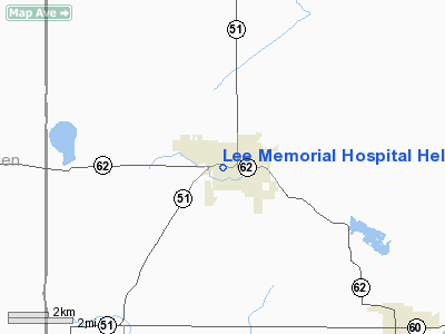
Lee Memorial Hospital Heliport |
Location & QuickFacts
| FAA Information Effective: | 2008-09-25 |
| Airport Identifier: | 13MI |
| Airport Status: | Operational |
| Longitude/Latitude: | 086-06-57.0420W/41-59-01.1640N
-86.115845/41.983657 (Estimated) |
| Elevation: | 748 ft / 227.99 m (Estimated) |
| Land: | 0 acres |
| From nearest city: | 0 nautical miles N of Dowagiac, MI |
| Location: | Cass County, MI |
| Magnetic Variation: | 02W (1985) |
Owner & Manager
| Ownership: | Publicly owned |
| Owner: | Lee Memorial Hospital |
| Address: | 420 W High St
Dowagiac, MI 49047 |
| Phone number: | 616-782-8681 |
| Manager: | Bill Schoor |
| Address: | 420 W High St
Dowagiac, MI 49047 |
| Phone number: | 616-782-8681 |
Airport Operations and Facilities
| Airport Use: | Private
MEDICAL USE. |
| Wind indicator: | Yes |
| Segmented Circle: | No |
| Control Tower: | No |
| Sectional chart: | Chicago |
| Region: | AGL - Great Lakes |
| Boundary ARTCC: | ZAU - Chicago |
| Tie-in FSS: | LAN - Lansing |
| FSS Toll Free: | 1-800-WX-BRIEF |
Runway Information
Helipad H1
| Dimension: | 60 x 60 ft / 18.3 x 18.3 m |
| Surface: | TURF, |
| |
Runway H1 |
Runway |
| Traffic Pattern: | Left | Left |
| Markings: | Basic, | , |
|
Radio Navigation Aids
| ID |
Type |
Name |
Ch |
Freq |
Var |
Dist |
| HAI | NDB | Three Rivers | | 407.00 | 02W | 23.5 nm |
| IRS | NDB | Sturgis | | 382.00 | 04W | 32.2 nm |
| MGC | NDB | Michigan City | | 203.00 | 01W | 35.5 nm |
| IUL | NDB | La Porte | | 356.00 | 03W | 41.4 nm |
| VP | NDB | Sedly | | 212.00 | 02W | 46.8 nm |
| BT | NDB | Batol | | 272.00 | 04W | 47.3 nm |
| CPB | NDB | Culver | | 391.00 | 01W | 47.7 nm |
| HLM | NDB | Holland | | 233.00 | 03W | 48.9 nm |
| ELX | VOR/DME | Keeler | 113X | 116.60 | 00E | 9.7 nm |
| PMM | VOR/DME | Pullman | 058X | 112.10 | 00E | 29.0 nm |
| AZO | VOR/DME | Kalamazoo | 027X | 109.00 | 01W | 29.4 nm |
| OXI | VOR/DME | Knox | 103X | 115.60 | 00E | 46.4 nm |
| GIJ | VORTAC | Gipper | 101X | 115.40 | 00E | 15.8 nm |
| GSH | VORTAC | Goshen | 084X | 113.70 | 00E | 27.8 nm |
| BTL | VORTAC | Battle Creek | 031X | 109.40 | 02W | 43.2 nm |
Remarks
- PRVDD OPNS ARE CONDUCTED IN AN AREA FM 90 TO 150 DEGS; FM 230 TO 300 & FM 325 TO 360 DEGS; AREA IS MKD; WIND IND IS MAINTAINED; CERTAIN OBS ARE REMOVED.
Images and information placed above are from
http://www.airport-data.com/airport/13MI/
We thank them for the data!
| General Info
|
| Country |
United States
|
| State |
MICHIGAN
|
| FAA ID |
13MI
|
| Latitude |
41-59-01.164N
|
| Longitude |
086-06-57.042W
|
| Elevation |
748 feet
|
| Near City |
DOWAGIAC
|
We don't guarantee the information is fresh and accurate. The data may
be wrong or outdated.
For more up-to-date information please refer to other sources.
|
|


