 |
|
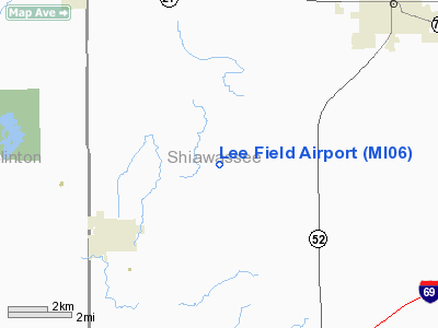
Location & QuickFacts
| FAA Information Effective: | 2008-09-25 |
| Airport Identifier: | MI06 |
| Airport Status: | Operational |
| Longitude/Latitude: | 084-16-59.8980W/42-55-23.1040N
-84.283305/42.923084 (Estimated) |
| Elevation: | 810 ft / 246.89 m (Estimated) |
| Land: | 10 acres |
| From nearest city: | 2 nautical miles SW of Bennington, MI |
| Location: | Shiawassee County, MI |
| Magnetic Variation: | 05W (1985) |
Owner & Manager
| Ownership: | Privately owned |
| Owner: | James J. Lee |
| Address: | 6270 W Garrison Rd
Laingsburg, MI 48848 |
| Phone number: | 517-651-6246 |
| Manager: | James J. Lee |
| Address: | 6270 W Garrison Rd
Laingsburg, MI 48848 |
| Phone number: | 517-651-6246 |
Airport Operations and Facilities
| Airport Use: | Private |
| Wind indicator: | Yes |
| Segmented Circle: | No |
| Control Tower: | No |
| Sectional chart: | Detroit |
| Region: | AGL - Great Lakes |
| Boundary ARTCC: | ZOB - Cleveland |
| Tie-in FSS: | LAN - Lansing |
| FSS on Airport: | No |
| FSS Toll Free: | 1-800-WX-BRIEF |
Airport Services
Runway Information
Runway 09/27
| Dimension: | 1900 x 65 ft / 579.1 x 19.8 m |
| Surface: | TURF, Fair Condition |
| |
Runway 09 |
Runway 27 |
| Traffic Pattern: | Left | Left |
| Displaced threshold: | 500.00 ft | 445.00 ft |
| Obstruction: | 35 ft trees, 5.0 ft from runway, 75L/ ft right of centerline
APCH RATIO 11:1 AT DSPLCD THLD; CONTROLLING OBSTN +45 FT TREES AT 500 FT DIST 125 FT R. | 15 ft road, 35.0 ft from runway, 2:1 slope to clear
APCH RATIO 20:1 AT DSPLCD THLD; CONTROLLING OBSTN +29 FT PLINE 584 FT DIST. |
|
Radio Navigation Aids
| ID |
Type |
Name |
Ch |
Freq |
Var |
Dist |
| OZW | NDB | Howell | | 243.00 | 05W | 21.7 nm |
| AMN | NDB | Alma | | 329.00 | 05W | 32.6 nm |
| HYX | NDB | Browne | | 385.00 | 06W | 35.8 nm |
| MBS | VOR/DME | Saginaw | 076X | 112.90 | 03W | 37.7 nm |
| JXN | VOR/DME | Jackson | 033X | 109.60 | 05W | 40.6 nm |
| MOP | VOR/DME | Mount Pleasant | 043X | 110.60 | 05W | 46.5 nm |
| LAN | VORTAC | Lansing | 045X | 110.80 | 05W | 22.1 nm |
| FNT | VORTAC | Flint | 116X | 116.90 | 06W | 23.7 nm |
| PSI | VORTAC | Pontiac | 047X | 111.00 | 03W | 35.7 nm |
| SVM | VORTAC | Salem | 090X | 114.30 | 03W | 43.4 nm |
Remarks
- RY 09 ALSO +4 FT FENCE & CROPS 0 FT DSTC.
- RY 09/27 SOFT WHEN WET ESPECIALLY 450 FT ON WEST END; SFC MODERATELY ROLLING TERRIAN.
- RY 27 ALSO +29 FT MKD PLINE 139 FT DSTC; APCH RATIO 4:1.
- PRVDD OBSTNS IN APCH AREA ARE RMVD/LWRD OR THR DSPLCD TO PRVD 20:1 APCH SLOPE.
Images and information placed above are from
http://www.airport-data.com/airport/MI06/
We thank them for the data!
| General Info
|
| Country |
United States
|
| State |
MICHIGAN
|
| FAA ID |
MI06
|
| Latitude |
42-55-23.104N
|
| Longitude |
084-16-59.898W
|
| Elevation |
810 feet
|
| Near City |
BENNINGTON
|
We don't guarantee the information is fresh and accurate. The data may
be wrong or outdated.
For more up-to-date information please refer to other sources.
|
|


