 |
|
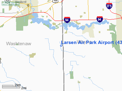
Location & QuickFacts
| FAA Information Effective: | 2008-09-25 |
| Airport Identifier: | 43G |
| Airport Status: | Operational |
| Longitude/Latitude: | 083-32-44.7710W/42-10-36.1450N
-83.545770/42.176707 (Estimated) |
| Elevation: | 696 ft / 212.14 m (Surveyed) |
| Land: | 40 acres |
| From nearest city: | 3 nautical miles SW of Belleville, MI |
| Location: | Washtenaw County, MI |
| Magnetic Variation: | 05W (1985) |
Owner & Manager
| Ownership: | Privately owned |
| Owner: | John G. Larsen |
| Address: | 7790 Rawsonville Road
Belleville, MI 48111 |
| Phone number: | 734-439-3502 |
| Manager: | John G. Larsen |
| Address: | 7790 Rawsonville Road
Belleville, MI 48111 |
| Phone number: | 734-439-3502 |
Airport Operations and Facilities
| Airport Use: | Open to public |
| Wind indicator: | Yes |
| Segmented Circle: | Yes |
| Control Tower: | No |
| Landing fee charge: | No |
| Sectional chart: | Detroit |
| Region: | AGL - Great Lakes |
| Boundary ARTCC: | ZOB - Cleveland |
| Tie-in FSS: | LAN - Lansing |
| FSS on Airport: | No |
| FSS Toll Free: | 1-800-WX-BRIEF |
| NOTAMs Facility: | LAN (NOTAM-d service avaliable) |
Airport Communications
Airport Services
| Fuel available: | 100LL |
| Airframe Repair: | MAJOR
BY PRIOR ARNGMT. |
| Power Plant Repair: | MAJOR
BY PRIOR ARNGMT. |
| Bottled Oxygen: | NONE |
| Bulk Oxygen: | NONE |
Runway Information
Runway 15/33
| Dimension: | 2253 x 80 ft / 686.7 x 24.4 m |
| Surface: | TURF, Fair Condition |
| |
Runway 15 |
Runway 33 |
| Traffic Pattern: | Right | Left |
| Displaced threshold: | 853.00 ft | 600.00 ft |
| Obstruction: | 6 ft fence, 90.0 ft from runway, 15:1 slope to clear
APCH RATIO 20:1 TO DSPLCD THLD, +89 FT TREES 1790 FT DSTC. | 15 ft road, 60.0 ft from runway, 4:1 slope to clear
RY 33 APCH RATIO 21:1 TO DSPLCD THLD, +50' P-LINE 1065 FT DSTC. |
|
Runway 18/36
| Dimension: | 2157 x 160 ft / 657.5 x 48.8 m |
| Surface: | TURF, Fair Condition |
| |
Runway 18 |
Runway 36 |
| Longitude: | 083-32-44.8800W | 083-32-44.2800W |
| Latitude: | 42-10-49.1400N | 42-10-27.8400N |
| Elevation: | 696.00 ft | 696.00 ft |
| Traffic Pattern: | Right | Left |
| Runway End Identifier: | No | No |
| Centerline Lights: | No | No |
| Touchdown Lights: | No | No |
| Obstruction: | 20 ft trees, 25.0 ft from runway, 1:1 slope to clear | 15 ft road, 25.0 ft from runway, 1:1 slope to clear |
|
Radio Navigation Aids
| ID |
Type |
Name |
Ch |
Freq |
Var |
Dist |
| TCU | NDB | Tecumseh | | 239.00 | 04W | 17.2 nm |
| RYS | NDB | Grosse Ile | | 419.00 | 06W | 18.1 nm |
| G | NDB | Golf | | 398.00 | 05W | 22.6 nm |
| VQ | NDB | Cargl | | 230.00 | 05W | 28.4 nm |
| ADG | NDB | Adrian | | 278.00 | 06W | 30.1 nm |
| QG | NDB | Windsor | | 353.00 | 06W | 31.2 nm |
| OZW | NDB | Howell | | 243.00 | 05W | 33.8 nm |
| USE | NDB | Fulton | | 375.00 | 05W | 43.0 nm |
| PT | NDB | Pelee Island | | 283.00 | 05W | 45.8 nm |
| PCW | NDB | Port Clinton | | 423.00 | 06W | 49.8 nm |
| TOL | TACAN | Toledo | 072X | | 05W | 36.8 nm |
| MTC | TACAN | Selfridge | 064X | | 06W | 41.1 nm |
| DXO | VOR/DME | Detroit | 081X | 113.40 | 06W | 8.3 nm |
| YQG | VOR/DME | Windsor | 085X | 113.80 | 06W | 32.2 nm |
| JXN | VOR/DME | Jackson | 033X | 109.60 | 05W | 40.9 nm |
| VWV | VOR/DME | Waterville | 078X | 113.10 | 02W | 43.8 nm |
| CRL | VORTAC | Carleton | 104X | 115.70 | 03W | 8.7 nm |
| SVM | VORTAC | Salem | 090X | 114.30 | 03W | 14.1 nm |
| PSI | VORTAC | Pontiac | 047X | 111.00 | 03W | 31.5 nm |
| FNT | VORTAC | Flint | 116X | 116.90 | 06W | 48.3 nm |
| YIP | VOT | Willow Run | | 112.00 | | 3.6 nm |
| DTW | VOT | Detroit Met Wayne | | 109.80 | | 8.6 nm |
| DET | VOT | Detroit City | | 111.60 | | 27.3 nm |
Remarks
- SOFT DURING THAWING SEASON.
- RWY 18/36 LOCAL USE ONLY - DISPLACEMENTS NOT MARKED.
- EXISTED PRIOR TO 1959.
Images and information placed above are from
http://www.airport-data.com/airport/43G/
We thank them for the data!
| General Info
|
| Country |
United States
|
| State |
MICHIGAN
|
| FAA ID |
43G
|
| Latitude |
42-10-36.145N
|
| Longitude |
083-32-44.771W
|
| Elevation |
696 feet
|
| Near City |
BELLEVILLE
|
We don't guarantee the information is fresh and accurate. The data may
be wrong or outdated.
For more up-to-date information please refer to other sources.
|
|


