 |
|
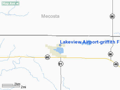
Lakeview Airport - Griffith Field Airport |
Location & QuickFacts
| FAA Information Effective: | 2008-09-25 |
| Airport Identifier: | 13C |
| Airport Status: | Operational |
| Longitude/Latitude: | 085-15-53.2920W/43-27-07.6940N
-85.264803/43.452137 (Estimated) |
| Elevation: | 969 ft / 295.35 m (Surveyed) |
| Land: | 74 acres |
| From nearest city: | 1 nautical miles NE of Lakeview, MI |
| Location: | Montcalm County, MI |
| Magnetic Variation: | 05W (2000) |
Owner & Manager
| Ownership: | Publicly owned |
| Owner: | Village Of Lakeview |
| Address: | 315 Lincoln Ave. Po Box 30
Lakeview, MI 48850 |
| Phone number: | 989-352-6322 |
| Manager: | Wally J. Delamater |
| Address: | P.o. Box 30, 315 E. Lincoln
Lakeview, MI 48850 |
| Phone number: | 517-352-6322
ARPT PHONE: 989-352-7306. |
Airport Operations and Facilities
| Airport Use: | Open to public |
| Wind indicator: | Yes |
| Segmented Circle: | Yes |
| Control Tower: | No |
| Lighting Schedule: | DUSK-DAWN
ACTVT MIRL RY 09/27; PAPI & REIL RYS 09 & 27 - CTAF. |
| Beacon Color: | Clear-Green (lighted land airport) |
| Landing fee charge: | No |
| Sectional chart: | Chicago |
| Region: | AGL - Great Lakes |
| Boundary ARTCC: | ZAU - Chicago |
| Tie-in FSS: | LAN - Lansing |
| FSS on Airport: | No |
| FSS Toll Free: | 1-800-WX-BRIEF |
| NOTAMs Facility: | LAN (NOTAM-d service avaliable) |
| Federal Agreements: | NGY |
Airport Communications
| CTAF: | 122.800 |
| Unicom: | 122.800 |
Airport Services
| Fuel available: | 100LL |
| Airframe Repair: | MAJOR |
| Power Plant Repair: | MAJOR |
| Bulk Oxygen: | NONE |
Runway Information
Runway 09/27
| Dimension: | 3500 x 75 ft / 1066.8 x 22.9 m |
| Surface: | ASPH, Good Condition |
| Weight Limit: | Single wheel: 12000 lbs. |
| Edge Lights: | Medium |
| |
Runway 09 |
Runway 27 |
| Longitude: | 085-16-17.0110W | 085-15-29.5730W |
| Latitude: | 43-27-07.3080N | 43-27-08.0780N |
| Elevation: | 963.00 ft | 967.00 ft |
| Alignment: | 89 | 127 |
| Traffic Pattern: | Left | Left |
| Markings: | Basic, Good Condition | Basic, Good Condition |
| Crossing Height: | 40.00 ft | 50.00 ft |
| VASI: | 2-light PAPI on left side | 2-light PAPI on left side |
| Visual Glide Angle: | 3.00° | 3.00° |
| Runway End Identifier: | Yes | Yes |
| Centerline Lights: | No | No |
| Touchdown Lights: | No | No |
| Obstruction: | 76 ft trees, 1703.0 ft from runway, 79 ft right of centerline, 20:1 slope to clear | 49 ft trees, 1172.0 ft from runway, 125 ft right of centerline, 20:1 slope to clear |
|
Radio Navigation Aids
| ID |
Type |
Name |
Ch |
Freq |
Var |
Dist |
| AMN | NDB | Alma | | 329.00 | 05W | 22.3 nm |
| GDW | NDB | Wiggins | | 209.00 | 04W | 46.3 nm |
| CAD | NDB | Cadillac | | 269.00 | 04W | 49.9 nm |
| HIC | VOR/DME | White Cloud | 123X | 117.60 | 01W | 21.0 nm |
| MOP | VOR/DME | Mount Pleasant | 043X | 110.60 | 05W | 25.2 nm |
| GRR | VOR/DME | Grand Rapids | 106Y | 115.95 | 04W | 41.3 nm |
| MKG | VORTAC | Muskegon | 099X | 115.20 | 01W | 37.9 nm |
Remarks
- AGRICULTURAL & HELICOPTER OPNS ON GRASS AREA NORTH OF RY 09/27.
Images and information placed above are from
http://www.airport-data.com/airport/13C/
We thank them for the data!
| General Info
|
| Country |
United States
|
| State |
MICHIGAN
|
| FAA ID |
13C
|
| Latitude |
43-27-07.694N
|
| Longitude |
085-15-53.292W
|
| Elevation |
969 feet
|
| Near City |
LAKEVIEW
|
We don't guarantee the information is fresh and accurate. The data may
be wrong or outdated.
For more up-to-date information please refer to other sources.
|
|


