 |
|
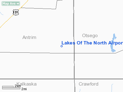
Lakes Of The North Airport |
Location & QuickFacts
| FAA Information Effective: | 2008-09-25 |
| Airport Identifier: | 4Y4 |
| Airport Status: | Operational |
| Longitude/Latitude: | 084-52-35.1460W/44-54-45.0380N
-84.876429/44.912511 (Estimated) |
| Elevation: | 1286 ft / 391.97 m (Surveyed) |
| Land: | 40 acres |
| From nearest city: | 11 nautical miles SW of Gaylord, MI |
| Location: | Antrim County, MI |
| Magnetic Variation: | 05W (1985) |
Owner & Manager
| Ownership: | Privately owned |
| Owner: | Lakes Of The North Assn |
| Address: | 5950 Skytrails Ct
Mancelona, MI 49659 |
| Phone number: | 231-585-6000 |
| Manager: | Scott Brown |
| Address: | 5950 Skytrails Ct
Mancelona, MI 49659 |
| Phone number: | 231-585-6000 |
Airport Operations and Facilities
| Airport Use: | Open to public |
| Wind indicator: | Yes |
| Segmented Circle: | No |
| Control Tower: | No |
| Lighting Schedule: | RDO-CTL
ACTVT LIRL RY 05/23 - CTAF. |
| Landing fee charge: | No |
| Sectional chart: | Lake Huron |
| Region: | AGL - Great Lakes |
| Boundary ARTCC: | ZMP - Minneapolis |
| Tie-in FSS: | LAN - Lansing |
| FSS on Airport: | No |
| FSS Toll Free: | 1-800-WX-BRIEF |
| NOTAMs Facility: | LAN (NOTAM-d service avaliable) |
Airport Communications
Airport Services
| Airframe Repair: | NONE |
| Power Plant Repair: | NONE |
Runway Information
Runway 05/23
| Dimension: | 4285 x 40 ft / 1306.1 x 12.2 m |
| Surface: | ASPH, Poor Condition
RWY SFC ROUGH & UNEVEN, EXTENSIVE CRACKS IN PVMNT. |
| Edge Lights: | Low |
| |
Runway 05 |
Runway 23 |
| Longitude: | 084-52-58.9100W | 084-52-11.3500W |
| Latitude: | 44-54-32.2900N | 44-54-57.7500N |
| Elevation: | 1286.00 ft | 1286.00 ft |
| Traffic Pattern: | Left | Left |
| Markings: | Basic, Poor Condition
RY MKG FADED. | Basic, Poor Condition
RY MKG FADED. |
| Displaced threshold: | 400.00 ft | 450.00 ft |
| Obstruction: | 45 ft trees, 245.0 ft from runway, 115 ft right of centerline, 1:1 slope to clear
APCH RATIO 20:1 FM DSPLCD THLD BASED ON STRAIGHT OUT OVER +45 FT TREES; 920 FT DSTC; APCH RATIO 0:1 BASED ON +40 FT TREES 102 FT R/L.
RWY 05 TREES/ROAD. | 15 ft road, 201.0 ft from runway, 43 ft right of centerline
RWY 23 APCH RATIO 20:1 FM DSPLCD THLD OVER +36 FT TREE; 60 FT R; 720 FT FM DSPLCD THLD. APCH RATIO 0:1 BASED ON 40 FT TREES 100 FT L.
+15 FT RD FM 0-99 FT DSTC; 46-100 FT R; +30 FT TREES; 0 FT DSTC; 93 FT L. |
|
Radio Navigation Aids
| ID |
Type |
Name |
Ch |
Freq |
Var |
Dist |
| GYG | NDB | Grayling | | 359.00 | 06W | 10.0 nm |
| BFA | NDB | Boyne Falls | | 263.00 | 06W | 15.4 nm |
| CXK | NDB | Clam Lake | | 251.00 | 05W | 15.5 nm |
| TV | NDB | Gwenn | | 365.00 | 05W | 25.9 nm |
| CVX | NDB | Charlevoix | | 392.00 | 05W | 28.7 nm |
| CAD | NDB | Cadillac | | 269.00 | 04W | 44.7 nm |
| CGG | VOR | Grayling | | 109.80 | 06W | 15.2 nm |
| GLR | VOR/DME | Gaylord | 029X | 109.20 | 06W | 9.5 nm |
| HTL | VOR/DME | Houghton Lake | 053X | 111.60 | 05W | 34.5 nm |
| TVC | VORTAC | Traverse City | 093X | 114.60 | 02W | 32.3 nm |
| PLN | VORTAC | Pellston | 055X | 111.80 | 06W | 44.1 nm |
Remarks
- TREES IN PRIM SFC BOTH SIDES; 93 FT FM CNTRLN; ACFT PKG IN PRIM SFC, N SIDE; E END.
- DEER ON & INVOF ARPT.
- RY SLOPES UPWARD FM E TO W. WEST END APPROX 20' HIGHER THAN E END.
Images and information placed above are from
http://www.airport-data.com/airport/4Y4/
We thank them for the data!
| General Info
|
| Country |
United States
|
| State |
MICHIGAN
|
| FAA ID |
4Y4
|
| Latitude |
44-54-45.038N
|
| Longitude |
084-52-35.146W
|
| Elevation |
1286 feet
|
| Near City |
GAYLORD
|
We don't guarantee the information is fresh and accurate. The data may
be wrong or outdated.
For more up-to-date information please refer to other sources.
|
|


