|
|
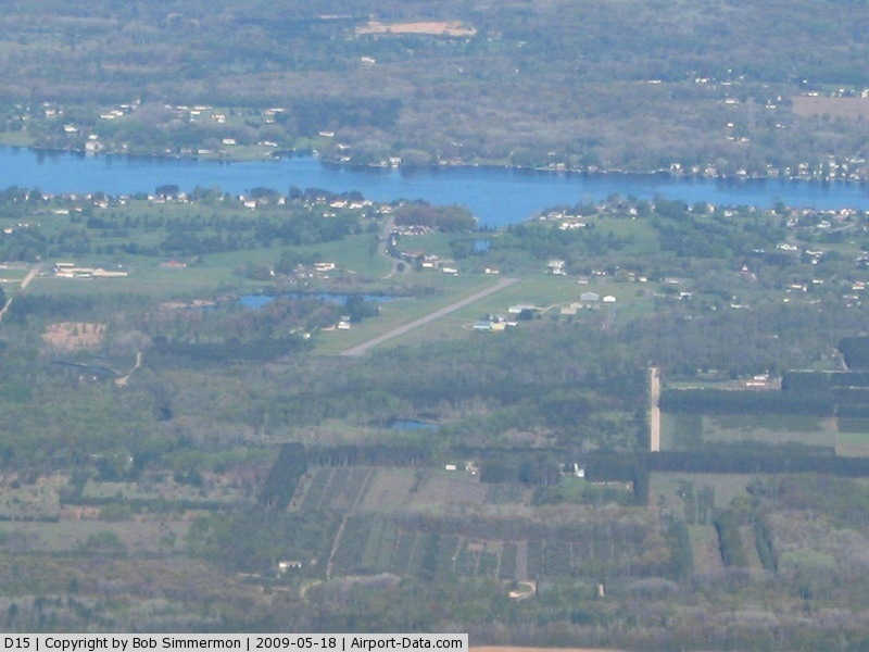
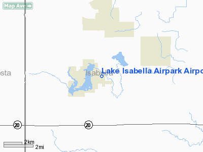
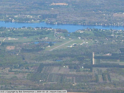
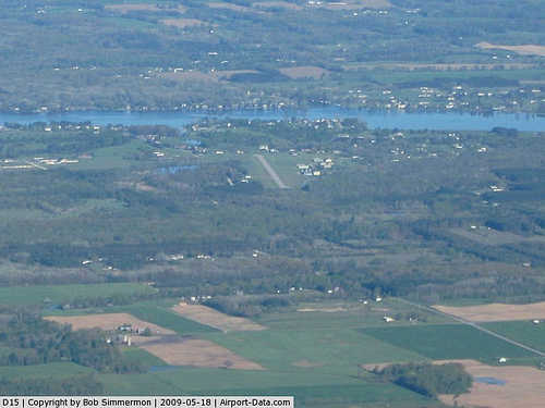
Lake Isabella Airpark Airport |
|
 |
(Click on the photo to enlarge) |
|
 |
(Click on the photo to enlarge) |
Location & QuickFacts
| FAA Information Effective: | 2008-09-25 |
| Airport Identifier: | D15 |
| Airport Status: | Operational |
| Longitude/Latitude: | 084-58-55.0860W/43-38-40.1020N
-84.981968/43.644473 (Estimated) |
| Elevation: | 886 ft / 270.05 m (Surveyed) |
| Land: | 18 acres |
| From nearest city: | 1 nautical miles E of Lake Isabella, MI |
| Location: | Isabella County, MI |
| Magnetic Variation: | 05W (1985) |
Owner & Manager
| Ownership: | Publicly owned |
| Owner: | Sherry Yens |
| Address: | 1010 Clubhouse Way
Lake Isabella, MI 48893-9339 |
| Phone number: | 989-644-8654 |
| Manager: | Elmer Ledbetter |
| Address: | 1010 Clubhouse Way
Lake Isabella, MI 48893-9339 |
| Phone number: | 989-644-2504 |
Airport Operations and Facilities
| Airport Use: | Open to public |
| Wind indicator: | Yes |
| Segmented Circle: | No |
| Control Tower: | No |
| Landing fee charge: | No |
| Sectional chart: | Detroit |
| Region: | AGL - Great Lakes |
| Boundary ARTCC: | ZMP - Minneapolis |
| Tie-in FSS: | LAN - Lansing |
| FSS on Airport: | No |
| FSS Toll Free: | 1-800-WX-BRIEF |
| NOTAMs Facility: | LAN (NOTAM-d service avaliable) |
Airport Communications
| CTAF: | 122.800 |
| Unicom: | 122.800 |
Airport Services
| Bottled Oxygen: | NONE |
| Bulk Oxygen: | NONE |
Runway Information
Runway 11/29
| Dimension: | 2582 x 50 ft / 787.0 x 15.2 m |
| Surface: | ASPH, Good Condition |
| |
Runway 11 |
Runway 29 |
| Longitude: | 084-59-12.3200W | 084-58-37.8300W |
| Latitude: | 43-38-42.1300N | 43-38-38.0500N |
| Elevation: | 886.00 ft | 886.00 ft |
| Traffic Pattern: | Left | Left |
| Markings: | Basic, Good Condition | Basic, Good Condition |
| Displaced threshold: | 1089.00 ft | 717.00 ft |
| Obstruction: | 68 ft tree, 271.0 ft from runway, 103 ft left of centerline, 1:1 slope to clear
APCH RATIO 20:1 AT DSPLCD THLD OVER 68 FT TREE, 1360 FT DSTC, 100 FT L.
+17 FT ROAD 41-90 FT FM RY END, & HOUSE 144 FT FM RWY END, 105 FT R & HOUSE 177 FT FM RWY, 120 L, AND 45 FT TREE, 135 FT DSTC, 103 FT L, APCH RATIO 3:1. | 41 ft trees, 201.0 ft from runway
RWY 29 APCH RATIO 20:1 OVER 41 FT TREES, 820 FT DSTC, 0B.
+15 FT ROAD 36 - 83 FT AND 41 FT TREES 99 FT FROM RWY END. |
|
Radio Navigation Aids
| ID |
Type |
Name |
Ch |
Freq |
Var |
Dist |
| AMN | NDB | Alma | | 329.00 | 05W | 21.1 nm |
| GDW | NDB | Wiggins | | 209.00 | 04W | 29.4 nm |
| CAD | NDB | Cadillac | | 269.00 | 04W | 42.3 nm |
| MOP | VOR/DME | Mount Pleasant | 043X | 110.60 | 05W | 10.7 nm |
| HIC | VOR/DME | White Cloud | 123X | 117.60 | 01W | 32.2 nm |
| MBS | VOR/DME | Saginaw | 076X | 112.90 | 03W | 40.0 nm |
| HTL | VOR/DME | Houghton Lake | 053X | 111.60 | 05W | 45.1 nm |
| BXZ | VOR/DME | West Branch | 079X | 113.20 | 06W | 49.9 nm |
Remarks
- NO REGULAR SNOW REMOVAL, FOR ARPT CONDITIONS CALL 898-644-8654.
Images and information placed above are from
http://www.airport-data.com/airport/D15/
We thank them for the data!
| General Info
|
| Country |
United States
|
| State |
MICHIGAN
|
| FAA ID |
D15
|
| Latitude |
43-38-40.102N
|
| Longitude |
084-58-55.086W
|
| Elevation |
886 feet
|
| Near City |
VILLAGE OF LAKE ISABELLA
|
We don't guarantee the information is fresh and accurate. The data may
be wrong or outdated.
For more up-to-date information please refer to other sources.
|
|