 |
|
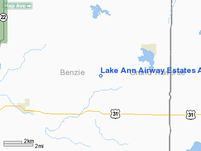
Lake Ann Airway Estates Airport |
Location & QuickFacts
| FAA Information Effective: | 2008-09-25 |
| Airport Identifier: | 4M0 |
| Airport Status: | Operational |
| Longitude/Latitude: | 085-54-49.0000W/44-41-52.0000N
-85.913611/44.697778 (Estimated) |
| Elevation: | 820 ft / 249.94 m (Estimated) |
| Land: | 80 acres |
| From nearest city: | 12 nautical miles W of Traverse City, MI |
| Location: | Leelanau County, MI |
| Magnetic Variation: | 05W (1995) |
Owner & Manager
| Ownership: | Privately owned |
| Owner: | Robert Leroy |
| Address: | 9001 Green Briar
Lake Ann, MI 49650
ARPT PHYSICAL ADDR. 4411 MAPLE CITY HYW, INTERLOCHEN MI 49643 |
| Phone number: | 231-642-7554 C |
| Manager: | Robert Leroy |
| Address: | 9001 Green Briar
Lake Ann, MI 49650 |
| Phone number: | 231-642-7554 C |
Airport Operations and Facilities
| Airport Use: | Open to public |
| Wind indicator: | Yes |
| Segmented Circle: | No |
| Control Tower: | No |
| Sectional chart: | Green Bay |
| Region: | AGL - Great Lakes |
| Boundary ARTCC: | ZMP - Minneapolis |
| Tie-in FSS: | LAN - Lansing |
| FSS on Airport: | No |
| FSS Toll Free: | 1-800-WX-BRIEF |
| NOTAMs Facility: | LAN (NOTAM-d service avaliable) |
Airport Communications
Runway Information
Runway 09/27
| Dimension: | 2537 x 100 ft / 773.3 x 30.5 m |
| Surface: | TURF, Good Condition |
| |
Runway 09 |
Runway 27 |
| Traffic Pattern: | Left | Left |
| Markings: | None,
09/27 & DSPLCD THLDS MKD WITH 3 FT YELLOW CONES. | None, |
| Displaced threshold: | 800.00 ft | 1337.00 ft |
| Obstruction: | 45 ft trees, 100.0 ft from runway, 100 ft left of centerline, 2:1 slope to clear
APCH RATIO 20:1 FM DSPLCD THLD; ALSO 20:1OVER +81 FT TREES, 1620 FT DSTC. | 75 ft trees, 0.0 ft from runway, 125 ft right of centerline
APCH RATIO 20:1 FM DSPLCD THLD OVER +75 FT TREE; 1500 FT DCTC. BASED ON STRAIGHT OUT; APCH RATIO 10:1 FM DSPLCD THLD BASED ON 75 FT TREE; 750 FT DSTC, 130 FT L/R. |
|
Radio Navigation Aids
| ID |
Type |
Name |
Ch |
Freq |
Var |
Dist |
| TV | NDB | Gwenn | | 365.00 | 05W | 20.8 nm |
| CXK | NDB | Clam Lake | | 251.00 | 05W | 31.2 nm |
| CAD | NDB | Cadillac | | 269.00 | 04W | 33.2 nm |
| CVX | NDB | Charlevoix | | 392.00 | 05W | 45.5 nm |
| GYG | NDB | Grayling | | 359.00 | 06W | 46.5 nm |
| LDM | NDB | Ludington | | 341.00 | 03W | 49.0 nm |
| MBL | VOR/DME | Manistee | 051X | 111.40 | 05W | 29.5 nm |
| TVC | VORTAC | Traverse City | 093X | 114.60 | 02W | 15.6 nm |
Remarks
- RY 27 END +75 FT TREES; 125 FT R/L OF RY CNTRLN; 150 FT FM RY END.
- SEE AIRSPACE CASE 95-AGL-642-NRA. ALSO REFER TO 93-AGL-733-NRA AND 91-AGL-628-NRA.
Images and information placed above are from
http://www.airport-data.com/airport/4M0/
We thank them for the data!
| General Info
|
| Country |
United States
|
| State |
MICHIGAN
|
| FAA ID |
4M0
|
| Latitude |
44-41-52.000N
|
| Longitude |
085-54-49.000W
|
| Elevation |
820 feet
|
| Near City |
TRAVERSE CITY
|
We don't guarantee the information is fresh and accurate. The data may
be wrong or outdated.
For more up-to-date information please refer to other sources.
|
|


