 |
|
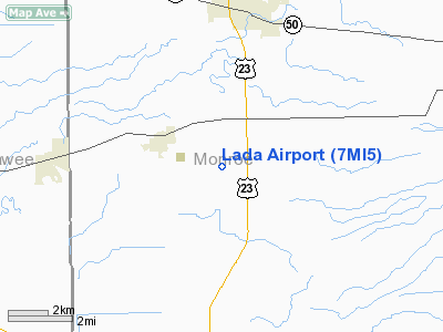
Location & QuickFacts
| FAA Information Effective: | 2008-09-25 |
| Airport Identifier: | 7MI5 |
| Airport Status: | Operational |
| Longitude/Latitude: | 083-40-35.7750W/41-53-15.1680N
-83.676604/41.887547 (Estimated) |
| Elevation: | 678 ft / 206.65 m (Surveyed) |
| Land: | 120 acres |
| From nearest city: | 2 nautical miles SE of Petersburg, MI |
| Location: | Monroe County, MI |
| Magnetic Variation: | 05W (1980) |
Owner & Manager
| Ownership: | Privately owned |
| Owner: | George A. Lada |
| Address: | 4408 Summerfield Road
Petersburg, MI 49270 |
| Phone number: | 313-279-1762 |
| Manager: | George A. Lada |
| Address: | 4408 Summerfield Road
Petersburg, MI 49270 |
| Phone number: | 313-279-1762 |
Airport Operations and Facilities
| Airport Use: | Private |
| Wind indicator: | Yes |
| Segmented Circle: | Yes |
| Control Tower: | No |
| Landing fee charge: | No |
| Sectional chart: | Detroit |
| Region: | AGL - Great Lakes |
| Boundary ARTCC: | ZOB - Cleveland |
| Tie-in FSS: | LAN - Lansing |
| FSS on Airport: | No |
| FSS Toll Free: | 1-800-WX-BRIEF |
Airport Communications
| Unicom: | 122.800
UNICOM UNMONITORED. |
Airport Services
| Airframe Repair: | MAJOR
& A72 MAKE PRIOR ARRANGEMENT FOR MAJOR AIRFRAME & PWR PLANT RPRS CALL 313-279-1762. |
| Power Plant Repair: | MAJOR |
Runway Information
Runway 09/27
| Dimension: | 2650 x 125 ft / 807.7 x 38.1 m |
| Surface: | TURF, Fair Condition |
| |
Runway 09 |
Runway 27 |
| Traffic Pattern: | Left | Left |
| Displaced threshold: | 850.00 ft | 300.00 ft |
| Obstruction: | 87 ft trees, 300.0 ft from runway, 3:1 slope to clear
APCH RATIO 13:1 AT DSPLCD THLD. | 15 ft road, 50.0 ft from runway, 3:1 slope to clear
APCH RATIO 23:1 AT DSPLCD THLD. |
|
Runway 18/36
| Dimension: | 2580 x 200 ft / 786.4 x 61.0 m |
| Surface: | TURF, Fair Condition |
| |
Runway 18 |
Runway 36 |
| Traffic Pattern: | Left | Left |
| Displaced threshold: | 475.00 ft | 700.00 ft |
| Obstruction: | 85 ft trees, 1300.0 ft from runway, 15:1 slope to clear
APCH RATIO 20:1 AT DSPLCD THLD. | 38 ft trees, 60.0 ft from runway, 40 ft right of centerline, 1:1 slope to clear
APCH RATIO 20:1 AT DSPLCD THLD. |
|
Radio Navigation Aids
| ID |
Type |
Name |
Ch |
Freq |
Var |
Dist |
| TCU | NDB | Tecumseh | | 239.00 | 04W | 12.8 nm |
| ADG | NDB | Adrian | | 278.00 | 06W | 18.0 nm |
| USE | NDB | Fulton | | 375.00 | 05W | 26.4 nm |
| RYS | NDB | Grosse Ile | | 419.00 | 06W | 26.7 nm |
| G | NDB | Golf | | 398.00 | 05W | 35.3 nm |
| PCW | NDB | Port Clinton | | 423.00 | 06W | 42.5 nm |
| VQ | NDB | Cargl | | 230.00 | 05W | 42.8 nm |
| BYN | NDB | Bryan | | 260.00 | 04W | 43.1 nm |
| FZI | NDB | Fostoria | | 379.00 | 05W | 43.8 nm |
| QG | NDB | Windsor | | 353.00 | 06W | 44.2 nm |
| PT | NDB | Pelee Island | | 283.00 | 05W | 45.6 nm |
| OZW | NDB | Howell | | 243.00 | 05W | 46.9 nm |
| DFI | NDB | Defiance | | 246.00 | 05W | 47.3 nm |
| TOL | TACAN | Toledo | 072X | | 05W | 18.5 nm |
| DXO | VOR/DME | Detroit | 081X | 113.40 | 06W | 24.0 nm |
| VWV | VOR/DME | Waterville | 078X | 113.10 | 02W | 26.3 nm |
| JXN | VOR/DME | Jackson | 033X | 109.60 | 05W | 41.4 nm |
| YQG | VOR/DME | Windsor | 085X | 113.80 | 06W | 43.6 nm |
| LFD | VOR/DME | Litchfield | 049X | 111.20 | 05W | 49.8 nm |
| CRL | VORTAC | Carleton | 104X | 115.70 | 03W | 13.7 nm |
| SVM | VORTAC | Salem | 090X | 114.30 | 03W | 31.6 nm |
| PSI | VORTAC | Pontiac | 047X | 111.00 | 03W | 49.3 nm |
| YIP | VOT | Willow Run | | 112.00 | | 21.9 nm |
| DTW | VOT | Detroit Met Wayne | | 109.80 | | 24.7 nm |
| DET | VOT | Detroit City | | 111.60 | | 42.8 nm |
Remarks
- ALL RYS HAVE IREG SURFACES & MAY BE SOFT IN SPRING.
- OCNL GLIDER OPERS EACH SIDE OF RY 18/36.
- HEAVY FARM EQUIP LCTD ON PRIM SFC OF RY 36; FIRST 1200 FT.
- NO SNOW REMOVAL.
Images and information placed above are from
http://www.airport-data.com/airport/7MI5/
We thank them for the data!
| General Info
|
| Country |
United States
|
| State |
MICHIGAN
|
| FAA ID |
7MI5
|
| Latitude |
41-53-15.168N
|
| Longitude |
083-40-35.775W
|
| Elevation |
678 feet
|
| Near City |
PETERSBURG
|
We don't guarantee the information is fresh and accurate. The data may
be wrong or outdated.
For more up-to-date information please refer to other sources.
|
|


