 |
|
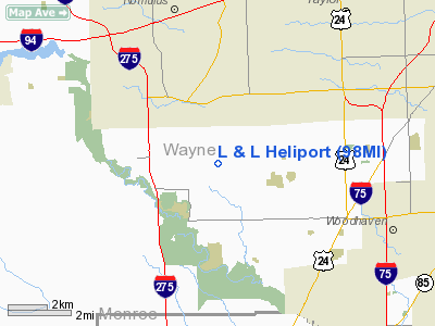
Location & QuickFacts
| FAA Information Effective: | 2008-09-25 |
| Airport Identifier: | 98MI |
| Airport Status: | Operational |
| Longitude/Latitude: | 083-20-43.0000W/42-09-48.0000N
-83.345278/42.163333 (Estimated) |
| Elevation: | 630 ft / 192.02 m (Estimated) |
| Land: | 0 acres |
| From nearest city: | 2 nautical miles E of Huron Township, MI |
| Location: | Wayne County, MI |
| Magnetic Variation: | () |
Owner & Manager
| Ownership: | Privately owned |
| Owner: | Larry Franzel |
| Address: | 19360 Merriman Rd.
Romulus, MI 48174 |
| Phone number: | 734-753-4445 |
| Manager: | Larry Franzel |
| Address: | 19360 Merriman Rd.
Romulus, MI 48174 |
| Phone number: | 734-753-4445 |
Airport Operations and Facilities
| Airport Use: | Private |
| Wind indicator: | Yes |
| Control Tower: | No |
| Sectional chart: | Detroit |
| Region: | AGL - Great Lakes |
| Boundary ARTCC: | ZOB - Cleveland |
| Tie-in FSS: | LAN - Lansing |
| FSS Toll Free: | 1-800-WX-BRIEF |
Runway Information
Helipad H1
| Dimension: | 30 x 30 ft / 9.1 x 9.1 m |
| Surface: | CONC, |
| |
Runway H1 |
Runway |
| Traffic Pattern: | Left | Left |
|
Radio Navigation Aids
| ID |
Type |
Name |
Ch |
Freq |
Var |
Dist |
| RYS | NDB | Grosse Ile | | 419.00 | 06W | 9.4 nm |
| G | NDB | Golf | | 398.00 | 05W | 14.1 nm |
| VQ | NDB | Cargl | | 230.00 | 05W | 20.9 nm |
| QG | NDB | Windsor | | 353.00 | 06W | 23.0 nm |
| TCU | NDB | Tecumseh | | 239.00 | 04W | 25.1 nm |
| ADG | NDB | Adrian | | 278.00 | 06W | 37.1 nm |
| PT | NDB | Pelee Island | | 283.00 | 05W | 38.0 nm |
| OZW | NDB | Howell | | 243.00 | 05W | 40.2 nm |
| PCW | NDB | Port Clinton | | 423.00 | 06W | 44.2 nm |
| USE | NDB | Fulton | | 375.00 | 05W | 48.5 nm |
| MTC | TACAN | Selfridge | 064X | | 06W | 35.4 nm |
| TOL | TACAN | Toledo | 072X | | 05W | 39.8 nm |
| DXO | VOR/DME | Detroit | 081X | 113.40 | 06W | 3.1 nm |
| YQG | VOR/DME | Windsor | 085X | 113.80 | 06W | 23.6 nm |
| VWV | VOR/DME | Waterville | 078X | 113.10 | 02W | 44.8 nm |
| JXN | VOR/DME | Jackson | 033X | 109.60 | 05W | 49.9 nm |
| CRL | VORTAC | Carleton | 104X | 115.70 | 03W | 8.6 nm |
| SVM | VORTAC | Salem | 090X | 114.30 | 03W | 18.4 nm |
| PSI | VORTAC | Pontiac | 047X | 111.00 | 03W | 33.4 nm |
| DTW | VOT | Detroit Met Wayne | | 109.80 | | 4.0 nm |
| YIP | VOT | Willow Run | | 112.00 | | 9.0 nm |
| DET | VOT | Detroit City | | 111.60 | | 20.6 nm |
Remarks
- PRVDD ALL APCHS FM 030 TO 090 DEGREES AND ALL DEP FM 200 TO 310 DEGREES; AREA IS MKD; WIND INDICATOR IS MAINTAINED; COMPLY WITH 14 CFR SECTION 91.126 (B)(2).
Images and information placed above are from
http://www.airport-data.com/airport/98MI/
We thank them for the data!
We don't guarantee the information is fresh and accurate. The data may
be wrong or outdated.
For more up-to-date information please refer to other sources.
|
|


