 |
|
Location & QuickFacts
| FAA Information Effective: | 2008-09-25 |
| Airport Identifier: | 6MI0 |
| Airport Status: | Operational |
| Longitude/Latitude: | 084-57-07.1400W/44-36-53.0400N
-84.951983/44.614733 (Estimated) |
| Elevation: | 1100 ft / 335.28 m (Estimated) |
| Land: | 0 acres |
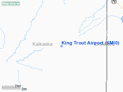
| From nearest city: | 11 nautical miles SW of Grayling, MI |
| Location: | Kalkaska County, MI |
| Magnetic Variation: | 05W (1990) |
Owner & Manager
| Ownership: | Privately owned |
| Owner: | King Trout Inc |
| Address: | 327 Seymour
Lansing, MI 48933 |
| Phone number: | 517-371-2577 |
| Manager: | George M. Carr |
| Address: | 327 Seymour
Lansing, MI 48933 |
| Phone number: | 517-371-2577 |
Airport Operations and Facilities
| Airport Use: | Private |
| Segmented Circle: | No |
| Control Tower: | No |
| Sectional chart: | Lake Huron |
| Region: | AGL - Great Lakes |
| Boundary ARTCC: | ZMP - Minneapolis |
| Tie-in FSS: | LAN - Lansing |
| FSS Toll Free: | 1-800-WX-BRIEF |
Runway Information
Runway 06/24
| Dimension: | 2100 x 60 ft / 640.1 x 18.3 m |
| Surface: | TURF, |
| |
Runway 06 |
Runway 24 |
| Traffic Pattern: | Left | Left |
| Obstruction: | 30 ft trees | 30 ft trees |
|
Radio Navigation Aids
| ID |
Type |
Name |
Ch |
Freq |
Var |
Dist |
| GYG | NDB | Grayling | | 359.00 | 06W | 9.7 nm |
| CXK | NDB | Clam Lake | | 251.00 | 05W | 21.1 nm |
| TV | NDB | Gwenn | | 365.00 | 05W | 21.6 nm |
| CAD | NDB | Cadillac | | 269.00 | 04W | 28.5 nm |
| BFA | NDB | Boyne Falls | | 263.00 | 06W | 33.2 nm |
| BHW | NDB | Hardwood | | 236.00 | 06W | 43.3 nm |
| CVX | NDB | Charlevoix | | 392.00 | 05W | 43.5 nm |
| GDW | NDB | Wiggins | | 209.00 | 04W | 43.9 nm |
| CGG | VOR | Grayling | | 109.80 | 06W | 10.4 nm |
| HTL | VOR/DME | Houghton Lake | 053X | 111.60 | 05W | 19.7 nm |
| GLR | VOR/DME | Gaylord | 029X | 109.20 | 06W | 26.1 nm |
| BXZ | VOR/DME | West Branch | 079X | 113.20 | 06W | 39.9 nm |
| TVC | VORTAC | Traverse City | 093X | 114.60 | 02W | 25.8 nm |
Remarks
- PRVDD ANY OBSTRUCTIONS IN RY APCH SLOPE SFC BE REMOVED/LOWERED OR RY THR BE DSPLCD & MKD TO PRVD A MIN 20:1 APCH SFC CLNC OVER THE OBSTRUCTIONS.
Images and information placed above are from
http://www.airport-data.com/airport/6MI0/
We thank them for the data!
| General Info
|
| Country |
United States
|
| State |
MICHIGAN
|
| FAA ID |
6MI0
|
| Latitude |
44-36-53.040N
|
| Longitude |
084-57-07.140W
|
| Elevation |
1100 feet
|
| Near City |
GRAYLING
|
We don't guarantee the information is fresh and accurate. The data may
be wrong or outdated.
For more up-to-date information please refer to other sources.
|
|


