 |
|
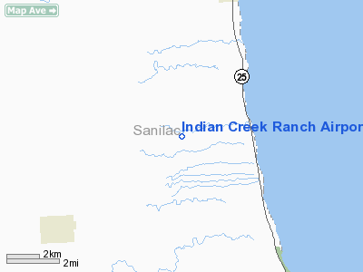
Indian Creek Ranch Airport |
Location & QuickFacts
| FAA Information Effective: | 2008-09-25 |
| Airport Identifier: | 56G |
| Airport Status: | Operational |
| Longitude/Latitude: | 082-38-51.5004W/43-34-39.7620N
-82.647639/43.577712 (Estimated) |
| Elevation: | 745 ft / 227.08 m (Estimated) |
| Land: | 270 acres |
| From nearest city: | 5 nautical miles NE of Deckerville, MI |
| Location: | Sanilac County, MI |
| Magnetic Variation: | 07W (1985) |
Owner & Manager
| Ownership: | Privately owned |
| Owner: | Tom Rich |
| Address: | 3830 Loree Rd
Deckerville, MI 48427 |
| Phone number: | 810-376-4846 |
| Manager: | Tom Rich |
| Address: | 3830 Loree Rd
Deckerville, MI 48427 |
| Phone number: | 810-376-4846 |
Airport Operations and Facilities
| Airport Use: | Open to public |
| Wind indicator: | Yes |
| Control Tower: | No |
| Landing fee charge: | No |
| Sectional chart: | Detroit |
| Region: | AGL - Great Lakes |
| Boundary ARTCC: | ZOB - Cleveland |
| Tie-in FSS: | LAN - Lansing |
| FSS on Airport: | No |
| FSS Toll Free: | 1-800-WX-BRIEF |
| NOTAMs Facility: | LAN (NOTAM-d service avaliable) |
Airport Communications
Airport Services
| Airframe Repair: | NONE |
| Power Plant Repair: | NONE |
Runway Information
Runway 09/27
| Dimension: | 3569 x 100 ft / 1087.8 x 30.5 m |
| Surface: | TURF, Fair Condition |
| |
Runway 09 |
Runway 27 |
| Longitude: | 082-39-14.1000W | 082-38-25.6200W |
| Latitude: | 43-34-42.3000N | 43-34-43.2000N |
| Traffic Pattern: | Left | Left |
| Obstruction: | 100 ft tank, 3000.0 ft from runway, 30:1 slope to clear | 40 ft pline, 815.0 ft from runway, 20:1 slope to clear |
|
Runway 18/36
| Dimension: | 2390 x 100 ft / 728.5 x 30.5 m |
| Surface: | TURF, Fair Condition |
| |
Runway 18 |
Runway 36 |
| Longitude: | 082-38-54.3000W | 082-38-53.6000W |
| Latitude: | 43-34-47.1000N | 43-34-23.5000N |
| Traffic Pattern: | Left | Left |
| Markings: | , | None, |
| Displaced threshold: | 400.00 ft | 400.00 ft |
| Obstruction: | 30 ft trees, 207.0 ft from runway, 6:1 slope to clear
RY 18 APCH RATIO 20:1 AT DSPLCD THLD. | 15 ft road, 40.0 ft from runway, 2:1 slope to clear
RWY 36 APCH RATIO 31:1 AT DSPLCD TH. |
|
Radio Navigation Aids
| ID |
Type |
Name |
Ch |
Freq |
Var |
Dist |
| GD | NDB | Goderich | | 286.00 | 08W | 41.1 nm |
| ZR | NDB | Sarnia | | 404.00 | 06W | 42.4 nm |
| BAX | VOR/DME | Bad Axe | 019X | 108.20 | 05W | 19.1 nm |
| ECK | VORTAC | Peck | 087X | 114.00 | 07W | 19.6 nm |
Remarks
- NUMEROUS DEER ON & INVOF ARPT.
- ARPT CLSD NOV 1 TO APR 1.
- RYS SOFT IN SPRING.
- THRS MUST BE DSPLCD AND MRKD TO ALLOW A 20:1 APCH RATIO OVER THE OBSTRUCTIONS.
Images and information placed above are from
http://www.airport-data.com/airport/56G/
We thank them for the data!
| General Info
|
| Country |
United States
|
| State |
MICHIGAN
|
| FAA ID |
56G
|
| Latitude |
43-34-35.072N
|
| Longitude |
082-38-49.742W
|
| Elevation |
745 feet
|
| Near City |
DECKERVILLE
|
We don't guarantee the information is fresh and accurate. The data may
be wrong or outdated.
For more up-to-date information please refer to other sources.
|
|


