 |
|
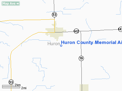
Huron County Memorial Airport |
| Huron County Memorial Airport |
| IATA: none – ICAO: KBAX – FAA LID: BAX |
| Summary |
| Airport type |
Public |
| Owner |
Huron County Road Commission |
| Serves |
Bad Axe, Michigan |
| Elevation AMSL |
763 ft / 233 m |
| Coordinates |
43°46′49″N 082°59′08″W / 43.78028°N 82.98556°W / 43.78028; -82.98556 |
| Runways |
| Direction |
Length |
Surface |
| ft |
m |
| 4/22 |
3,495 |
1,065 |
Asphalt |
| 17/35 |
5,009 |
1,527 |
Asphalt |
| Statistics (2008) |
| Aircraft operations |
10,000 |
| Based aircraft |
20 |
| Source: Federal Aviation Administration |
Huron County Memorial Airport (ICAO: KBAX, FAA LID: BAX) is a county-owned, public-use airport located one nautical mile (1.85 km) south of the central business district of Bad Axe, a city in Huron County, Michigan, United States. According to the FAA's National Plan of Integrated Airport Systems for 2009–2013, it is categorized as a general aviation airport.
Although many U.S. airports use the same three-letter location identifier for the FAA and IATA, this airport is assigned BAX by the FAA and no designation from the IATA (which assigned BAX to Barnaul Airport in Barnaul, Altai Krai, Russia).
Facilities and aircraft
Huron County Memorial Airport covers an area of 386 acres (156 ha) at an elevation of 763 feet (233 m) above mean sea level. It has two asphalt paved runways: 17/35 is 5,009 by 75 feet (1,527 x 23 m) and 4/22 is 3,495 by 75 feet (1,065 x 23 m).
For the 12-month period ending December 31, 2008, the airport had 10,000 general aviationaircraft operations, an average of 27 per day. At that time there were 20 aircraft based at this airport: 85% single-engine, 10% multi-engine and 5% jet.
The above content comes from Wikipedia and is published under free licenses – click here to read more.
Location & QuickFacts
| FAA Information Effective: | 2008-09-25 |
| Airport Identifier: | BAX |
| Airport Status: | Operational |
| Longitude/Latitude: | 082-59-07.5000W/43-46-48.8000N
-82.985417/43.780222 (Estimated) |
| Elevation: | 763 ft / 232.56 m (Surveyed) |
| Land: | 386 acres |
| From nearest city: | 1 nautical miles S of Bad Axe, MI |
| Location: | Huron County, MI |
| Magnetic Variation: | 05W (1980) |
Owner & Manager
| Ownership: | Publicly owned |
| Owner: | Neal J. Hentschl |
| Address: | P.o. Box 270, 417 South Hanselman Street
Bad Axe, MI 48413 |
| Phone number: | 989-269-6404 |
| Manager: | Ellen M. Engler |
| Address: | 352 Thompson Rd
Bad Axe, MI 48413 |
| Phone number: | 989-269-6511 |
Airport Operations and Facilities
| Airport Use: | Open to public |
| Wind indicator: | Yes |
| Segmented Circle: | Yes |
| Control Tower: | No |
| Lighting Schedule: | DUSK-DAWN
MIRL RYS 04/22 & 17/35 OPER DUSK-2130; TO INCR INTST & AFT 2130 ACTVT - CTAF. ACTVT PAPI & REIL RYS 17 & 35 - CTAF. |
| Beacon Color: | Clear-Green (lighted land airport) |
| Landing fee charge: | No |
| Sectional chart: | Detroit |
| Region: | AGL - Great Lakes |
| Boundary ARTCC: | ZOB - Cleveland |
| Tie-in FSS: | LAN - Lansing |
| FSS on Airport: | No |
| FSS Toll Free: | 1-800-WX-BRIEF |
| NOTAMs Facility: | BAX (NOTAM-d service avaliable) |
| Federal Agreements: | NGY |
Airport Communications
| CTAF: | 122.975 |
| Unicom: | 122.975 |
Airport Services
Runway Information
Runway 04/22
| Dimension: | 3495 x 75 ft / 1065.3 x 22.9 m |
| Surface: | ASPH, Good Condition
HAS NUMEROUS CRACKS . |
| Weight Limit: | Single wheel: 16000 lbs. |
| Edge Lights: | Non-standard lighting system
RY 04-22 NSTD MIRL; LGTS LAST 2000 FT NOT SPLIT/AMBER LENS. |
| |
Runway 04 |
Runway 22 |
| Longitude: | 082-59-20.6444W | 082-58-58.0252W |
| Latitude: | 43-46-43.0697N | 43-47-13.4456N |
| Elevation: | 755.00 ft | 762.00 ft |
| Alignment: | 28 | 127 |
| Traffic Pattern: | Left | Left |
| Markings: | Non-precision instrument, Good Condition
MKGS FADED. | Non-precision instrument, Good Condition
MKGS FADED. |
| Displaced threshold: | 300.00 ft | 0.00 ft |
| Centerline Lights: | No | No |
| Touchdown Lights: | No | No |
| Obstruction: | 23 ft rr, 201.0 ft from runway, 250 ft left of centerline
APCH 21:1 TO DSPLCD THLD. | 47 ft trees, 435.0 ft from runway, 285 ft right of centerline, 5:1 slope to clear |
|
Runway 17/35
| Dimension: | 5009 x 75 ft / 1526.7 x 22.9 m |
| Surface: | ASPH, Fair Condition
HAS NUMEROUS CRACKS . |
| Edge Lights: | Medium
RY 04-22 NSTD MIRL; LGTS LAST 2000 FT NOT SPLIT/AMBER LENS. |
| |
Runway 17 |
Runway 35 |
| Longitude: | 082-59-15.2023W | 082-58-57.2755W |
| Latitude: | 43-47-06.1383N | 43-46-18.4044N |
| Elevation: | 763.00 ft | 753.00 ft |
| Alignment: | 127 | 127 |
| Traffic Pattern: | Left | Left |
| Markings: | Non-precision instrument, Fair Condition | Non-precision instrument, Fair Condition |
| VASI: | 4-light PAPI on left side | 4-light PAPI on left side |
| Runway End Identifier: | Yes | Yes |
| Obstruction: | 72 ft trees, 1800.0 ft from runway, 202 ft left of centerline, 22:1 slope to clear | 63 ft trees, 1775.0 ft from runway, 442 ft right of centerline, 25:1 slope to clear |
|
Radio Navigation Aids
| ID |
Type |
Name |
Ch |
Freq |
Var |
Dist |
| HYX | NDB | Browne | | 385.00 | 06W | 43.4 nm |
| BAX | VOR/DME | Bad Axe | 019X | 108.20 | 05W | 0.2 nm |
| ASP | VOR/DME | Au Sable | 108X | 116.10 | 07W | 43.9 nm |
| MBS | VOR/DME | Saginaw | 076X | 112.90 | 03W | 49.8 nm |
| ECK | VORTAC | Peck | 087X | 114.00 | 07W | 33.6 nm |
Remarks
- BIRDS ON AND INVOF ARPT.
- TWY 'A' CLSD WINTER MONTHS.
Images and information placed above are from
http://www.airport-data.com/airport/BAX/
We thank them for the data!
| General Info
|
| Country |
United States
|
| State |
MICHIGAN
|
| FAA ID |
BAX
|
| Latitude |
43-46-48.840N
|
| Longitude |
082-59-07.545W
|
| Elevation |
766 feet
|
| Near City |
BAD AXE
|
We don't guarantee the information is fresh and accurate. The data may
be wrong or outdated.
For more up-to-date information please refer to other sources.
|
|


