 |
|
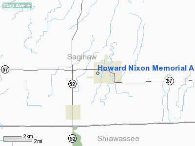
Howard Nixon Memorial Airport |
Location & QuickFacts
| FAA Information Effective: | 2008-09-25 |
| Airport Identifier: | 50G |
| Airport Status: | Operational |
| Longitude/Latitude: | 084-07-59.9110W/43-11-00.0930N
-84.133309/43.183359 (Estimated) |
| Elevation: | 644 ft / 196.29 m (Surveyed) |
| Land: | 52 acres |
| From nearest city: | 1 nautical miles W of Chesaning, MI |
| Location: | Saginaw County, MI |
| Magnetic Variation: | 05W (1985) |
Owner & Manager
| Ownership: | Publicly owned |
| Owner: | Village Of Chesaning
VILLAGE ADMIN -MARLENE SCHULTZ; PHONE 989-845-3800. |
| Address: | 205 S 4th St
Chesaning, MI 48616 |
| Phone number: | 989-845-3800 |
| Manager: | Gerald Morford |
| Address: | 10062 Stanley Rd
Flushing, MI 48433 |
| Phone number: | 810-513-4255
ASST MGR JIM KOZLOWSKI 989-845-2149 |
Airport Operations and Facilities
| Airport Use: | Open to public |
| Wind indicator: | Yes |
| Segmented Circle: | Yes |
| Control Tower: | No |
| Lighting Schedule: | RDO-CTL
ACTVT LIRL RY 18/36 - CTAF. |
| Landing fee charge: | No |
| Sectional chart: | Detroit |
| Region: | AGL - Great Lakes |
| Boundary ARTCC: | ZOB - Cleveland |
| Tie-in FSS: | LAN - Lansing |
| FSS on Airport: | No |
| FSS Toll Free: | 1-800-WX-BRIEF |
| NOTAMs Facility: | LAN (NOTAM-d service avaliable) |
Airport Communications
Airport Services
| Airframe Repair: | NONE |
| Power Plant Repair: | NONE |
| Bottled Oxygen: | NONE |
| Bulk Oxygen: | NONE |
Runway Information
Runway 09/27
| Dimension: | 2800 x 150 ft / 853.4 x 45.7 m |
| Surface: | TURF, Fair Condition |
| |
Runway 09 |
Runway 27 |
| Longitude: | 084-08-18.7400W | 084-07-50.9400W |
| Latitude: | 43-10-54.6500N | 43-10-54.6500N |
| Elevation: | 644.00 ft | 644.00 ft |
| Traffic Pattern: | Left | Left |
| Displaced threshold: | 0.00 ft | 600.00 ft |
| Obstruction: | 70 ft trees, 280.0 ft from runway, 165L/ ft right of centerline, 4:1 slope to clear | 61 ft tree, 318.0 ft from runway, 75 ft left of centerline, 5:1 slope to clear
APCH RATIO 15:1 TO DSPLCD THLD OVER 61' TREE, 918' DSTC, 75' L. |
|
Runway 18/36
| Dimension: | 2200 x 150 ft / 670.6 x 45.7 m |
| Surface: | TURF, Fair Condition |
| Edge Lights: | Low |
| |
Runway 18 |
Runway 36 |
| Longitude: | 084-07-55.2700W | 084-07-56.1800W |
| Latitude: | 43-11-16.0300N | 43-10-54.3100N |
| Elevation: | 644.00 ft | 644.00 ft |
| Traffic Pattern: | Left | Left |
| Displaced threshold: | 400.00 ft | 414.00 ft |
| Runway End Identifier: | No | No |
| Obstruction: | 69 ft trees, 408.0 ft from runway, 80 ft right of centerline, 5:1 slope to clear
APCH RATIO 11:1 TO DSPLCD THLD, OVER 69 FT TREE, 808 FT DSTC, 80 FT R. | 65 ft tree, 585.0 ft from runway, 147 ft right of centerline, 9:1 slope to clear
RWY 36 APCH RATIO 15:1 TO DSPLCD THLD, OVER 65 FT TREE 999 DSTC, 147 FT R. |
|
Radio Navigation Aids
| ID |
Type |
Name |
Ch |
Freq |
Var |
Dist |
| HYX | NDB | Browne | | 385.00 | 06W | 19.2 nm |
| AMN | NDB | Alma | | 329.00 | 05W | 29.8 nm |
| OZW | NDB | Howell | | 243.00 | 05W | 33.6 nm |
| GDW | NDB | Wiggins | | 209.00 | 04W | 49.6 nm |
| MBS | VOR/DME | Saginaw | 076X | 112.90 | 03W | 21.1 nm |
| MOP | VOR/DME | Mount Pleasant | 043X | 110.60 | 05W | 37.3 nm |
| FNT | VORTAC | Flint | 116X | 116.90 | 06W | 21.4 nm |
| LAN | VORTAC | Lansing | 045X | 110.80 | 05W | 37.4 nm |
| PSI | VORTAC | Pontiac | 047X | 111.00 | 03W | 39.2 nm |
Remarks
- NO WINTER SNOW REMOVAL.
- RYS SOFT IN SPRING.
Images and information placed above are from
http://www.airport-data.com/airport/50G/
We thank them for the data!
| General Info
|
| Country |
United States
|
| State |
MICHIGAN
|
| FAA ID |
50G
|
| Latitude |
43-11-00.093N
|
| Longitude |
084-07-59.911W
|
| Elevation |
644 feet
|
| Near City |
CHESANING
|
We don't guarantee the information is fresh and accurate. The data may
be wrong or outdated.
For more up-to-date information please refer to other sources.
|
|


