 |
|
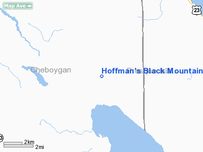
Hoffman's Black Mountain Aerodrome Airport |
Location & QuickFacts
| FAA Information Effective: | 2008-09-25 |
| Airport Identifier: | 2M7 |
| Airport Status: | Operational |
| Longitude/Latitude: | 084-18-29.0000W/45-31-55.0000N
-84.308056/45.531944 (Estimated) |
| Elevation: | 677 ft / 206.35 m (Estimated) |
| Land: | 160 acres |
| From nearest city: | 11 nautical miles SE of Cheboygan, MI |
| Location: | Cheboygan County, MI |
| Magnetic Variation: | 06W (1995) |
Owner & Manager
| Ownership: | Privately owned |
| Owner: | Allen And Betsy Hoffman |
| Address: | 9341 Twin Lakes Road
Cheboygan, MI 49721 |
| Phone number: | 231-627-2418 |
| Manager: | Allen D. Hoffman |
| Address: | 9341 Twin Lakes Road
Cheboygan, MI 49721 |
| Phone number: | 231-627-2418 |
Airport Operations and Facilities
| Airport Use: | Open to public |
| Wind indicator: | Yes |
| Segmented Circle: | No |
| Control Tower: | No |
| Sectional chart: | Lake Huron |
| Region: | AGL - Great Lakes |
| Boundary ARTCC: | ZMP - Minneapolis |
| Tie-in FSS: | LAN - Lansing |
| FSS on Airport: | No |
| FSS Toll Free: | 1-800-WX-BRIEF |
| NOTAMs Facility: | LAN (NOTAM-d service avaliable) |
Airport Communications
| CTAF: | 122.800 |
| Unicom: | 122.800 |
Airport Services
| Airframe Repair: | MAJOR |
| Power Plant Repair: | MAJOR |
Runway Information
Runway 15/33
| Dimension: | 2800 x 90 ft / 853.4 x 27.4 m |
| Surface: | TURF, Fair Condition
SOFT WHEN WET. CALL 231-627-2418 TO CFM RWY CONDS.
RY 15/33 SOFT WHEN WET. CALL 231-627-2418 TO CFM RY CONDS. RY ROUGH, UNEVEN, TIRE RUTS. |
| |
Runway 15 |
Runway 33 |
| Traffic Pattern: | Left | Left |
| Displaced threshold: | 1200.00 ft | 900.00 ft |
| Obstruction: | 60 ft trees, 120 ft right of centerline
RWY 15 APCH RATIO 20:1 FM DSPLCD THLD. | 40 ft trees, 0.0 ft from runway, 105 ft right of centerline
APCH RATIO 20:1 FM DSPLCD THLD OVER +55 FT TREES; 1100 FT FM DSPLCD THLD. |
|
Radio Navigation Aids
| ID |
Type |
Name |
Ch |
Freq |
Var |
Dist |
| PZQ | NDB | Rogers City | | 215.00 | 07W | 21.9 nm |
| BFA | NDB | Boyne Falls | | 263.00 | 06W | 34.0 nm |
| DRM | NDB | Drummond Island | | 218.00 | 07W | 37.1 nm |
| CVX | NDB | Charlevoix | | 392.00 | 05W | 42.9 nm |
| CI | NDB | Koloe | | 400.00 | 06W | 49.1 nm |
| GLR | VOR/DME | Gaylord | 029X | 109.20 | 06W | 35.4 nm |
| PLN | VORTAC | Pellston | 055X | 111.80 | 06W | 16.1 nm |
| APN | VORTAC | Alpena | 025X | 108.80 | 07W | 41.7 nm |
Remarks
- RY 15/33 DITCH ON BOTH SIDES OF RY.
- PRVDD THE AREA 125 FT EITHER SIDE & 200 FT OFF RY ENDS IS CLEARS; ANY OBSTR IN THE APCH ARE LWRD OR REMOVED OR THLDS DSPLCD TO PRVD A CLEAR 20:1 APCH.
Images and information placed above are from
http://www.airport-data.com/airport/2M7/
We thank them for the data!
| General Info
|
| Country |
United States
|
| State |
MICHIGAN
|
| FAA ID |
2M7
|
| Latitude |
45-31-55.000N
|
| Longitude |
084-18-29.000W
|
| Elevation |
677 feet
|
| Near City |
CHEBOYGAN
|
We don't guarantee the information is fresh and accurate. The data may
be wrong or outdated.
For more up-to-date information please refer to other sources.
|
|


