 |
|
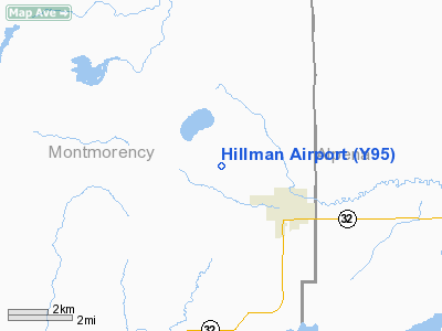
Location & QuickFacts
| FAA Information Effective: | 2008-09-25 |
| Airport Identifier: | Y95 |
| Airport Status: | Operational |
| Longitude/Latitude: | 083-56-24.9900W/45-05-00.0350N
-83.940275/45.083343 (Estimated) |
| Elevation: | 850 ft / 259.08 m (Estimated) |
| Land: | 200 acres |
| From nearest city: | 2 nautical miles NW of Hillman, MI |
| Location: | Montmorency County, MI |
| Magnetic Variation: | 06W (1985) |
Owner & Manager
| Ownership: | Publicly owned |
| Owner: | Village Of Hillman |
| Address: | P O Box 96
Hillman, MI 49746 |
| Phone number: | 989-742-4751 |
| Manager: | Mark Mellingen |
| Address: | Box 367
Hillman, MI 49746 |
| Phone number: | 989-742-4131
UNATNDD ARPT PHONE 989-742-4471. AMGR RES 989-742-4790. |
Airport Operations and Facilities
| Airport Use: | Open to public |
| Wind indicator: | Yes |
| Segmented Circle: | Yes |
| Control Tower: | No |
| Lighting Schedule: | RDO-CTL
ACTVT MIRL RY 04/22 - CTAF. |
| Landing fee charge: | No |
| Sectional chart: | Lake Huron |
| Region: | AGL - Great Lakes |
| Boundary ARTCC: | ZMP - Minneapolis |
| Tie-in FSS: | LAN - Lansing |
| FSS on Airport: | No |
| FSS Toll Free: | 1-800-WX-BRIEF |
| NOTAMs Facility: | LAN (NOTAM-d service avaliable) |
Airport Communications
Airport Services
| Power Plant Repair: | NONE |
| Bottled Oxygen: | NONE |
| Bulk Oxygen: | NONE |
Runway Information
Runway 04/22
| Dimension: | 3400 x 60 ft / 1036.3 x 18.3 m |
| Surface: | ASPH, Good Condition
RWY 18/36 SFC ROUGH & MODERATELY ROLLING, NOT MOWED |
| Edge Lights: | Medium |
| |
Runway 04 |
Runway 22 |
| Longitude: | 083-55-53.9400W | 083-55-30.4200W |
| Latitude: | 45-04-41.4700N | 45-05-10.6200N |
| Elevation: | 844.00 ft | 847.00 ft |
| Traffic Pattern: | Left | Left |
| Markings: | Non-precision instrument, Fair Condition | Basic, Fair Condition |
| Displaced threshold: | 0.00 ft | 760.00 ft |
| Obstruction: | 41 ft trees, 1020.0 ft from runway, 20:1 slope to clear | 65 ft trees, 201.0 ft from runway, 75 ft right of centerline
APCH RATIO 20:1 AT DSPLCD THLD; CTLG OBSTN +65 FT TREES; 1300 FT DSTC 100 FT R/L.
+50 FT TREES 170 FT FM RY END. |
|
Runway 18/36
| Dimension: | 2850 x 150 ft / 868.7 x 45.7 m |
| Surface: | TURF, Poor Condition
RWY 18/36 SFC ROUGH & MODERATELY ROLLING, NOT MOWED |
| |
Runway 18 |
Runway 36 |
| Longitude: | 083-56-30.4500W | 083-56-30.4500W |
| Latitude: | 45-05-06.1000N | 45-04-44.3800N |
| Elevation: | 850.00 ft | 850.00 ft |
| Traffic Pattern: | Left | Left |
| Obstruction: | 63 ft trees, 315.0 ft from runway, 5:1 slope to clear | 42 ft tree, 840.0 ft from runway, 20:1 slope to clear |
|
Radio Navigation Aids
| ID |
Type |
Name |
Ch |
Freq |
Var |
Dist |
| PZQ | NDB | Rogers City | | 215.00 | 07W | 20.0 nm |
| BFA | NDB | Boyne Falls | | 263.00 | 06W | 41.9 nm |
| GYG | NDB | Grayling | | 359.00 | 06W | 42.8 nm |
| CGG | VOR | Grayling | | 109.80 | 06W | 41.4 nm |
| GLR | VOR/DME | Gaylord | 029X | 109.20 | 06W | 32.7 nm |
| ASP | VOR/DME | Au Sable | 108X | 116.10 | 07W | 44.7 nm |
| APN | VORTAC | Alpena | 025X | 108.80 | 07W | 16.3 nm |
| PLN | VORTAC | Pellston | 055X | 111.80 | 06W | 44.9 nm |
Remarks
Images and information placed above are from
http://www.airport-data.com/airport/Y95/
We thank them for the data!
| General Info
|
| Country |
United States
|
| State |
MICHIGAN
|
| FAA ID |
Y95
|
| Latitude |
45-05-00.035N
|
| Longitude |
083-56-24.990W
|
| Elevation |
850 feet
|
| Near City |
HILLMAN
|
We don't guarantee the information is fresh and accurate. The data may
be wrong or outdated.
For more up-to-date information please refer to other sources.
|
|


