 |
|
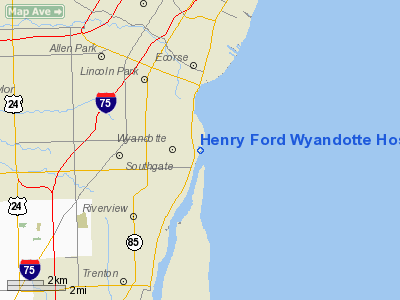
Henry Ford Wyandotte Hospital Heliport |
Location & QuickFacts
| FAA Information Effective: | 2008-09-25 |
| Airport Identifier: | MI61 |
| Airport Status: | Operational |
| Longitude/Latitude: | 083-08-39.0000W/42-12-30.1430N
-83.144167/42.208373 (Estimated) |
| Elevation: | 578 ft / 176.17 m (Estimated) |
| Land: | 0 acres |
| From nearest city: | 0 nautical miles N of Wyandotte, MI |
| Location: | Wayne County, MI |
| Magnetic Variation: | 06W (1985) |
Owner & Manager
| Ownership: | Privately owned |
| Owner: | Henry Ford Health System |
| Address: | Wyandotte Hospital
Wyandotte, MI 48192 |
| Phone number: | 313-284-2400 |
| Manager: | Tom Edwards |
| Address: | Box 10
Wyandotte, MI 48192 |
| Phone number: | 313-284-2400
EXT2604 |
Airport Operations and Facilities
| Airport Use: | Private
MEDICAL USE. |
| Wind indicator: | Yes |
| Segmented Circle: | No |
| Control Tower: | No |
| Landing fee charge: | No |
| Sectional chart: | Detroit |
| Region: | AGL - Great Lakes |
| Boundary ARTCC: | ZOB - Cleveland |
| Tie-in FSS: | LAN - Lansing |
| FSS on Airport: | No |
| FSS Toll Free: | 1-800-WX-BRIEF |
Airport Services
| Airframe Repair: | NONE |
| Power Plant Repair: | NONE |
Runway Information
Helipad H1
| Dimension: | 40 x 40 ft / 12.2 x 12.2 m |
| Surface: | CONC, |
| |
Runway H1 |
Runway |
| Traffic Pattern: | Left | Left |
|
Radio Navigation Aids
| ID |
Type |
Name |
Ch |
Freq |
Var |
Dist |
| G | NDB | Golf | | 398.00 | 05W | 4.8 nm |
| RYS | NDB | Grosse Ile | | 419.00 | 06W | 6.5 nm |
| VQ | NDB | Cargl | | 230.00 | 05W | 12.3 nm |
| QG | NDB | Windsor | | 353.00 | 06W | 13.8 nm |
| PT | NDB | Pelee Island | | 283.00 | 05W | 33.4 nm |
| TCU | NDB | Tecumseh | | 239.00 | 04W | 34.4 nm |
| PCW | NDB | Port Clinton | | 423.00 | 06W | 43.3 nm |
| OZW | NDB | Howell | | 243.00 | 05W | 45.3 nm |
| ADG | NDB | Adrian | | 278.00 | 06W | 46.4 nm |
| 4L | NDB | Chatham | | 236.00 | 06W | 47.9 nm |
| MTC | TACAN | Selfridge | 064X | | 06W | 28.0 nm |
| TOL | TACAN | Toledo | 072X | | 05W | 47.2 nm |
| DXO | VOR/DME | Detroit | 081X | 113.40 | 06W | 9.9 nm |
| YQG | VOR/DME | Windsor | 085X | 113.80 | 06W | 14.3 nm |
| CRL | VORTAC | Carleton | 104X | 115.70 | 03W | 17.0 nm |
| SVM | VORTAC | Salem | 090X | 114.30 | 03W | 23.4 nm |
| PSI | VORTAC | Pontiac | 047X | 111.00 | 03W | 34.3 nm |
| DTW | VOT | Detroit Met Wayne | | 109.80 | | 9.9 nm |
| DET | VOT | Detroit City | | 111.60 | | 13.1 nm |
| YIP | VOT | Willow Run | | 112.00 | | 16.9 nm |
Images and information placed above are from
http://www.airport-data.com/airport/MI61/
We thank them for the data!
| General Info
|
| Country |
United States
|
| State |
MICHIGAN
|
| FAA ID |
MI61
|
| Latitude |
42-12-30.143N
|
| Longitude |
083-08-29.724W
|
| Elevation |
578 feet
|
| Near City |
WYANDOTTE
|
We don't guarantee the information is fresh and accurate. The data may
be wrong or outdated.
For more up-to-date information please refer to other sources.
|
|


