 |
|
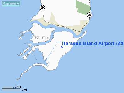
Location & QuickFacts
| FAA Information Effective: | 2008-09-25 |
| Airport Identifier: | Z92 |
| Airport Status: | Operational |
| Longitude/Latitude: | 082-34-32.4000W/42-35-21.9000N
-82.575667/42.589417 (Estimated) |
| Elevation: | 578 ft / 176.17 m (Estimated) |
| Land: | 107 acres |
| From nearest city: | 0 nautical miles N of Harsens Island, MI |
| Location: | St Clair County, MI |
| Magnetic Variation: | 06W (1990) |
Owner & Manager
| Ownership: | Privately owned |
| Owner: | Daryl Repokis |
| Address: | 2238 Columbine Rd
Harsens Island, MI 48028 |
| Phone number: | 810-748-0000 |
| Manager: | Jan Zboril |
| Address: | 3307 Dreen Dr
Harsens Island, MI 48028 |
| Phone number: | 810-748-8825 |
Airport Operations and Facilities
| Airport Use: | Open to public |
| Wind indicator: | Yes |
| Segmented Circle: | No |
| Control Tower: | No |
| Sectional chart: | Detroit |
| Region: | AGL - Great Lakes |
| Boundary ARTCC: | ZOB - Cleveland |
| Tie-in FSS: | LAN - Lansing |
| FSS on Airport: | No |
| FSS Toll Free: | 1-800-WX-BRIEF |
| NOTAMs Facility: | LAN (NOTAM-d service avaliable) |
Airport Communications
Airport Services
Runway Information
Runway 04/22
| Dimension: | 2225 x 100 ft / 678.2 x 30.5 m |
| Surface: | TURF, Good Condition |
| |
Runway 04 |
Runway 22 |
| Longitude: | 082-34-42.6100W | 082-34-22.2400W |
| Latitude: | 42-35-13.9100N | 42-35-29.9300N |
| Traffic Pattern: | Left | Left |
| Displaced threshold: | 371.00 ft | 230.00 ft |
| Obstruction: | 45 ft trees, 260.0 ft from runway, 130 ft left of centerline, 5:1 slope to clear
APCH RATIO 0:1 AT DSPLCD THLD, 45 FT TREE 30 FT DSTC 90 FT R. | 17 ft road, 78.0 ft from runway, 4:1 slope to clear
APCH RATIO 0:1 AT DSPLCD THLD +45 FT TREE 0 FT DSTC 120 FT L. |
|
Radio Navigation Aids
| ID |
Type |
Name |
Ch |
Freq |
Var |
Dist |
| QG | NDB | Windsor | | 353.00 | 06W | 21.1 nm |
| VQ | NDB | Cargl | | 230.00 | 05W | 21.9 nm |
| ZR | NDB | Sarnia | | 404.00 | 06W | 26.0 nm |
| 4L | NDB | Chatham | | 236.00 | 06W | 27.7 nm |
| G | NDB | Golf | | 398.00 | 05W | 29.5 nm |
| RYS | NDB | Grosse Ile | | 419.00 | 06W | 39.0 nm |
| PT | NDB | Pelee Island | | 283.00 | 05W | 48.9 nm |
| MTC | TACAN | Selfridge | 064X | | 06W | 11.4 nm |
| YQG | VOR/DME | Windsor | 085X | 113.80 | 06W | 23.3 nm |
| DXO | VOR/DME | Detroit | 081X | 113.40 | 06W | 41.8 nm |
| ECK | VORTAC | Peck | 087X | 114.00 | 07W | 40.5 nm |
| PSI | VORTAC | Pontiac | 047X | 111.00 | 03W | 42.8 nm |
| SVM | VORTAC | Salem | 090X | 114.30 | 03W | 46.4 nm |
| DET | VOT | Detroit City | | 111.60 | | 22.5 nm |
| DTW | VOT | Detroit Met Wayne | | 109.80 | | 41.2 nm |
| YIP | VOT | Willow Run | | 112.00 | | 47.1 nm |
Remarks
- NO SNOW REMOVAL.
- AVOID FLT OVER STATE WILDLIFE REFUGE AREAS S & W OF ARPT.
- PROVIDED AREA 125 FT EITHER SIDE OF RY CNTRLN & 240 FT OFF RY END CLEARED OF ALL OBSTRUCTIONS; AREA 60 FT EITHER SIDE OF RY CNTRLN & 240 FT OFF EACH RY END BE IN COMPLIANCE W/RSA CRITERIA PER AC150/5300-13 PARA 305.
Images and information placed above are from
http://www.airport-data.com/airport/Z92/
We thank them for the data!
| General Info
|
| Country |
United States
|
| State |
MICHIGAN
|
| FAA ID |
Z92
|
| Latitude |
42-35-23.000N
|
| Longitude |
082-34-35.000W
|
| Elevation |
578 feet
|
| Near City |
HARSENS ISLAND
|
We don't guarantee the information is fresh and accurate. The data may
be wrong or outdated.
For more up-to-date information please refer to other sources.
|
|


