 |
|
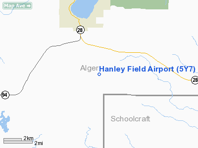
Location & QuickFacts
| FAA Information Effective: | 2008-09-25 |
| Airport Identifier: | 5Y7 |
| Airport Status: | Operational |
| Longitude/Latitude: | 086-37-15.5650W/46-21-14.8200N
-86.620990/46.354117 (Estimated) |
| Elevation: | 984 ft / 299.92 m (Estimated) |
| Land: | 252 acres |
| From nearest city: | 3 nautical miles SE of Munising, MI |
| Location: | Alger County, MI |
| Magnetic Variation: | 04W (1985) |
Owner & Manager
| Ownership: | Publicly owned |
| Owner: | U.s. Forest Service
ARPT LEASED TO ALGER COUNTY; COURT HOUSE; 101 COURT ST MUNISING MI 49862. 906-387-2076 |
| Address: | 101 Court Street
Munising, MI 49862 |
| Phone number: | 906-387-2512 |
| Manager: | Tony Williams |
| Address: | 101 Court Street
|
| Phone number: | 906-387-4211 |
Airport Operations and Facilities
| Airport Use: | Open to public |
| Wind indicator: | Yes |
| Segmented Circle: | Yes |
| Control Tower: | No |
| Lighting Schedule: | DUSK-DAWN |
| Beacon Color: | Clear-Green (lighted land airport) |
| Landing fee charge: | No |
| Sectional chart: | Green Bay |
| Region: | AGL - Great Lakes |
| Boundary ARTCC: | ZMP - Minneapolis |
| Tie-in FSS: | GRB - Green Bay |
| FSS on Airport: | No |
| FSS Toll Free: | 1-800-WX-BRIEF |
| NOTAMs Facility: | GRB (NOTAM-d service avaliable) |
Airport Communications
Airport Services
| Airframe Repair: | NONE |
| Power Plant Repair: | NONE |
| Bottled Oxygen: | NONE |
| Bulk Oxygen: | NONE |
Runway Information
Runway 18/36
| Dimension: | 4000 x 120 ft / 1219.2 x 36.6 m |
| Surface: | TURF, Good Condition |
| |
Runway 18 |
Runway 36 |
| Longitude: | 086-37-05.1700W | 086-37-05.1700W |
| Latitude: | 46-21-36.2500N | 46-20-56.7600N |
| Elevation: | 982.00 ft | 963.00 ft |
| Traffic Pattern: | Left | Left |
| Obstruction: | 68 ft trees, 952.0 ft from runway, 220 ft right of centerline, 14:1 slope to clear
APCH RATIO 50:1 BASED ON STRAIGHT OUT. | 62 ft trees, 2108.0 ft from runway, 34:1 slope to clear |
|
Radio Navigation Aids
| ID |
Type |
Name |
Ch |
Freq |
Var |
Dist |
| ISQ | VOR/DME | Schoolcraft County | 041X | 110.40 | 05W | 29.4 nm |
| SAW | VOR/DME | Sawyer | 118X | 117.10 | 04W | 32.2 nm |
| MQT | VOR/DME | Marquette/dcmsnd | 114X | 116.70 | 02W | 41.3 nm |
| ESC | VOR/DME | Escanaba | 045X | 110.80 | 00E | 42.7 nm |
| ERY | VOR/DME | Newberry | 019X | 108.20 | 06W | 48.1 nm |
Remarks
- ARPT CLSD NOV - MAY 14.
- BIRDS & DEER ON & INVOF ARPT.
- ULTRALIGHT ACTIVITY ON & INVOF ARPT.
Images and information placed above are from
http://www.airport-data.com/airport/5Y7/
We thank them for the data!
| General Info
|
| Country |
United States
|
| State |
MICHIGAN
|
| FAA ID |
5Y7
|
| Latitude |
46-21-14.820N
|
| Longitude |
086-37-15.565W
|
| Elevation |
984 feet
|
| Near City |
MUNISING
|
We don't guarantee the information is fresh and accurate. The data may
be wrong or outdated.
For more up-to-date information please refer to other sources.
|
|


