 |
|
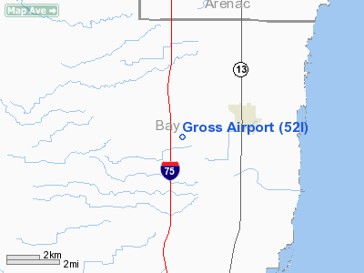
Location & QuickFacts
| FAA Information Effective: | 2008-09-25 |
| Airport Identifier: | 52I |
| Airport Status: | Operational |
| Longitude/Latitude: | 084-00-41.0000W/43-50-48.8000N
-84.011389/43.846889 (Estimated) |
| Elevation: | 615 ft / 187.45 m (Estimated) |
| Land: | 10 acres |
| From nearest city: | 3 nautical miles W of Pinconning, MI |
| Location: | Bay County, MI |
| Magnetic Variation: | 06W (1985) |
Owner & Manager
| Ownership: | Privately owned |
| Owner: | Carl A. Gross Inc |
| Address: | 706 5th St, Box 31
Pinconning, MI 48650 |
| Phone number: | 989-879-5048 |
| Manager: | James M. Klein |
| Address: | 706 5th St Box 31
Pinconning, MI 48650 |
| Phone number: | 989-708-7583
ASST AMGR MICHAEL HARTMAN 989-239-9878. |
Airport Operations and Facilities
| Airport Use: | Open to public |
| Wind indicator: | Yes |
| Segmented Circle: | No |
| Control Tower: | No |
| Lighting Schedule: | RDO-CTL
ACTVT LIRL RY 09/27 - CTAF. |
| Landing fee charge: | No |
| Sectional chart: | Detroit |
| Region: | AGL - Great Lakes |
| Boundary ARTCC: | ZMP - Minneapolis |
| Responsible ARTCC: | ZOB - Cleveland |
| Tie-in FSS: | LAN - Lansing |
| FSS on Airport: | No |
| FSS Toll Free: | 1-800-WX-BRIEF |
| NOTAMs Facility: | LAN (NOTAM-d service avaliable) |
Airport Communications
Airport Services
| Bottled Oxygen: | NONE |
| Bulk Oxygen: | NONE |
Runway Information
Runway 09/27
| Dimension: | 2565 x 100 ft / 781.8 x 30.5 m |
| Surface: | TURF, Good Condition |
| Edge Lights: | Low |
| |
Runway 09 |
Runway 27 |
| Longitude: | 084-00-58.5000W | 084-00-23.5000W |
| Latitude: | 43-50-48.8000N | 43-50-48.8000N |
| Traffic Pattern: | Left | Left |
| Displaced threshold: | 0.00 ft | 442.00 ft |
| Touchdown Lights: | No | No |
| Obstruction: | 66 ft trees, 1320.0 ft from runway, 20:1 slope to clear | 15 ft road, 60.0 ft from runway, 4:1 slope to clear
APCH RATIO AT DSPLCD THLD 14:1 OVER 22 FT TREES, 308 FT DSTC, 55 FT L. |
|
Radio Navigation Aids
| ID |
Type |
Name |
Ch |
Freq |
Var |
Dist |
| GDW | NDB | Wiggins | | 209.00 | 04W | 21.4 nm |
| BHW | NDB | Hardwood | | 236.00 | 06W | 24.4 nm |
| HYX | NDB | Browne | | 385.00 | 06W | 25.8 nm |
| AMN | NDB | Alma | | 329.00 | 05W | 46.1 nm |
| MBS | VOR/DME | Saginaw | 076X | 112.90 | 03W | 19.2 nm |
| BXZ | VOR/DME | West Branch | 079X | 113.20 | 06W | 24.9 nm |
| MOP | VOR/DME | Mount Pleasant | 043X | 110.60 | 05W | 34.3 nm |
| HTL | VOR/DME | Houghton Lake | 053X | 111.60 | 05W | 41.8 nm |
| BAX | VOR/DME | Bad Axe | 019X | 108.20 | 05W | 44.8 nm |
| ASP | VOR/DME | Au Sable | 108X | 116.10 | 07W | 44.9 nm |
Remarks
- FOR SNOW REMOVAL COND CALL 989-708-7583.
- BLDGS IN PRIM SFC EAST END, 70 FT N; 93 FT S OF CNTRLN; ALSO 4 FT FENCE ALONG RWY EDGE, FIRST 140 FT, S SIDE; +15-45 FT TREES 95 FT S OF CNTRLN WEST END.
- RWY 09 -6 FT DITCH, 15 FT FROM THLD, 5 FT L/R.
- PRVDD THRS DSPCLD & CLRLY MKD TO PRVD MIN 20:1 CLRNC OVER OBSTN.
Images and information placed above are from
http://www.airport-data.com/airport/52I/
We thank them for the data!
| General Info
|
| Country |
United States
|
| State |
MICHIGAN
|
| FAA ID |
52I
|
| Latitude |
43-50-48.078N
|
| Longitude |
084-00-58.958W
|
| Elevation |
615 feet
|
| Near City |
PINCONNING
|
We don't guarantee the information is fresh and accurate. The data may
be wrong or outdated.
For more up-to-date information please refer to other sources.
|
|


