 |
|
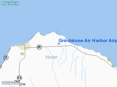
Grindstone Air Harbor Airport |
Location & QuickFacts
| FAA Information Effective: | 2008-09-25 |
| Airport Identifier: | 29C |
| Airport Status: | Operational |
| Longitude/Latitude: | 082-54-51.0000W/44-02-52.0000N
-82.914167/44.047778 (Estimated) |
| Elevation: | 640 ft / 195.07 m (Estimated) |
| Land: | 8 acres |
| From nearest city: | 4 nautical miles E of Port Austin, MI |
| Location: | Huron County, MI |
| Magnetic Variation: | 07W (1995) |
Owner & Manager
| Ownership: | Privately owned |
| Owner: | Kelly J. Hanson |
| Address: | 3100 Pte. Aux Barques Rd
Port Austin, MI 48467 |
| Phone number: | 989-269-7299 |
| Manager: | Kelly J. Hanson |
| Address: | 3100 Pte. Aux Barques Rd
Port Austin, MI 48467 |
| Phone number: | 989-269-7299 |
Airport Operations and Facilities
| Airport Use: | Open to public |
| Wind indicator: | Yes |
| Segmented Circle: | No |
| Control Tower: | No |
| Sectional chart: | Lake Huron |
| Region: | AGL - Great Lakes |
| Boundary ARTCC: | ZMP - Minneapolis |
| Tie-in FSS: | LAN - Lansing |
| FSS on Airport: | No |
| FSS Toll Free: | 1-800-WX-BRIEF |
| NOTAMs Facility: | LAN (NOTAM-d service avaliable) |
Airport Communications
Runway Information
Runway 18/36
| Dimension: | 1800 x 85 ft / 548.6 x 25.9 m |
| Surface: | TURF, Fair Condition |
| |
Runway 18 |
Runway 36 |
| Traffic Pattern: | Left | Left |
| Obstruction: | 40 ft trees, 10.0 ft from runway, 60 ft right of centerline | 40 ft trees, 0.0 ft from runway, 54 ft left of centerline |
|
Radio Navigation Aids
| ID |
Type |
Name |
Ch |
Freq |
Var |
Dist |
| BAX | VOR/DME | Bad Axe | 019X | 108.20 | 05W | 16.2 nm |
| ASP | VOR/DME | Au Sable | 108X | 116.10 | 07W | 31.8 nm |
| ECK | VORTAC | Peck | 087X | 114.00 | 07W | 48.4 nm |
Remarks
- RWY 36, 25 FT POWER LINE, 720 FT SOUTH OF RWY. APCH RATIO 28:1.
- MAN-MADE OR NATURAL OBJECTS EXIST WITHIN THE ASP NEEDED TO ENSURE SAFETY IN TKOF/LNDG OF ACFT.
Images and information placed above are from
http://www.airport-data.com/airport/29C/
We thank them for the data!
| General Info
|
| Country |
United States
|
| State |
MICHIGAN
|
| FAA ID |
29C
|
| Latitude |
44-02-52.000N
|
| Longitude |
082-54-51.000W
|
| Elevation |
640 feet
|
| Near City |
PORT AUSTIN
|
We don't guarantee the information is fresh and accurate. The data may
be wrong or outdated.
For more up-to-date information please refer to other sources.
|
|


