 |
|
Location & QuickFacts
| FAA Information Effective: | 2008-09-25 |
| Airport Identifier: | Y88 |
| Airport Status: | Operational |
| Longitude/Latitude: | 085-45-30.2740W/44-36-22.0050N
-85.758409/44.606113 (Estimated) |
| Elevation: | 866 ft / 263.96 m (Surveyed) |
| Land: | 0 acres |
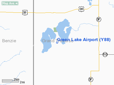
| From nearest city: | 3 nautical miles S of Interlochen, MI |
| Location: | Grand Traverse County, MI |
| Magnetic Variation: | 04W (1985) |
Owner & Manager
| Ownership: | Publicly owned |
| Owner: | Green Lake Township |
| Address: | Green Lake Township Hall
Interlochen, MI 49643 |
| Phone number: | 231-947-4598 |
| Manager: | Jim Anderson |
| Address: | 119 S Elmwood Ave
Traverse City, MI 49684 |
| Phone number: | 231-947-4598 |
Airport Operations and Facilities
| Airport Use: | Open to public |
| Wind indicator: | Yes |
| Segmented Circle: | Yes |
| Control Tower: | No |
| Landing fee charge: | No |
| Sectional chart: | Green Bay |
| Region: | AGL - Great Lakes |
| Boundary ARTCC: | ZMP - Minneapolis |
| Tie-in FSS: | LAN - Lansing |
| FSS on Airport: | No |
| FSS Toll Free: | 1-800-WX-BRIEF |
| NOTAMs Facility: | LAN (NOTAM-d service avaliable) |
Airport Communications
Airport Services
| Airframe Repair: | NONE |
| Power Plant Repair: | NONE |
| Bottled Oxygen: | NONE |
| Bulk Oxygen: | NONE |
Runway Information
Runway 05/23
| Dimension: | 2800 x 170 ft / 853.4 x 51.8 m |
| Surface: | TURF, Fair Condition |
| |
Runway 05 |
Runway 23 |
| Longitude: | 085-45-48.7500W | 085-45-19.1000W |
| Latitude: | 44-36-14.0600N | 44-36-31.8300N |
| Elevation: | 866.00 ft | 866.00 ft |
| Traffic Pattern: | Left | Left |
| Displaced threshold: | 0.00 ft | 600.00 ft |
| Obstruction: | 75 ft trees, 125 ft right of centerline
APCH RATIO 20:1 STRAIGHT OUT. | 63 ft trees, 126.0 ft from runway, 135 ft right of centerline, 2:1 slope to clear
APCH RATIO 2:1 AT DSPLCD THLD; +55 FT TREES 158 FT L 150 FT FM DSPLCD THLD; APCH RATIO 20:1 STRAIGHT OUT. |
|
Runway 16/34
| Dimension: | 1700 x 170 ft / 518.2 x 51.8 m |
| Surface: | TURF, Fair Condition |
| |
Runway 16 |
Runway 34 |
| Longitude: | 085-45-29.8500W | 085-45-22.3300W |
| Latitude: | 44-36-30.5800N | 44-36-10.5500N |
| Elevation: | 866.00 ft | 866.00 ft |
| Traffic Pattern: | Left | Left |
| Displaced threshold: | 200.00 ft | 380.00 ft |
| Obstruction: | 23 ft trees, 460.0 ft from runway, 20:1 slope to clear
APCH RATIO 28:1 AT DSPLCD THLD. | 53 ft trees, 742.0 ft from runway, 14:1 slope to clear
APCH RATIO 20:1 AT DSPLCD THLD. |
|
Radio Navigation Aids
| ID |
Type |
Name |
Ch |
Freq |
Var |
Dist |
| TV | NDB | Gwenn | | 365.00 | 05W | 16.0 nm |
| CAD | NDB | Cadillac | | 269.00 | 04W | 24.8 nm |
| CXK | NDB | Clam Lake | | 251.00 | 05W | 28.3 nm |
| GYG | NDB | Grayling | | 359.00 | 06W | 40.7 nm |
| CVX | NDB | Charlevoix | | 392.00 | 05W | 46.7 nm |
| LDM | NDB | Ludington | | 341.00 | 03W | 47.7 nm |
| BFA | NDB | Boyne Falls | | 263.00 | 06W | 49.0 nm |
| CGG | VOR | Grayling | | 109.80 | 06W | 44.3 nm |
| MBL | VOR/DME | Manistee | 051X | 111.40 | 05W | 29.3 nm |
| HTL | VOR/DME | Houghton Lake | 053X | 111.60 | 05W | 49.2 nm |
| TVC | VORTAC | Traverse City | 093X | 114.60 | 02W | 9.7 nm |
Remarks
- ATHLETIC FIELDS ON CNTRLN N END RY 16/34; DO NOT USE RY WHEN IN USE.
- NOISE SENSITIVE AREA ONE MILE NORTH OF ARPT.
- 460 FT ANTENNA 1.25 MI N OF ARPT.
- REMOTE CONTROL MODEL ACFT OPER AREA SOUTH OF RY 34 END.
- PRIOR TO 1959.
Images and information placed above are from
http://www.airport-data.com/airport/Y88/
We thank them for the data!
| General Info
|
| Country |
United States
|
| State |
MICHIGAN
|
| FAA ID |
Y88
|
| Latitude |
44-36-22.005N
|
| Longitude |
085-45-30.274W
|
| Elevation |
866 feet
|
| Near City |
INTERLOCHEN
|
We don't guarantee the information is fresh and accurate. The data may
be wrong or outdated.
For more up-to-date information please refer to other sources.
|
|


