 |
|
Location & QuickFacts
| FAA Information Effective: | 2008-09-25 |
| Airport Identifier: | 15MI |
| Airport Status: | Operational |
| Longitude/Latitude: | 082-55-53.7120W/42-32-40.1260N
-82.931587/42.544479 (Estimated) |
| Elevation: | 638 ft / 194.46 m (Estimated) |
| Land: | 0 acres |
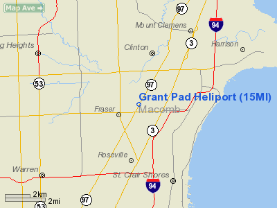
| From nearest city: | 1 nautical miles NE of Fraser, MI |
| Location: | Macomb County, MI |
| Magnetic Variation: | 06W (1985) |
Owner & Manager
| Ownership: | Privately owned |
| Owner: | Grant Industries, Inc. |
| Address: | 33415 Groesbeck Hwy
Fraser, MI 48026 |
| Phone number: | 313-293-9200 |
| Address: |
|
Airport Operations and Facilities
| Airport Use: | Private |
| Wind indicator: | Yes |
| Segmented Circle: | No |
| Control Tower: | No |
| Sectional chart: | Detroit |
| Region: | AGL - Great Lakes |
| Boundary ARTCC: | ZOB - Cleveland |
| Tie-in FSS: | LAN - Lansing |
| FSS Toll Free: | 1-800-WX-BRIEF |
Runway Information
Helipad H1
| Dimension: | 30 x 30 ft / 9.1 x 9.1 m |
| Surface: | CONC,
ROOFTOP. |
| |
Runway H1 |
Runway |
| Traffic Pattern: | Left | Left |
|
Radio Navigation Aids
| ID |
Type |
Name |
Ch |
Freq |
Var |
Dist |
| VQ | NDB | Cargl | | 230.00 | 05W | 11.4 nm |
| QG | NDB | Windsor | | 353.00 | 06W | 14.2 nm |
| G | NDB | Golf | | 398.00 | 05W | 18.8 nm |
| RYS | NDB | Grosse Ile | | 419.00 | 06W | 28.4 nm |
| ZR | NDB | Sarnia | | 404.00 | 06W | 38.9 nm |
| 4L | NDB | Chatham | | 236.00 | 06W | 40.4 nm |
| OZW | NDB | Howell | | 243.00 | 05W | 47.0 nm |
| PT | NDB | Pelee Island | | 283.00 | 05W | 47.4 nm |
| MTC | TACAN | Selfridge | 064X | | 06W | 6.0 nm |
| YQG | VOR/DME | Windsor | 085X | 113.80 | 06W | 18.3 nm |
| DXO | VOR/DME | Detroit | 081X | 113.40 | 06W | 27.7 nm |
| PSI | VORTAC | Pontiac | 047X | 111.00 | 03W | 28.2 nm |
| SVM | VORTAC | Salem | 090X | 114.30 | 03W | 30.5 nm |
| CRL | VORTAC | Carleton | 104X | 115.70 | 03W | 37.9 nm |
| ECK | VORTAC | Peck | 087X | 114.00 | 07W | 43.8 nm |
| FNT | VORTAC | Flint | 116X | 116.90 | 06W | 44.0 nm |
| DET | VOT | Detroit City | | 111.60 | | 9.2 nm |
| DTW | VOT | Detroit Met Wayne | | 109.80 | | 27.1 nm |
| YIP | VOT | Willow Run | | 112.00 | | 32.2 nm |
Remarks
- PRVDD OPNS ARE CONDUCTED FM 340 TO 050 DEGS & FM 080 TO 225 DEGS; AREA IS MKD & WIND INDICATOR IS MAINTAINED.
Images and information placed above are from
http://www.airport-data.com/airport/15MI/
We thank them for the data!
| General Info
|
| Country |
United States
|
| State |
MICHIGAN
|
| FAA ID |
15MI
|
| Latitude |
42-32-40.126N
|
| Longitude |
082-55-53.712W
|
| Elevation |
638 feet
|
| Near City |
FRASER
|
We don't guarantee the information is fresh and accurate. The data may
be wrong or outdated.
For more up-to-date information please refer to other sources.
|
|


