 |
|
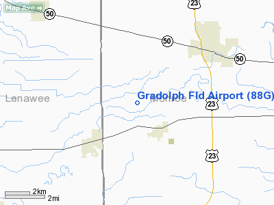
Location & QuickFacts
| FAA Information Effective: | 2008-09-25 |
| Airport Identifier: | 88G |
| Airport Status: | Operational |
| Longitude/Latitude: | 083-44-05.7790W/41-55-11.1660N
-83.734939/41.919768 (Estimated) |
| Elevation: | 673 ft / 205.13 m (Surveyed) |
| Land: | 23 acres |
| From nearest city: | 2 nautical miles NW of Petersburg, MI |
| Location: | Monroe County, MI |
| Magnetic Variation: | 05W (1985) |
Owner & Manager
| Ownership: | Privately owned |
| Owner: | Fred E. Waibel |
| Address: | 1785 Dennison Road, Box 308
Petersburg, MI 49270 |
| Phone number: | 734-279-1679 |
| Manager: | Fred E. Waibel |
| Address: | 1785 Dennison Road, Box 308
Petersburg, MI 49270 |
| Phone number: | 734-279-1679 |
Airport Operations and Facilities
| Airport Use: | Open to public |
| Wind indicator: | Yes |
| Control Tower: | No |
| Lighting Schedule: | PHONE REQ
FOR LIRL RY 09/27 & ROTG BCN CALL 734-279-1679. |
| Beacon Color: | Clear-Green (lighted land airport)
ROTG BCN OTS INDEFLY. |
| Landing fee charge: | No |
| Sectional chart: | Detroit |
| Region: | AGL - Great Lakes |
| Boundary ARTCC: | ZOB - Cleveland |
| Tie-in FSS: | LAN - Lansing |
| FSS on Airport: | No |
| FSS Toll Free: | 1-800-WX-BRIEF |
| NOTAMs Facility: | LAN (NOTAM-d service avaliable) |
Airport Communications
Airport Services
| Airframe Repair: | MAJOR |
| Power Plant Repair: | MAJOR |
| Bottled Oxygen: | NONE |
| Bulk Oxygen: | NONE |
Runway Information
Runway 09/27
| Dimension: | 2306 x 110 ft / 702.9 x 33.5 m |
| Surface: | TURF, Good Condition |
| Edge Lights: | Non-standard lighting system
RWY 09/27 NSTD LIRL DUE TO LENS COLOR & CONFIGURATION. |
| |
Runway 09 |
Runway 27 |
| Longitude: | 083-44-21.5100W | 083-43-50.0200W |
| Latitude: | 41-55-11.1500N | 41-55-11.1500N |
| Elevation: | 673.00 ft | 673.00 ft |
| Traffic Pattern: | Left | Left |
| Displaced threshold: | 310.00 ft | 230.00 ft |
| Runway End Identifier: | No | No |
| Centerline Lights: | No | No |
| Touchdown Lights: | No | No |
| Obstruction: | 45 ft trees, 60 ft right of centerline
RWY 09 APCH RATIO 3:1 FM DSPLCD THLD TO +45 FT TREES; 150 FT FM DSPLCD THLD 70 FT R. | 22 ft pline, 228.0 ft from runway, 10:1 slope to clear
RWY 27 APCH RATIO 5:1 FM DSPLCD THLD TO +50 FT TREES 284 FT FM DSPLCD THLD; 121 FT R. |
|
Radio Navigation Aids
| ID |
Type |
Name |
Ch |
Freq |
Var |
Dist |
| TCU | NDB | Tecumseh | | 239.00 | 04W | 9.6 nm |
| ADG | NDB | Adrian | | 278.00 | 06W | 15.6 nm |
| USE | NDB | Fulton | | 375.00 | 05W | 25.8 nm |
| RYS | NDB | Grosse Ile | | 419.00 | 06W | 28.2 nm |
| G | NDB | Golf | | 398.00 | 05W | 36.3 nm |
| BYN | NDB | Bryan | | 260.00 | 04W | 42.1 nm |
| VQ | NDB | Cargl | | 230.00 | 05W | 43.6 nm |
| OZW | NDB | Howell | | 243.00 | 05W | 44.4 nm |
| QG | NDB | Windsor | | 353.00 | 06W | 45.3 nm |
| PCW | NDB | Port Clinton | | 423.00 | 06W | 45.7 nm |
| FZI | NDB | Fostoria | | 379.00 | 05W | 46.5 nm |
| DFI | NDB | Defiance | | 246.00 | 05W | 46.9 nm |
| PT | NDB | Pelee Island | | 283.00 | 05W | 48.4 nm |
| TOL | TACAN | Toledo | 072X | | 05W | 19.8 nm |
| DXO | VOR/DME | Detroit | 081X | 113.40 | 06W | 24.1 nm |
| VWV | VOR/DME | Waterville | 078X | 113.10 | 02W | 28.5 nm |
| JXN | VOR/DME | Jackson | 033X | 109.60 | 05W | 38.2 nm |
| YQG | VOR/DME | Windsor | 085X | 113.80 | 06W | 45.0 nm |
| LFD | VOR/DME | Litchfield | 049X | 111.20 | 05W | 46.8 nm |
| CRL | VORTAC | Carleton | 104X | 115.70 | 03W | 14.6 nm |
| SVM | VORTAC | Salem | 090X | 114.30 | 03W | 30.1 nm |
| PSI | VORTAC | Pontiac | 047X | 111.00 | 03W | 47.8 nm |
| YIP | VOT | Willow Run | | 112.00 | | 21.1 nm |
| DTW | VOT | Detroit Met Wayne | | 109.80 | | 24.8 nm |
| DET | VOT | Detroit City | | 111.60 | | 43.3 nm |
Remarks
Images and information placed above are from
http://www.airport-data.com/airport/88G/
We thank them for the data!
| General Info
|
| Country |
United States
|
| State |
MICHIGAN
|
| FAA ID |
88G
|
| Latitude |
41-55-11.166N
|
| Longitude |
083-44-05.779W
|
| Elevation |
673 feet
|
| Near City |
PETERSBURG
|
We don't guarantee the information is fresh and accurate. The data may
be wrong or outdated.
For more up-to-date information please refer to other sources.
|
|


