 |
|
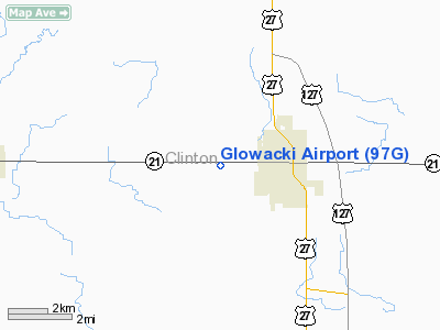
Location & QuickFacts
| FAA Information Effective: | 2008-09-25 |
| Airport Identifier: | 97G |
| Airport Status: | Operational |
| Longitude/Latitude: | 084-35-44.9530W/43-00-00.1150N
-84.595820/43.000032 (Estimated) |
| Elevation: | 775 ft / 236.22 m (Estimated) |
| Land: | 8 acres |
| From nearest city: | 2 nautical miles W of St Johns, MI |
| Location: | Clinton County, MI |
| Magnetic Variation: | 05W (1985) |
Owner & Manager
| Ownership: | Privately owned |
| Owner: | Sybil Glowacki
OWNER LIVES ON ARPT. |
| Address: | 3561 West M-21
St Johns, MI 48879 |
| Phone number: | 989-224-2759 |
| Manager: | Greg Glowacki |
| Address: | 3561 West M-21
St Johns, MI 48879 |
| Phone number: | 989-224-2759 |
Airport Operations and Facilities
| Airport Use: | Open to public |
| Wind indicator: | Yes |
| Segmented Circle: | No |
| Control Tower: | No |
| Landing fee charge: | No |
| Sectional chart: | Detroit |
| Region: | AGL - Great Lakes |
| Boundary ARTCC: | ZOB - Cleveland |
| Tie-in FSS: | LAN - Lansing |
| FSS on Airport: | No |
| FSS Toll Free: | 1-800-WX-BRIEF |
| NOTAMs Facility: | LAN (NOTAM-d service avaliable) |
Airport Communications
Airport Services
| Airframe Repair: | NONE |
| Power Plant Repair: | NONE |
Runway Information
Runway 09/27
| Dimension: | 1528 x 100 ft / 465.7 x 30.5 m |
| Surface: | TURF, Good Condition |
| |
Runway 09 |
Runway 27 |
| Traffic Pattern: | Left | Left |
| Obstruction: | 73 ft trees, 2481.0 ft from runway, 33:1 slope to clear | 65 ft bldg, 1474.0 ft from runway, 42 ft left of centerline, 22:1 slope to clear |
|
Radio Navigation Aids
| ID |
Type |
Name |
Ch |
Freq |
Var |
Dist |
| AMN | NDB | Alma | | 329.00 | 05W | 21.1 nm |
| OZW | NDB | Howell | | 243.00 | 05W | 34.7 nm |
| HYX | NDB | Browne | | 385.00 | 06W | 41.4 nm |
| BT | NDB | Batol | | 272.00 | 04W | 46.3 nm |
| MOP | VOR/DME | Mount Pleasant | 043X | 110.60 | 05W | 37.9 nm |
| MBS | VOR/DME | Saginaw | 076X | 112.90 | 03W | 39.2 nm |
| GRR | VOR/DME | Grand Rapids | 106Y | 115.95 | 04W | 41.7 nm |
| JXN | VOR/DME | Jackson | 033X | 109.60 | 05W | 44.9 nm |
| LAN | VORTAC | Lansing | 045X | 110.80 | 05W | 17.6 nm |
| FNT | VORTAC | Flint | 116X | 116.90 | 06W | 37.4 nm |
Remarks
- RY 27 TERRAIN SLOPES DOWNWARD E TO W; RY SOFT IN SPRING.
- 345 FT ANT ENE OF ARPT.
- RDO-CTL ACFT OPER ON ARPT.
- 15 FT TREE N SIDE OF RY ON RY EDGE, 132 FT EAST OF RY 09.
Images and information placed above are from
http://www.airport-data.com/airport/97G/
We thank them for the data!
| General Info
|
| Country |
United States
|
| State |
MICHIGAN
|
| FAA ID |
97G
|
| Latitude |
43-00-00.115N
|
| Longitude |
084-35-44.953W
|
| Elevation |
775 feet
|
| Near City |
ST JOHNS
|
We don't guarantee the information is fresh and accurate. The data may
be wrong or outdated.
For more up-to-date information please refer to other sources.
|
|


