 |
|
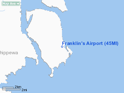
Location & QuickFacts
| FAA Information Effective: | 2008-09-25 |
| Airport Identifier: | 45MI |
| Airport Status: | Operational |
| Longitude/Latitude: | 084-07-35.0920W/46-15-50.0640N
-84.126414/46.263907 (Estimated) |
| Elevation: | 630 ft / 192.02 m (Estimated) |
| Land: | 0 acres |
| From nearest city: | 7 nautical miles SE of Barbeau, MI |
| Location: | Chippewa County, MI |
| Magnetic Variation: | 07W (1985) |
Owner & Manager
| Ownership: | Privately owned |
| Owner: | Ron Franklin |
| Address: | Neebish Is
Barbeau, MI 49710 |
| Phone number: | 906-632-2067 |
| Address: |
|
Airport Operations and Facilities
| Airport Use: | Private
PERSONAL USE. |
| Wind indicator: | Yes |
| Segmented Circle: | No |
| Control Tower: | No |
| Landing fee charge: | No |
| Sectional chart: | Lake Huron |
| Region: | AGL - Great Lakes |
| Boundary ARTCC: | ZMP - Minneapolis |
| Tie-in FSS: | GRB - Green Bay |
| FSS on Airport: | No |
| FSS Toll Free: | 1-800-WX-BRIEF |
Airport Services
| Airframe Repair: | NONE |
| Power Plant Repair: | NONE |
| Bottled Oxygen: | NONE |
| Bulk Oxygen: | NONE |
Runway Information
Runway 18/36
| Dimension: | 2150 x 80 ft / 655.3 x 24.4 m |
| Surface: | TURF, |
| |
Runway 18 |
Runway 36 |
| Longitude: | 084-07-35.0900W | 084-07-35.0900W |
| Latitude: | 46-16-00.6700N | 46-15-39.4400N |
| Elevation: | 630.00 ft | 630.00 ft |
| Traffic Pattern: | Left | Left |
| Runway End Identifier: | No | No |
| Centerline Lights: | No | No |
| Touchdown Lights: | No | No |
| Obstruction: | 60 ft trees/road, 200.0 ft from runway, 3:1 slope to clear | 40 ft trees/hill, 240.0 ft from runway, 6:1 slope to clear |
|
Radio Navigation Aids
| ID |
Type |
Name |
Ch |
Freq |
Var |
Dist |
| CI | NDB | Koloe | | 400.00 | 06W | 17.8 nm |
| DRM | NDB | Drummond Island | | 218.00 | 07W | 22.2 nm |
| A | NDB | Gros Cap | | 286.00 | 06W | 25.2 nm |
| SSM | VOR/DME | Sault Ste Marie | 059X | 112.20 | 04W | 11.9 nm |
| PLN | VORTAC | Pellston | 055X | 111.80 | 06W | 44.2 nm |
Remarks
- FISHING RESORT-NO PUBLIC SERVICES.
- RWY 18/36 NOT PLOWED WINTERS - FOR COND IN SPRING - CALL 906-632-2067.
- +60' TREES IN TRANSITION SURFACE EAST SIDE OF RWY.
- PRIVATE ROAD AT NORTH END.
Images and information placed above are from
http://www.airport-data.com/airport/45MI/
We thank them for the data!
| General Info
|
| Country |
United States
|
| State |
MICHIGAN
|
| FAA ID |
45MI
|
| Latitude |
46-15-50.064N
|
| Longitude |
084-07-35.092W
|
| Elevation |
630 feet
|
| Near City |
BARBEAU
|
We don't guarantee the information is fresh and accurate. The data may
be wrong or outdated.
For more up-to-date information please refer to other sources.
|
|


