 |
|
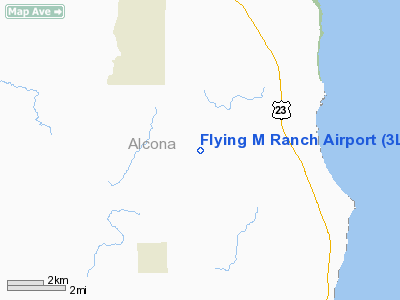
Location & QuickFacts
| FAA Information Effective: | 2008-09-25 |
| Airport Identifier: | 3L7 |
| Airport Status: | Operational |
| Longitude/Latitude: | 083-22-46.8920W/44-44-18.0440N
-83.379692/44.738346 (Estimated) |
| Elevation: | 830 ft / 252.98 m (Estimated) |
| Land: | 10 acres |
| From nearest city: | 3 nautical miles NE of Lincoln, MI |
| Location: | Alcona County, MI |
| Magnetic Variation: | 07W (1985) |
Owner & Manager
| Ownership: | Privately owned |
| Owner: | Nancy Milwrick
OWNER LIVES ON PREMISES. |
| Address: | 2818 N Covill
Lincoln, MI 48742 |
| Phone number: | 989-736-0800 |
| Manager: | Nancy Milwrick |
| Address: | 2818 N Covill
Lincoln, MI 48742 |
| Phone number: | 989-736-0800 |
Airport Operations and Facilities
| Airport Use: | Open to public |
| Wind indicator: | Yes |
| Segmented Circle: | No |
| Control Tower: | No |
| Sectional chart: | Lake Huron |
| Region: | AGL - Great Lakes |
| Boundary ARTCC: | ZMP - Minneapolis |
| Tie-in FSS: | LAN - Lansing |
| FSS on Airport: | No |
| FSS Toll Free: | 1-800-WX-BRIEF |
| NOTAMs Facility: | LAN (NOTAM-d service avaliable) |
Airport Communications
| CTAF: | 123.000 |
| Unicom: | 123.000 |
Airport Services
| Bottled Oxygen: | NONE |
| Bulk Oxygen: | NONE |
Runway Information
Runway 09/27
| Dimension: | 2200 x 90 ft / 670.6 x 27.4 m |
| Surface: | TURF, Good Condition
SFC SLIGHTLY ROUGH & IREG ON ROLLING TERRAIN. RY SLOPES DOWN FROM WEST TO EAST. |
| |
Runway 09 |
Runway 27 |
| Traffic Pattern: | Left | Left |
| Displaced threshold: | 600.00 ft | 0.00 ft |
| Runway End Identifier: | No | No |
| Centerline Lights: | No | No |
| Touchdown Lights: | No | No |
| Obstruction: | 23 ft pline, 137.0 ft from runway, 5:1 slope to clear
+55' TREE 110' RIGHT OF RWY CNTRLN.
APCH RATIO 20:1 AT DSPLCD THLD. | 43 ft trees, 860.0 ft from runway, 135 ft left of centerline, 20:1 slope to clear |
|
Radio Navigation Aids
| ID |
Type |
Name |
Ch |
Freq |
Var |
Dist |
| BHW | NDB | Hardwood | | 236.00 | 06W | 42.2 nm |
| PZQ | NDB | Rogers City | | 215.00 | 07W | 44.2 nm |
| ASP | VOR/DME | Au Sable | 108X | 116.10 | 07W | 17.4 nm |
| BXZ | VOR/DME | West Branch | 079X | 113.20 | 06W | 45.6 nm |
| APN | VORTAC | Alpena | 025X | 108.80 | 07W | 22.0 nm |
Remarks
- OCCASIONAL DEER ON RWY.
- RWY SOFT IN SPRING.
- ARPT CLSD NOV-APR & WHEN SNOW COVERED; NO SNOW REMOVAL.
- PRVDD 125 FT EITHER SIDE OF RY CENTERLINE AND 200 FT OFF RY END CLEAR OF OBSTRUCTIONS AND ANY OBSTRUCTIONS IN RY APCH SLOPE ARE REMOVED/LOWERED OR THLD DSPLCD AND MKD, TO PROVIDE A 20:1 APCH SLOPE.
Images and information placed above are from
http://www.airport-data.com/airport/3L7/
We thank them for the data!
| General Info
|
| Country |
United States
|
| State |
MICHIGAN
|
| FAA ID |
3L7
|
| Latitude |
44-44-18.044N
|
| Longitude |
083-22-46.892W
|
| Elevation |
830 feet
|
| Near City |
LINCOLN
|
We don't guarantee the information is fresh and accurate. The data may
be wrong or outdated.
For more up-to-date information please refer to other sources.
|
|


