 |
|
|
 |
(Click on the photo to enlarge) |
|
 |
(Click on the photo to enlarge) |
Location & QuickFacts
| FAA Information Effective: | 2008-09-25 |
| Airport Identifier: | 39Z |
| Airport Status: | Operational |
| Longitude/Latitude: | 086-07-25.1850W/43-06-18.0670N
-86.123662/43.105019 (Estimated) |
| Elevation: | 630 ft / 192.02 m (Estimated) |
| Land: | 30 acres |
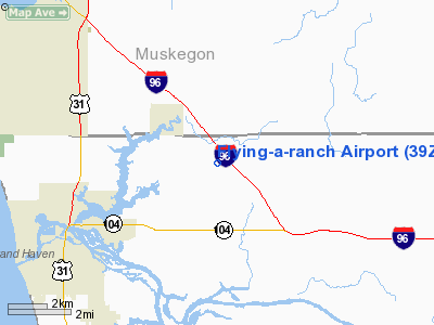
| From nearest city: | 2 nautical miles SE of Fruitport, MI |
| Location: | Ottawa County, MI |
| Magnetic Variation: | 03W (1985) |
Owner & Manager
| Ownership: | Privately owned |
| Owner: | Michael C. Alman |
| Address: | 18605 Mienk Dr
Fruitport, MI 49415 |
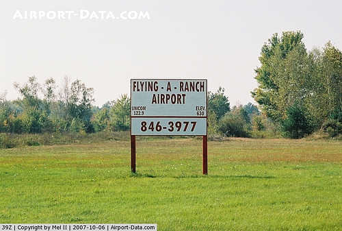
| Phone number: | 616-846-3977 |
| Manager: | Michael C. Alman |
| Address: | 18605 Mienk Dr
Fruitport, MI 49415 |
| Phone number: | 616-846-3977 |
Airport Operations and Facilities
| Airport Use: | Open to public |
| Wind indicator: | Yes |
| Segmented Circle: | Yes |
| Control Tower: | No |
| Landing fee charge: | No |
| Sectional chart: | Chicago |
| Region: | AGL - Great Lakes |
| Traffic Pattern Alt: | 800 ft |
| Boundary ARTCC: | ZAU - Chicago |
| Tie-in FSS: | LAN - Lansing |
| FSS on Airport: | No |
| FSS Toll Free: | 1-800-WX-BRIEF |
| NOTAMs Facility: | LAN (NOTAM-d service avaliable) |
Airport Communications
Airport Services
| Airframe Repair: | MAJOR |
| Power Plant Repair: | MAJOR |
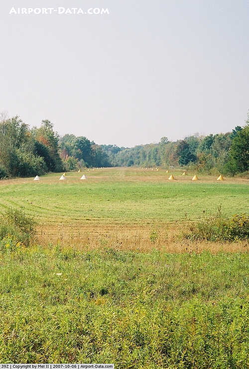
Runway Information
Runway 09/27
| Dimension: | 1925 x 70 ft / 586.7 x 21.3 m |
| Surface: | TURF, Good Condition |
| |
Runway 09 |
Runway 27 |
| Traffic Pattern: | Left | Right |
| Displaced threshold: | 327.00 ft | 0.00 ft |
| Obstruction: | 50 ft trees, 70 ft right of centerline
RWY 09 APCH RATIO 0:1 AT DSPLCD THLD BASED ON 30 FT TREES; 61 FT R, 0 FT DSTC., 20:1 BASED ON STRAIGHT OUT. | 23 ft trees, 640.0 ft from runway, 50 ft left of centerline, 27:1 slope to clear |
|
Radio Navigation Aids
| ID |
Type |
Name |
Ch |
Freq |
Var |
Dist |
| HLM | NDB | Holland | | 233.00 | 03W | 18.6 nm |
| HIC | VOR/DME | White Cloud | 123X | 117.60 | 01W | 33.4 nm |
| GRR | VOR/DME | Grand Rapids | 106Y | 115.95 | 04W | 33.6 nm |
| PMM | VOR/DME | Pullman | 058X | 112.10 | 00E | 38.4 nm |
| MKG | VORTAC | Muskegon | 099X | 115.20 | 01W | 5.3 nm |
Remarks
- FUEL AVBL FOR EMERGENCY USE ONLY
- NO SNOW REMOVAL.
- SEE AIRSPACE CASE 97-AGL-654-NRA.
Images and information placed above are from
http://www.airport-data.com/airport/39Z/
We thank them for the data!
| General Info
|
| Country |
United States
|
| State |
MICHIGAN
|
| FAA ID |
39Z
|
| Latitude |
43-06-18.067N
|
| Longitude |
086-07-25.185W
|
| Elevation |
630 feet
|
| Near City |
FRUITPORT
|
We don't guarantee the information is fresh and accurate. The data may
be wrong or outdated.
For more up-to-date information please refer to other sources.
|
|


