 |
|
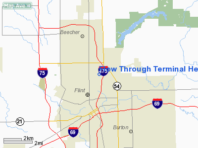
Flow Through Terminal Heliport |
Location & QuickFacts
| FAA Information Effective: | 2008-09-25 |
| Airport Identifier: | 01MI |
| Airport Status: | Operational |
| Longitude/Latitude: | 083-40-46.8430W/43-02-58.0960N
-83.679679/43.049471 (Estimated) |
| Elevation: | 736 ft / 224.33 m (Estimated) |
| Land: | 21 acres |
| From nearest city: | 0 nautical miles N of Flint, MI |
| Location: | Genesee County, MI |
| Magnetic Variation: | 07W (1985) |
Owner & Manager
| Ownership: | Privately owned |
| Owner: | Unit, Inc. |
| Address: | 4002 James P Cole Blvd
Flint, MI 48505 |
| Phone number: | 313-235-1500 |
| Manager: | Jack Mackenzie |
| Address: | 4002 James P Cole Blvd
Flint, MI 48505 |
| Phone number: | 313-235-1500 |
Airport Operations and Facilities
| Airport Use: | Private |
| Wind indicator: | Yes |
| Segmented Circle: | No |
| Control Tower: | No |
| Beacon Color: | Clear-Green (lighted land airport) |
| Landing fee charge: | No |
| Sectional chart: | Detroit |
| Region: | AGL - Great Lakes |
| Boundary ARTCC: | ZOB - Cleveland |
| Tie-in FSS: | LAN - Lansing |
| FSS on Airport: | No |
| FSS Toll Free: | 1-800-WX-BRIEF |
Runway Information
Helipad H1
| Dimension: | 50 x 50 ft / 15.2 x 15.2 m |
| Surface: | CONC, |
| |
Runway H1 |
Runway |
| Traffic Pattern: | Left | Left |
|
Radio Navigation Aids
| ID |
Type |
Name |
Ch |
Freq |
Var |
Dist |
| HYX | NDB | Browne | | 385.00 | 06W | 24.3 nm |
| OZW | NDB | Howell | | 243.00 | 05W | 28.4 nm |
| MTC | TACAN | Selfridge | 064X | | 06W | 45.7 nm |
| MBS | VOR/DME | Saginaw | 076X | 112.90 | 03W | 33.8 nm |
| FNT | VORTAC | Flint | 116X | 116.90 | 06W | 5.8 nm |
| PSI | VORTAC | Pontiac | 047X | 111.00 | 03W | 21.9 nm |
| SVM | VORTAC | Salem | 090X | 114.30 | 03W | 38.7 nm |
| ECK | VORTAC | Peck | 087X | 114.00 | 07W | 44.0 nm |
| LAN | VORTAC | Lansing | 045X | 110.80 | 05W | 49.1 nm |
| DET | VOT | Detroit City | | 111.60 | | 48.6 nm |
| YIP | VOT | Willow Run | | 112.00 | | 49.5 nm |
Remarks
- OPNS ARE CONDUCTED IN AN AREA FROM 60 DEG TO 100 DEG & FROM 185 DEG TO 260 DEG & FROM 340 DEG TO 360 DEG; WND INDICATOR IS MAINTAINED, AREA IS APPROPRIATELY MARKED.
Images and information placed above are from
http://www.airport-data.com/airport/01MI/
We thank them for the data!
| General Info
|
| Country |
United States
|
| State |
MICHIGAN
|
| FAA ID |
01MI
|
| Latitude |
43-02-58.096N
|
| Longitude |
083-40-46.843W
|
| Elevation |
736 feet
|
| Near City |
FLINT
|
We don't guarantee the information is fresh and accurate. The data may
be wrong or outdated.
For more up-to-date information please refer to other sources.
|
|


