 |
|
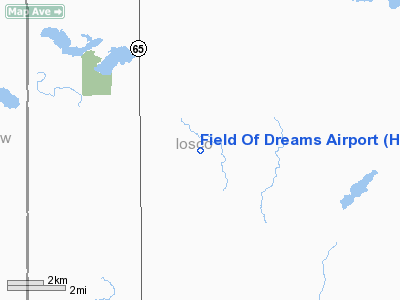
Location & QuickFacts
| FAA Information Effective: | 2008-09-25 |
| Airport Identifier: | H80 |
| Airport Status: | Operational |
| Longitude/Latitude: | 083-45-45.6000W/44-21-52.9000N
-83.762667/44.364694 (Estimated) |
| Elevation: | 830 ft / 252.98 m (Estimated) |
| Land: | 58 acres |
| From nearest city: | 3 nautical miles SE of Hale, MI |
| Location: | Iosco County, MI |
| Magnetic Variation: | 06W (1990) |
Owner & Manager
| Ownership: | Privately owned |
| Owner: | Dale Blust & Clinton Loomis |
| Address: | 6221 W Curtis
Hale, MI 48739 |
| Phone number: | 989-728-3101 |
| Manager: | Dale Blust
CLINTON LOOMIS, ASST MGR 989-728-3893 |
| Address: | 6106 W Curtis
Hale, MI 48739 |
| Phone number: | 989-728-3101 |
Airport Operations and Facilities
| Airport Use: | Open to public |
| Wind indicator: | Yes |
| Segmented Circle: | Yes |
| Control Tower: | No |
| Sectional chart: | Lake Huron |
| Region: | AGL - Great Lakes |
| Boundary ARTCC: | ZMP - Minneapolis |
| Tie-in FSS: | LAN - Lansing |
| FSS on Airport: | No |
| FSS Toll Free: | 1-800-WX-BRIEF |
| NOTAMs Facility: | LAN (NOTAM-d service avaliable) |
Airport Communications
Airport Services
Runway Information
Runway 08/26
| Dimension: | 2400 x 90 ft / 731.5 x 27.4 m |
| Surface: | TURF, Good Condition |
| |
Runway 08 |
Runway 26 |
| Longitude: | 083-46-01.5700W | 083-45-29.5700W |
| Latitude: | 44-21-49.9300N | 44-21-55.8500N |
| Traffic Pattern: | Left | Left |
| Displaced threshold: | 1000.00 ft | 0.00 ft |
| Obstruction: | 55 ft tree, 330.0 ft from runway, 55 ft left of centerline, 6:1 slope to clear
APCH RATIO 25:1 AT DSPLCD THLD. | 47 ft tree, 517.0 ft from runway, 125 ft right of centerline, 11:1 slope to clear
APCH RATIO 20:1 BASED ON STRAIGHT OUT OVR +56 FT TREES, 1400 FT DSTC. |
|
Radio Navigation Aids
| ID |
Type |
Name |
Ch |
Freq |
Var |
Dist |
| BHW | NDB | Hardwood | | 236.00 | 06W | 15.5 nm |
| GDW | NDB | Wiggins | | 209.00 | 04W | 38.8 nm |
| CGG | VOR | Grayling | | 109.80 | 06W | 45.6 nm |
| ASP | VOR/DME | Au Sable | 108X | 116.10 | 07W | 16.6 nm |
| BXZ | VOR/DME | West Branch | 079X | 113.20 | 06W | 19.5 nm |
| HTL | VOR/DME | Houghton Lake | 053X | 111.60 | 05W | 38.8 nm |
| BAX | VOR/DME | Bad Axe | 019X | 108.20 | 05W | 48.5 nm |
| APN | VORTAC | Alpena | 025X | 108.80 | 07W | 44.0 nm |
Remarks
- ARPT CLSD NOV-APR.
- ELECTRIC PERIMETER FENCE.
- RWY MAY BE SOFT IN SPRING WEST END. VERIFY CONDITIONS.
- LARGE HAY BALES ALONG SOUTH EDGE OF RY. +30 FT BLDG. 72 FT S OF RY CL, +60 FT TREE 96 FT N OF RY CL.
- FARM EQUPMENT PARKED IN RY 26 APCH.
- LOW LEVEL MIL JETS OPER NEAR ARPT, ARPT LIES WITHIN PIKE WEST MOA & 3 MILES FM MIL TRNG RTE VR 1624.
- PROVIDED AREA 125 FT EITHER SIDE OF RY CNTRLN & 200 FT OFF RY ENDS BE CLEAR OF OBSTN; OBSTN IN RY APCH SLOPE SFC BE REMOVED/LOWERED OR RY THLD BE DSPLCD OR REALIGNED TO PROVIDE 20:1 APCHCLEARANCE OVER OBSTN. SFC AREA 60 FT EITHER SIDE CNTRLN & 240 FT OFF RY ENDS SUITABLE TO RDCG RISK OF DMG TOACFT.
Images and information placed above are from
http://www.airport-data.com/airport/H80/
We thank them for the data!
| General Info
|
| Country |
United States
|
| State |
MICHIGAN
|
| FAA ID |
H80
|
| Latitude |
44-21-54.000N
|
| Longitude |
083-45-45.000W
|
| Elevation |
830 feet
|
| Near City |
HALE
|
We don't guarantee the information is fresh and accurate. The data may
be wrong or outdated.
For more up-to-date information please refer to other sources.
|
|


