 |
|
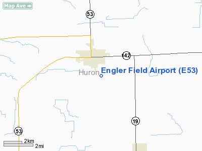
Location & QuickFacts
| FAA Information Effective: | 2008-09-25 |
| Airport Identifier: | E53 |
| Airport Status: | Operational |
| Longitude/Latitude: | 082-59-10.4950W/43-47-01.7230N
-82.986249/43.783812 (Estimated) |
| Elevation: | 700 ft / 213.36 m (Estimated) |
| Land: | 20 acres |
| From nearest city: | 4 nautical miles NW of Bad Axe, MI |
| Location: | Huron County, MI |
| Magnetic Variation: | 07W (1995) |
Owner & Manager
| Ownership: | Privately owned |
| Owner: | Alan & Ellen Engler
OWNER RESIDES AT ARPT. |
| Address: | 1815 North Thomas Road
Bad Axe, MI 48413 |
| Phone number: | 989-269-6511 |
| Manager: | Alan Engler |
| Address: | 1815 North Thomas Road
Bad Axe, MI 48413 |
| Phone number: | 989-269-6511 |
Airport Operations and Facilities
| Airport Use: | Open to public |
| Wind indicator: | Yes |
| Control Tower: | No |
| Sectional chart: | Detroit |
| Region: | AGL - Great Lakes |
| Boundary ARTCC: | ZOB - Cleveland |
| Tie-in FSS: | LAN - Lansing |
| FSS on Airport: | No |
| FSS Toll Free: | 1-800-WX-BRIEF |
| NOTAMs Facility: | LAN (NOTAM-d service avaliable) |
Airport Communications
Airport Services
| Airframe Repair: | MINOR |
| Power Plant Repair: | MINOR |
Runway Information
Runway 07/25
| Dimension: | 2523 x 65 ft / 769.0 x 19.8 m |
| Surface: | TURF, Fair Condition |
| Edge Lights: | Non-standard lighting system
NSTD LIRL, NOT FOR PUBLIC USE. FIRST 575 FT RY 25 NOT LIGHTED. |
| |
Runway 07 |
Runway 25 |
| Longitude: | 083-03-05.2200W | 083-02-31.6800W |
| Latitude: | 43-50-43.6200N | 43-50-49.2600N |
| Traffic Pattern: | Left | Left |
| Displaced threshold: | 0.00 ft | 575.00 ft |
| Obstruction: | 60 ft trees, 60 ft right of centerline | 20 ft pline, 40.0 ft from runway, 2:1 slope to clear
APCH RATIO 0:1 AT DSPLCD THLD; +40 FT TREES 60 FT R FM DSPLCD THLD. |
|
Radio Navigation Aids
| ID |
Type |
Name |
Ch |
Freq |
Var |
Dist |
| HYX | NDB | Browne | | 385.00 | 06W | 43.5 nm |
| BAX | VOR/DME | Bad Axe | 019X | 108.20 | 05W | 0.1 nm |
| ASP | VOR/DME | Au Sable | 108X | 116.10 | 07W | 43.7 nm |
| MBS | VOR/DME | Saginaw | 076X | 112.90 | 03W | 49.8 nm |
| ECK | VORTAC | Peck | 087X | 114.00 | 07W | 33.8 nm |
Remarks
- SNOW REMOVAL IREG FOR INFO CALL 989-269-8815.
- RY 7, +7 FT CORN CROP DURING GROWING SEASON.
- RWY 25, -2 FT DITCH 45 FT EAST OF RWY.
- MAN-MADE OR NATURAL OBJECTS EXIST WITHIN THE ASP NEEDED TO ENSURE SAFETY IN THE TKOF/LNDG OF ACFT.
Images and information placed above are from
http://www.airport-data.com/airport/E53/
We thank them for the data!
| General Info
|
| Country |
United States
|
| State |
MICHIGAN
|
| FAA ID |
E53
|
| Latitude |
43-47-01.723N
|
| Longitude |
082-59-10.495W
|
| Elevation |
700 feet
|
| Near City |
BAD AXE
|
We don't guarantee the information is fresh and accurate. The data may
be wrong or outdated.
For more up-to-date information please refer to other sources.
|
|


