 |
|
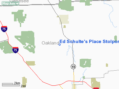
Ed Schulte's Place Stolport |
Location & QuickFacts
| FAA Information Effective: | 2008-09-25 |
| Airport Identifier: | MI45 |
| Airport Status: | Operational |
| Longitude/Latitude: | 083-27-06.7970W/42-48-29.1030N
-83.451888/42.808084 (Estimated) |
| Elevation: | 1050 ft / 320.04 m (Estimated) |
| Land: | 0 acres |
| From nearest city: | 2 nautical miles S of Ortonville, MI |
| Location: | Oakland County, MI |
| Magnetic Variation: | 06W (1985) |
Owner & Manager
| Ownership: | Privately owned |
| Owner: | Edward J. Schulte |
| Address: | 1145 Bald Eagle Lake Rd
Ortonville, MI 48462 |
| Phone number: | 313-627-4087 |
| Address: |
|
Airport Operations and Facilities
| Airport Use: | Private
PERSONAL USE. |
| Wind indicator: | Yes |
| Segmented Circle: | No |
| Control Tower: | No |
| Landing fee charge: | No |
| Sectional chart: | Detroit |
| Region: | AGL - Great Lakes |
| Boundary ARTCC: | ZOB - Cleveland |
| Tie-in FSS: | LAN - Lansing |
| FSS on Airport: | No |
| FSS Toll Free: | 1-800-WX-BRIEF |
Runway Information
Runway 18/36
| Dimension: | 1500 x 100 ft / 457.2 x 30.5 m |
| Surface: | TURF, |
| |
Runway 18 |
Runway 36 |
| Traffic Pattern: | Right | Left |
|
Radio Navigation Aids
| ID |
Type |
Name |
Ch |
Freq |
Var |
Dist |
| OZW | NDB | Howell | | 243.00 | 05W | 25.9 nm |
| VQ | NDB | Cargl | | 230.00 | 05W | 35.0 nm |
| G | NDB | Golf | | 398.00 | 05W | 38.4 nm |
| QG | NDB | Windsor | | 353.00 | 06W | 39.4 nm |
| HYX | NDB | Browne | | 385.00 | 06W | 41.5 nm |
| RYS | NDB | Grosse Ile | | 419.00 | 06W | 44.5 nm |
| MTC | TACAN | Selfridge | 064X | | 06W | 29.8 nm |
| DXO | VOR/DME | Detroit | 081X | 113.40 | 06W | 36.0 nm |
| YQG | VOR/DME | Windsor | 085X | 113.80 | 06W | 43.5 nm |
| PSI | VORTAC | Pontiac | 047X | 111.00 | 03W | 7.4 nm |
| FNT | VORTAC | Flint | 116X | 116.90 | 06W | 16.1 nm |
| SVM | VORTAC | Salem | 090X | 114.30 | 03W | 24.8 nm |
| ECK | VORTAC | Peck | 087X | 114.00 | 07W | 42.0 nm |
| CRL | VORTAC | Carleton | 104X | 115.70 | 03W | 45.7 nm |
| DET | VOT | Detroit City | | 111.60 | | 31.0 nm |
| YIP | VOT | Willow Run | | 112.00 | | 34.6 nm |
| DTW | VOT | Detroit Met Wayne | | 109.80 | | 35.1 nm |
Remarks
- PROVIDED ONLY VFR WX CONDS ARE CONDUCTED.
Images and information placed above are from
http://www.airport-data.com/airport/MI45/
We thank them for the data!
| General Info
|
| Country |
United States
|
| State |
MICHIGAN
|
| FAA ID |
MI45
|
| Latitude |
42-48-29.103N
|
| Longitude |
083-27-06.797W
|
| Elevation |
1050 feet
|
| Near City |
ORTONVILLE
|
We don't guarantee the information is fresh and accurate. The data may
be wrong or outdated.
For more up-to-date information please refer to other sources.
|
|


