 |
|
Coordinates: 46°00′34″N 083°44′38″W / 46.00944°N 83.74389°W / 46.00944; -83.74389
| Drummond Island Airport |
| IATA: DRE – ICAO: KDRM – FAA LID: DRM |
| Summary |
| Airport type |
Public |
| Owner |
Drummond Township |
| Serves |
Drummond Island, Michigan |
| Elevation AMSL |
668 ft / 204 m |
| Runways |
| Direction |
Length |
Surface |
| ft |
m |
| 8/26 |
4,000 |
1,219 |
Asphalt |
| 18/36 |
2,500 |
762 |
Turf |
| Statistics (2005) |
| Aircraft operations |
7,482 |
| Source: Federal Aviation Administration |
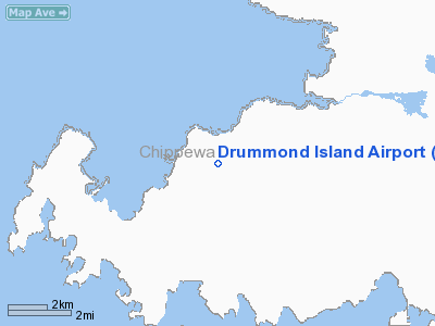
Drummond Island Airport (IATA: DRE, ICAO: KDRM, FAA LID: DRM, formerly Y66) is a public airport located one mile (2 km) southwest of the central business district of Drummond Island, in Chippewa County, Michigan, United States. It is owned by Drummond Township.
Although most U.S. airports use the same three-letter location identifier for the FAA and IATA, Drummond Island Airport is assigned DRM by the FAA and DRE by the IATA (which assigned DRM to Drama, Greece).
Facilities
Drummond Island Airport covers an area of 60 acres (24 ha) which contains two runways: 8/26 with 4,000 x 75 ft (1,219 x 23 m) asphalt pavement and 18/36 with 2,500 x 150 ft (762 x 46 m) turf surface. For the 12-month period ending December 31, 2005, the airport had 7,482 general aviation aircraft operations. The airport is staffed Monday through Saturday from 8:00 a.m. until 5 p.m. and is accessible by road from Drummond Rd, and is close to M-134.
The above content comes from Wikipedia and is published under free licenses – click here to read more.
Location & QuickFacts
| FAA Information Effective: | 2008-09-25 |
| Airport Identifier: | DRM |
| Airport Status: | Operational |
| Longitude/Latitude: | 083-44-38.1630W/46-00-33.5210N
-83.743934/46.009311 (Estimated) |
| Elevation: | 668 ft / 203.61 m (Surveyed) |
| Land: | 60 acres |
| From nearest city: | 1 nautical miles SW of Drummond Island, MI |
| Location: | Chippewa County, MI |
| Magnetic Variation: | 07W (1995) |
Owner & Manager
| Ownership: | Publicly owned |
| Owner: | Drummond Township |
| Address: | P.o.box 245
Drummond Island, MI 49726 |
| Phone number: | 906-493-5321 |
| Manager: | James Bailey |
| Address: | 34264 S. Townline Rd.
Drummond Island, MI 49726 |
| Phone number: | 906-493-5411 |
Airport Operations and Facilities
| Airport Use: | Open to public |
| Wind indicator: | Yes |
| Segmented Circle: | Yes |
| Control Tower: | No |
| Lighting Schedule: | DUSK-DAWN
ACTVT MIRL RY 08/26 & PAPI RYS 08 & 26 - CTAF. |
| Beacon Color: | Clear-Green (lighted land airport) |
| Landing fee charge: | No |
| Sectional chart: | Lake Huron |
| Region: | AGL - Great Lakes |
| Boundary ARTCC: | ZMP - Minneapolis |
| Responsible ARTCC: | ZYZ - Toronto |
| Tie-in FSS: | GRB - Green Bay |
| FSS on Airport: | No |
| FSS Toll Free: | 1-800-WX-BRIEF |
| NOTAMs Facility: | DRM (NOTAM-d service avaliable) |
| Federal Agreements: | N |
Airport Communications
| CTAF: | 122.800 |
| Unicom: | 122.800 |
Airport Services
| Fuel available: | 100LLA MOGAS |
| Airframe Repair: | MAJOR |
| Power Plant Repair: | MAJOR |
| Bottled Oxygen: | HIGH |
| Bulk Oxygen: | HIGH |
Runway Information
Runway 08/26
| Dimension: | 4000 x 75 ft / 1219.2 x 22.9 m |
| Surface: | ASPH,
RY 18/36 CENTER 20 FT PTN OF RY FM INTXN RY 18/36 N TO THE HANGAR LINE IS ASPH; REMAINDER OF RY TURF. |
| Edge Lights: | Medium |
| |
Runway 08 |
Runway 26 |
| Longitude: | 083-45-14.3020W | 083-44-20.3780W |
| Latitude: | 46-00-25.0220N | 46-00-37.1540N |
| Elevation: | 659.00 ft | 657.00 ft |
| Alignment: | 72 | 127 |
| Traffic Pattern: | Left | Left |
| Markings: | Non-precision instrument, Good Condition | Non-precision instrument, Good Condition
RY 8/26 MKG FADED |
| Crossing Height: | 35.00 ft | 25.00 ft |
| Displaced threshold: | 650.00 ft | 170.00 ft |
| VASI: | 2-light PAPI on left side | 2-light PAPI on left side |
| Visual Glide Angle: | 3.00° | 3.00° |
| Obstruction: | 30 ft trees, 201.0 ft from runway, 175 ft left of centerline
RY 08 APCH RATIO 20:1 AT DSPLCD THLD; +65 FT TREES, 1300 FT DSTC, 45 FT R; 900 FT DSTC, 200 FT R/L.
+4 FT FENCE 20 FT DSTC; +10 FT HILL 10 FT DSTC 50 FT L; +18 FT BLDG 97 FT DSTC 50 FT R; +50 FT TREES 20 FT DSTC, 90 FT R/L. | 15 ft road, 201.0 ft from runway, 125 ft right of centerline
RY 26 APCH RATIO 5:1 TO DSPLCD THLD; OVR +60 FT TREES 300 FT DSTC, 250 FT R.
+6 FT FENCE 54 FT DSTC; +15 FT ROAD 110 FT DSTC; +20 FT BLDG, 0 FT DSTC, 200 FT R. |
|
Runway 18/36
| Dimension: | 2500 x 150 ft / 762.0 x 45.7 m |
| Surface: | TURF, Fair Condition
RY 18/36 CENTER 20 FT PTN OF RY FM INTXN RY 18/36 N TO THE HANGAR LINE IS ASPH; REMAINDER OF RY TURF. |
| |
Runway 18 |
Runway 36 |
| Longitude: | 083-44-23.9370W | 083-44-23.0100W |
| Latitude: | 46-00-49.7470N | 46-00-25.0760N |
| Alignment: | 127 | 127 |
| Traffic Pattern: | Left | Left |
| Obstruction: | 50 ft trees, 75L/ ft right of centerline
RY 18 APCH RATIO 20 :1 BASED ON STRAIGHT OUT OVR 63 FT TREES, 1260 FT DSTC. | 40 ft trees, 0.0 ft from runway, 115 ft right of centerline |
|
Radio Navigation Aids
| ID |
Type |
Name |
Ch |
Freq |
Var |
Dist |
| DRM | NDB | Drummond Island | | 218.00 | 07W | 0.1 nm |
| PZQ | NDB | Rogers City | | 215.00 | 07W | 36.5 nm |
| CI | NDB | Koloe | | 400.00 | 06W | 38.5 nm |
| A | NDB | Gros Cap | | 286.00 | 06W | 47.2 nm |
| YZE | NDB | Gore Bay | | 245.00 | 07W | 47.4 nm |
| SSM | VOR/DME | Sault Ste Marie | 059X | 112.20 | 04W | 33.9 nm |
| PLN | VORTAC | Pellston | 055X | 111.80 | 06W | 44.8 nm |
Remarks
- OCNL GOLF CARTS & PEDESTRIANS CROSSING RY 08/26 DUE TO GOLF COURSE ON BOTH SIDES.
- FLIGHT NOTIFICATION SVC (ADCUS) AVBL.
- GCO AVBL ON FREQ 121.725 THRU FLT SVCS.
- BIRDS & DEER ON & INVOF ARPT.
Images and information placed above are from
http://www.airport-data.com/airport/DRM/
We thank them for the data!
| General Info
|
| Country |
United States
|
| State |
MICHIGAN
|
| FAA ID |
DRM
|
| Latitude |
46-00-33.521N
|
| Longitude |
083-44-38.163W
|
| Elevation |
668 feet
|
| Near City |
DRUMMOND ISLAND
|
We don't guarantee the information is fresh and accurate. The data may
be wrong or outdated.
For more up-to-date information please refer to other sources.
|
|


