 |
|
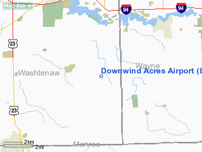
Location & QuickFacts
| FAA Information Effective: | 2008-09-25 |
| Airport Identifier: | 86MI |
| Airport Status: | Operational |
| Longitude/Latitude: | 083-34-02.7720W/42-09-10.1470N
-83.567437/42.152819 (Estimated) |
| Elevation: | 683 ft / 208.18 m (Surveyed) |
| Land: | 41 acres |
| From nearest city: | 1 nautical miles SW of Willis, MI |
| Location: | Washtenaw County, MI |
| Magnetic Variation: | 05W (1985) |
Owner & Manager
| Ownership: | Privately owned |
| Owner: | William V. Pargo |
| Address: | 9421 Macey Road
Willis, MI 48191 |
| Phone number: | 313-461-6161 |
| Manager: | William V. Pargo |
| Address: | 9421 Macey Road
Willis, MI 48191 |
| Phone number: | 313-562-0243 |
Airport Operations and Facilities
| Airport Use: | Private |
| Wind indicator: | Yes |
| Segmented Circle: | Yes |
| Control Tower: | No |
| Landing fee charge: | No |
| Sectional chart: | Detroit |
| Region: | AGL - Great Lakes |
| Boundary ARTCC: | ZOB - Cleveland |
| Tie-in FSS: | LAN - Lansing |
| FSS on Airport: | No |
| FSS Toll Free: | 1-800-WX-BRIEF |
Airport Services
Runway Information
Runway 06/24
| Dimension: | 2460 x 100 ft / 749.8 x 30.5 m |
| Surface: | TURF, Poor Condition
TURF IREG; ROUGH WITH SEVERAL CHUCK HOLES THROUGHOUT. |
| |
Runway 06 |
Runway 24 |
| Traffic Pattern: | Right | Left |
| Displaced threshold: | 500.00 ft | 415.00 ft |
| Runway End Identifier: | No | No |
| Centerline Lights: | No | No |
| Touchdown Lights: | No | No |
| Obstruction: | 80 ft trees, 320.0 ft from runway, 15 ft right of centerline, 4:1 slope to clear
APCH RATIO 10:1 AT DSPLCD THLD. | 65 ft tree, 750.0 ft from runway, 125 ft right of centerline, 11:1 slope to clear
APCH RATIO 17:1 AT DSPLCD THLD. |
|
Radio Navigation Aids
| ID |
Type |
Name |
Ch |
Freq |
Var |
Dist |
| TCU | NDB | Tecumseh | | 239.00 | 04W | 15.6 nm |
| RYS | NDB | Grosse Ile | | 419.00 | 06W | 18.7 nm |
| G | NDB | Golf | | 398.00 | 05W | 23.8 nm |
| ADG | NDB | Adrian | | 278.00 | 06W | 28.4 nm |
| VQ | NDB | Cargl | | 230.00 | 05W | 29.9 nm |
| QG | NDB | Windsor | | 353.00 | 06W | 32.6 nm |
| OZW | NDB | Howell | | 243.00 | 05W | 34.4 nm |
| USE | NDB | Fulton | | 375.00 | 05W | 41.3 nm |
| PT | NDB | Pelee Island | | 283.00 | 05W | 46.0 nm |
| PCW | NDB | Port Clinton | | 423.00 | 06W | 49.3 nm |
| TOL | TACAN | Toledo | 072X | | 05W | 35.2 nm |
| MTC | TACAN | Selfridge | 064X | | 06W | 42.8 nm |
| DXO | VOR/DME | Detroit | 081X | 113.40 | 06W | 9.6 nm |
| YQG | VOR/DME | Windsor | 085X | 113.80 | 06W | 33.4 nm |
| JXN | VOR/DME | Jackson | 033X | 109.60 | 05W | 40.2 nm |
| VWV | VOR/DME | Waterville | 078X | 113.10 | 02W | 42.3 nm |
| CRL | VORTAC | Carleton | 104X | 115.70 | 03W | 8.0 nm |
| SVM | VORTAC | Salem | 090X | 114.30 | 03W | 15.4 nm |
| PSI | VORTAC | Pontiac | 047X | 111.00 | 03W | 33.0 nm |
| FNT | VORTAC | Flint | 116X | 116.90 | 06W | 49.6 nm |
| YIP | VOT | Willow Run | | 112.00 | | 5.3 nm |
| DTW | VOT | Detroit Met Wayne | | 109.80 | | 10.1 nm |
| DET | VOT | Detroit City | | 111.60 | | 28.8 nm |
Remarks
- +40 FT TREES AL QUADS IN PRIM SFC.
- ULTRALIGHT ACTIVITY ON ARPT.
- CHECK CALCULATIONS OF ACFT PERFORMANCE DATA DUE TO RY CONDS.
Images and information placed above are from
http://www.airport-data.com/airport/86MI/
We thank them for the data!
| General Info
|
| Country |
United States
|
| State |
MICHIGAN
|
| FAA ID |
86MI
|
| Latitude |
42-09-10.147N
|
| Longitude |
083-34-02.772W
|
| Elevation |
683 feet
|
| Near City |
WILLIS
|
We don't guarantee the information is fresh and accurate. The data may
be wrong or outdated.
For more up-to-date information please refer to other sources.
|
|


