 |
|
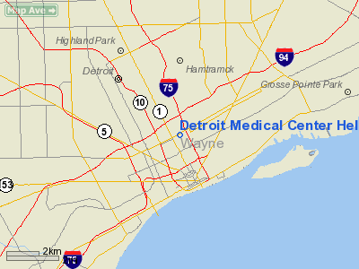
Detroit Medical Center Heliport |
Location & QuickFacts
| FAA Information Effective: | 2008-09-25 |
| Airport Identifier: | 5MI0 |
| Airport Status: | Operational |
| Longitude/Latitude: | 083-03-27.7170W/42-21-25.1350N
-83.057699/42.356982 (Estimated) |
| Elevation: | 630 ft / 192.02 m (Estimated) |
| Land: | 0 acres |
| From nearest city: | 4 nautical miles N of Detroit, MI |
| Location: | Wayne County, MI |
| Magnetic Variation: | 06W (1985) |
Owner & Manager
| Ownership: | Privately owned |
| Owner: | Detroit Medical Center Corp |
| Address: | 4201 St. Antoine
Detroit, MI 48201 |
| Phone number: | 313-745-5080 |
| Manager: | Hutzel Hospital |
| Address: | 4707 St Antoine Blvd
Detroit, MI 48201 |
| Phone number: | 313-745-7009 |
Airport Operations and Facilities
| Airport Use: | Private
MEDICAL USE. |
| Wind indicator: | Yes |
| Segmented Circle: | Yes |
| Control Tower: | No |
| Lighting Schedule: | PHONE REQ
FOR PERIMETER LGTS & ROTG BCN PHONE 313-745-7031. |
| Beacon Color: | Clear (unlighted land airport) |
| Landing fee charge: | No |
| Sectional chart: | Detroit |
| Region: | AGL - Great Lakes |
| Boundary ARTCC: | ZOB - Cleveland |
| Tie-in FSS: | LAN - Lansing |
| FSS on Airport: | No |
| FSS Toll Free: | 1-800-WX-BRIEF |
Runway Information
Helipad H1
| Dimension: | 80 x 80 ft / 24.4 x 24.4 m |
| Surface: | CONC, |
| Edge Lights: | Low |
| |
Runway H1 |
Runway |
| Traffic Pattern: | Left | Left |
|
Radio Navigation Aids
| ID |
Type |
Name |
Ch |
Freq |
Var |
Dist |
| VQ | NDB | Cargl | | 230.00 | 05W | 4.6 nm |
| G | NDB | Golf | | 398.00 | 05W | 6.8 nm |
| QG | NDB | Windsor | | 353.00 | 06W | 8.8 nm |
| RYS | NDB | Grosse Ile | | 419.00 | 06W | 16.0 nm |
| PT | NDB | Pelee Island | | 283.00 | 05W | 38.8 nm |
| TCU | NDB | Tecumseh | | 239.00 | 04W | 41.4 nm |
| 4L | NDB | Chatham | | 236.00 | 06W | 43.6 nm |
| OZW | NDB | Howell | | 243.00 | 05W | 44.5 nm |
| MTC | TACAN | Selfridge | 064X | | 06W | 18.4 nm |
| YQG | VOR/DME | Windsor | 085X | 113.80 | 06W | 12.0 nm |
| DXO | VOR/DME | Detroit | 081X | 113.40 | 06W | 16.2 nm |
| SVM | VORTAC | Salem | 090X | 114.30 | 03W | 24.0 nm |
| CRL | VORTAC | Carleton | 104X | 115.70 | 03W | 25.7 nm |
| PSI | VORTAC | Pontiac | 047X | 111.00 | 03W | 29.5 nm |
| FNT | VORTAC | Flint | 116X | 116.90 | 06W | 47.7 nm |
| DET | VOT | Detroit City | | 111.60 | | 3.4 nm |
| DTW | VOT | Detroit Met Wayne | | 109.80 | | 15.7 nm |
| YIP | VOT | Willow Run | | 112.00 | | 21.9 nm |
Remarks
- (E111-2) E111 CONT'D: TKOF/LNDG AREA IS APROPLY MKD; NON-OBSTRUCTING WIND INDCR IS MAINTD ADJ TO LNDG AREA.
- E111: ALL ELEC POLES & CANTENARIES LCTD ON PARCEL 6 OF SUBMITTED PLAN & THE 4 ELEC POLES LCTD SOUTHEAST OF PARCEL 6 ARE REMOVED PRIOR TO INITIATION... E111 CONT'D: OF OPNS; ALL APCH/DEP RTE HOP ARE CONDUCTED IN AN AREA FROM 135-240 DEGS USING THE PAD AS THE CENTER OF A COMPASS ROSE;
Images and information placed above are from
http://www.airport-data.com/airport/5MI0/
We thank them for the data!
| General Info
|
| Country |
United States
|
| State |
MICHIGAN
|
| FAA ID |
5MI0
|
| Latitude |
42-21-25.135N
|
| Longitude |
083-03-27.717W
|
| Elevation |
630 feet
|
| Near City |
DETROIT
|
We don't guarantee the information is fresh and accurate. The data may
be wrong or outdated.
For more up-to-date information please refer to other sources.
|
|


