 |
|
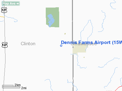
Location & QuickFacts
| FAA Information Effective: | 2008-09-25 |
| Airport Identifier: | 15W |
| Airport Status: | Operational |
| Longitude/Latitude: | 084-23-24.9130W/42-53-40.1120N
-84.390254/42.894476 (Estimated) |
| Elevation: | 826 ft / 251.76 m (Surveyed) |
| Land: | 55 acres |
| From nearest city: | 2 nautical miles NW of Laingsburg, MI |
| Location: | Clinton County, MI |
| Magnetic Variation: | 05W (1985) |
Owner & Manager
| Ownership: | Privately owned |
| Owner: | Kevin Dennis |
| Address: | 8715 Alward Rd
Laingsburg, MI 48848 |
| Phone number: | 517-651-5375 |
| Manager: | Kevin Dennis |
| Address: | 8715 Alward Rd
Laingsburg, MI 48848 |
| Phone number: | 517-651-5375 |
Airport Operations and Facilities
| Airport Use: | Open to public |
| Wind indicator: | Yes |
| Segmented Circle: | No |
| Control Tower: | No |
| Landing fee charge: | No |
| Sectional chart: | Detroit |
| Region: | AGL - Great Lakes |
| Boundary ARTCC: | ZOB - Cleveland |
| Tie-in FSS: | LAN - Lansing |
| FSS on Airport: | No |
| FSS Toll Free: | 1-800-WX-BRIEF |
| NOTAMs Facility: | LAN (NOTAM-d service avaliable) |
Airport Communications
Airport Services
| Airframe Repair: | NONE |
| Power Plant Repair: | NONE |
| Bottled Oxygen: | NONE |
Runway Information
Runway 09/27
| Dimension: | 1880 x 50 ft / 573.0 x 15.2 m |
| Surface: | TURF, Fair Condition
RWY 09/27 MODERATELY ROLLING TERRAIN.
MODERATELY ROLLING TERRAIN. |
| |
Runway 09 |
Runway 27 |
| Traffic Pattern: | Left | Left |
| Centerline Lights: | No | No |
| Obstruction: | 80 ft tree, 954.0 ft from runway, 112 ft left of centerline, 12:1 slope to clear | 58 ft tree, 750.0 ft from runway, 146 ft left of centerline, 13:1 slope to clear |
|
Radio Navigation Aids
| ID |
Type |
Name |
Ch |
Freq |
Var |
Dist |
| OZW | NDB | Howell | | 243.00 | 05W | 23.7 nm |
| AMN | NDB | Alma | | 329.00 | 05W | 31.1 nm |
| HYX | NDB | Browne | | 385.00 | 06W | 39.8 nm |
| BT | NDB | Batol | | 272.00 | 04W | 47.5 nm |
| JXN | VOR/DME | Jackson | 033X | 109.60 | 05W | 38.3 nm |
| MBS | VOR/DME | Saginaw | 076X | 112.90 | 03W | 40.7 nm |
| MOP | VOR/DME | Mount Pleasant | 043X | 110.60 | 05W | 46.3 nm |
| GRR | VOR/DME | Grand Rapids | 106Y | 115.95 | 04W | 49.2 nm |
| LAN | VORTAC | Lansing | 045X | 110.80 | 05W | 17.2 nm |
| FNT | VORTAC | Flint | 116X | 116.90 | 06W | 28.6 nm |
| PSI | VORTAC | Pontiac | 047X | 111.00 | 03W | 39.6 nm |
| SVM | VORTAC | Salem | 090X | 114.30 | 03W | 45.7 nm |
Remarks
- DEER ON & INVOF ARPT.
- MAN-MADE OR NATURAL OBJECTS OBSTRUCT THE TAKEOFF LANDING & RY SAFETY AREAS.
Images and information placed above are from
http://www.airport-data.com/airport/15W/
We thank them for the data!
| General Info
|
| Country |
United States
|
| State |
MICHIGAN
|
| FAA ID |
15W
|
| Latitude |
42-53-40.112N
|
| Longitude |
084-23-24.913W
|
| Elevation |
826 feet
|
| Near City |
LAINGSBURG
|
We don't guarantee the information is fresh and accurate. The data may
be wrong or outdated.
For more up-to-date information please refer to other sources.
|
|


