 |
|
David's Airport
David's Field |
| IATA: none – ICAO: none – FAA LID: 9C2 |
| Summary |
| Airport type |
Public |
| Owner |
Mike Abu-Rezeq |
| Serves |
Athens, Michigan |
| Elevation AMSL |
887 ft / 270 m |
| Coordinates |
42°03′55″N 085°14′30″W / 42.06528°N 85.24167°W / 42.06528; -85.24167 |
| Runways |
| Direction |
Length |
Surface |
| ft |
m |
| 9/27 |
2,500 |
762 |
Turf |
| Statistics (2005) |
| Aircraft operations |
1,000 |
| Source: Federal Aviation Administration |
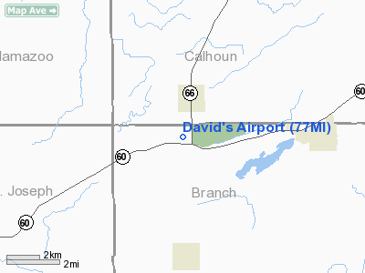
David's Airport (FAA LID: 9C2), also known as David's Field, is a privately-owned, public-use airport located in Branch County, Michigan, United States. It is two miles (3 km) south of the central business district of Athens, a village in Calhoun County. The airport
Facilities and aircraft
David's Airport covers an area of 9 acres (4 ha) and has one runway designated 9/27 with a 2,500 x 100 ft (762 x 30 m) turf surface. For the 12-month period ending December 31, 2005, the airport had 1,000 general aviation aircraft operations, an average of 83 per month.
The above content comes from Wikipedia and is published under free licenses – click here to read more.
Location & QuickFacts
| FAA Information Effective: | 2008-09-25 |
| Airport Identifier: | 77MI |
| Airport Status: | Operational |
| Longitude/Latitude: | 085-14-29.9350W/42-03-55.1690N
-85.241649/42.065325 (Estimated) |
| Elevation: | 887 ft / 270.36 m (Estimated) |
| Land: | 9 acres |
| From nearest city: | 2 nautical miles S of Athens, MI |
| Location: | Branch County, MI |
| Magnetic Variation: | 04W (1985) |
Owner & Manager
| Ownership: | Privately owned |
| Owner: | Mike Abu-rezeq |
| Address: | 7900 W 111th St
Polos Hills, IL 60465 |
| Phone number: | 708-878-6628 |
| Manager: | Mike Abu-rezeq |
| Address: | 7900 W 111th St
Polos Hills, IL 60465 |
| Phone number: | 708-878-6628 |
Airport Operations and Facilities
| Airport Use: | Private |
| Wind indicator: | Yes |
| Segmented Circle: | Yes |
| Control Tower: | No |
| Landing fee charge: | No |
| Sectional chart: | Chicago |
| Region: | AGL - Great Lakes |
| Boundary ARTCC: | ZAU - Chicago |
| Tie-in FSS: | LAN - Lansing |
| FSS on Airport: | No |
| FSS Toll Free: | 1-800-WX-BRIEF |
| NOTAMs Facility: | LAN (NOTAM-d service avaliable) |
Airport Communications
Airport Services
Runway Information
Runway 09/27
| Dimension: | 2801 x 100 ft / 853.7 x 30.5 m |
| Surface: | TURF, Good Condition |
| |
Runway 09 |
Runway 27 |
| Longitude: | 085-14-48.4900W | 085-14-11.3600W |
| Latitude: | 42-03-55.1500N | 42-03-55.1500N |
| Elevation: | 887.00 ft | 887.00 ft |
| Traffic Pattern: | Left | Left |
| Obstruction: | 60 ft tree, 30.0 ft from runway, 110 ft left of centerline
APCH RATIO 50:1 BASED ON STRAIGHT OUT. | 44 ft tree, 880.0 ft from runway, 8 ft left of centerline, 20:1 slope to clear |
|
Radio Navigation Aids
| ID |
Type |
Name |
Ch |
Freq |
Var |
Dist |
| HAI | NDB | Three Rivers | | 407.00 | 02W | 16.9 nm |
| IRS | NDB | Sturgis | | 382.00 | 04W | 17.4 nm |
| BT | NDB | Batol | | 272.00 | 04W | 18.0 nm |
| ANQ | NDB | Angola | | 347.00 | 05W | 26.5 nm |
| BYN | NDB | Bryan | | 260.00 | 04W | 49.5 nm |
| AZO | VOR/DME | Kalamazoo | 027X | 109.00 | 01W | 17.3 nm |
| LFD | VOR/DME | Litchfield | 049X | 111.20 | 05W | 21.3 nm |
| JXN | VOR/DME | Jackson | 033X | 109.60 | 05W | 36.8 nm |
| ELX | VOR/DME | Keeler | 113X | 116.60 | 00E | 39.6 nm |
| GRR | VOR/DME | Grand Rapids | 106Y | 115.95 | 04W | 44.8 nm |
| PMM | VOR/DME | Pullman | 058X | 112.10 | 00E | 45.3 nm |
| BTL | VORTAC | Battle Creek | 031X | 109.40 | 02W | 14.7 nm |
| LAN | VORTAC | Lansing | 045X | 110.80 | 05W | 46.0 nm |
| GSH | VORTAC | Goshen | 084X | 113.70 | 00E | 47.9 nm |
Remarks
- OCNL CROP DUSTING ACTIVITY.
- RY 09 POSSIBLE IRRIGATION EQUIPMENT IN APCH AREA & PRIM SFC.
- RY 27 HAS +24 FT PLINE 852 FT FM THR APCH RATIO 35:1; +15 FT RD 821 FT FM THR.
- VFR ONLY.
Images and information placed above are from
http://www.airport-data.com/airport/77MI/
We thank them for the data!
We don't guarantee the information is fresh and accurate. The data may
be wrong or outdated.
For more up-to-date information please refer to other sources.
|
|


