 |
|
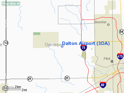
Location & QuickFacts
| FAA Information Effective: | 2008-09-25 |
| Airport Identifier: | 3DA |
| Airport Status: | Operational |
| Longitude/Latitude: | 083-48-17.6392W/43-03-09.0087N
-83.804900/43.052502 (Estimated) |
| Elevation: | 733 ft / 223.42 m (Surveyed) |
| Land: | 88 acres |
| From nearest city: | 2 nautical miles E of Flushing, MI |
| Location: | Genesee County, MI |
| Magnetic Variation: | 05W (1985) |
Owner & Manager
| Ownership: | Privately owned |
| Owner: | Dalton Airport Assoc. |
| Address: | 3400 Ann Drive
Flushing, MI 48433 |
| Phone number: | 810-624-4001 |
| Manager: | Anthony Sabourin |
| Address: | P.o. Box 310693
Flint, MI 48531 |
| Phone number: | 810-624-4001 |
Airport Operations and Facilities
| Airport Use: | Open to public |
| Wind indicator: | Yes |
| Control Tower: | No |
| Lighting Schedule: | DUSK-DAWN
ACTVT LIRL RY 18/36 - CTAF. |
| Beacon Color: | Clear-Green (lighted land airport) |
| Landing fee charge: | No |
| Sectional chart: | Detroit |
| Region: | AGL - Great Lakes |
| Boundary ARTCC: | ZOB - Cleveland |
| Tie-in FSS: | LAN - Lansing |
| FSS on Airport: | No |
| FSS Toll Free: | 1-800-WX-BRIEF |
| NOTAMs Facility: | LAN (NOTAM-d service avaliable) |
Airport Communications
| CTAF: | 122.800 |
| Unicom: | 122.800 |
Airport Services
| Fuel available: | 100LL
FUEL AVBL BY CREDIT CARD. |
| Bottled Oxygen: | NONE |
| Bulk Oxygen: | NONE |
Runway Information
Runway 09/27
| Dimension: | 1633 x 150 ft / 497.7 x 45.7 m |
| Surface: | TURF, Good Condition |
| |
Runway 09 |
Runway 27 |
| Longitude: | 083-48-34.0000W | 083-48-12.0047W |
| Latitude: | 43-03-25.0000N | 43-03-24.9994N |
| Elevation: | 733.00 ft | 0.00 ft |
| Traffic Pattern: | Left | Left |
| Displaced threshold: | 0.00 ft | 293.00 ft |
| Runway End Identifier: | No | No |
| Centerline Lights: | No | No |
| Touchdown Lights: | No | No |
| Obstruction: | 44 ft tree, 447.0 ft from runway, 80 ft right of centerline, 10:1 slope to clear | 18 ft road, 60.0 ft from runway, 3:1 slope to clear
RY 27 APCH RATIO 16:1 TO DSPLCD THLD; +35 FT TREE 570 FT DST. |
|
Runway 18/36
| Dimension: | 2510 x 50 ft / 765.0 x 15.2 m |
| Surface: | ASPH, Good Condition |
| Edge Lights: | Low |
| |
Runway 18 |
Runway 36 |
| Longitude: | 083-48-14.0000W | 083-48-14.3000W |
| Latitude: | 43-03-11.0000N | 43-02-46.2100N |
| Elevation: | 733.00 ft | 733.00 ft |
| Alignment: | 127 | 1 |
| Traffic Pattern: | Left | Left |
| Markings: | Basic, Good Condition
RY 18/36 MARKINGS FADED. | Basic, Good Condition
RY 18/36 MARKINGS FADED. |
| Displaced threshold: | 771.00 ft | 771.00 ft |
| Runway End Identifier: | No | No |
| Centerline Lights: | No | No |
| Touchdown Lights: | No | No |
| Obstruction: | 42 ft tree, 201.0 ft from runway, 35 ft left of centerline
RWY 18 APCH RATIO 17:1 TO DSPLCD THLD DUE TO +55 FT TREES 987 FT FROM THLD, 66 FT LEFT.
+18 FT ROAD 83 FT DIST. | 45 ft trees, 201.0 ft from runway
RWY 36 APCH RATIO 16:1 TO DSPLCD THLD DUE TO +54 FT TREES 867FT FM THLD, 60 FT LEFT.
+20-35 FT TREES 61 FT DSTC. |
|
Radio Navigation Aids
| ID |
Type |
Name |
Ch |
Freq |
Var |
Dist |
| HYX | NDB | Browne | | 385.00 | 06W | 22.9 nm |
| OZW | NDB | Howell | | 243.00 | 05W | 26.4 nm |
| AMN | NDB | Alma | | 329.00 | 05W | 45.9 nm |
| MBS | VOR/DME | Saginaw | 076X | 112.90 | 03W | 31.2 nm |
| FNT | VORTAC | Flint | 116X | 116.90 | 06W | 5.7 nm |
| PSI | VORTAC | Pontiac | 047X | 111.00 | 03W | 24.3 nm |
| SVM | VORTAC | Salem | 090X | 114.30 | 03W | 39.8 nm |
| LAN | VORTAC | Lansing | 045X | 110.80 | 05W | 44.2 nm |
| ECK | VORTAC | Peck | 087X | 114.00 | 07W | 49.2 nm |
Remarks
- RY 09/27 CLSD TO TSNT ACFT PERMLY.
- EXISTED PRIOR TO 1959.
Images and information placed above are from
http://www.airport-data.com/airport/3DA/
We thank them for the data!
| General Info
|
| Country |
United States
|
| State |
MICHIGAN
|
| FAA ID |
3DA
|
| Latitude |
43-03-25.098N
|
| Longitude |
083-48-24.858W
|
| Elevation |
733 feet
|
| Near City |
FLUSHING
|
We don't guarantee the information is fresh and accurate. The data may
be wrong or outdated.
For more up-to-date information please refer to other sources.
|
|


