 |
|
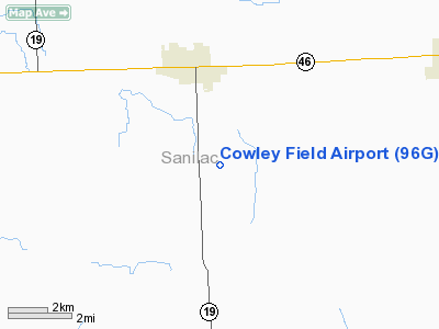
Location & QuickFacts
| FAA Information Effective: | 2008-09-25 |
| Airport Identifier: | 96G |
| Airport Status: | Operational |
| Longitude/Latitude: | 082-48-52.4400W/43-22-35.0800N
-82.814567/43.376411 (Estimated) |
| Elevation: | 770 ft / 234.70 m (Estimated) |
| Land: | 22 acres |
| From nearest city: | 3 nautical miles S of Sandusky, MI |
| Location: | Sanilac County, MI |
| Magnetic Variation: | 07W (1985) |
Owner & Manager
| Ownership: | Privately owned |
| Owner: | Dale Cowley |
| Address: | 1515 So Sandusky Rd
Sandusky, MI 48471 |
| Phone number: | 810-648-2352 |
| Manager: | Dale Cowley
AMGR LIVES AT ARPT. |
| Address: | 1515 So Sandusky Rd
Sandusky, MI 48471 |
| Phone number: | 810-648-2352 |
Airport Operations and Facilities
| Airport Use: | Open to public |
| Wind indicator: | Yes |
| Segmented Circle: | No |
| Control Tower: | No |
| Landing fee charge: | No |
| Sectional chart: | Detroit |
| Region: | AGL - Great Lakes |
| Boundary ARTCC: | ZOB - Cleveland |
| Tie-in FSS: | LAN - Lansing |
| FSS on Airport: | No |
| FSS Toll Free: | 1-800-WX-BRIEF |
| NOTAMs Facility: | LAN (NOTAM-d service avaliable) |
Airport Communications
Airport Services
| Airframe Repair: | NONE |
| Power Plant Repair: | NONE |
| Bottled Oxygen: | NONE |
| Bulk Oxygen: | NONE |
Runway Information
Runway 09/27
| Dimension: | 2465 x 50 ft / 751.3 x 15.2 m |
| Surface: | TURF, Good Condition |
| |
Runway 09 |
Runway 27 |
| Longitude: | 082-49-05.4400W | 082-48-39.4440W |
| Latitude: | 43-22-35.0700N | 43-22-35.0920N |
| Elevation: | 770.00 ft | 768.00 ft |
| Traffic Pattern: | Left | Left |
| Runway End Identifier: | No | No |
| Centerline Lights: | No | No |
| Touchdown Lights: | No | No |
| Obstruction: | 53 ft tree, 1089.0 ft from runway, 20:1 slope to clear | , 50:1 slope to clear |
|
Radio Navigation Aids
| ID |
Type |
Name |
Ch |
Freq |
Var |
Dist |
| ZR | NDB | Sarnia | | 404.00 | 06W | 36.5 nm |
| HYX | NDB | Browne | | 385.00 | 06W | 45.7 nm |
| MTC | TACAN | Selfridge | 064X | | 06W | 45.9 nm |
| BAX | VOR/DME | Bad Axe | 019X | 108.20 | 05W | 25.6 nm |
| ECK | VORTAC | Peck | 087X | 114.00 | 07W | 8.4 nm |
| FNT | VORTAC | Flint | 116X | 116.90 | 06W | 47.7 nm |
Remarks
- DEER & TURKEYS ON & INVOF ARPT.
- BE ALERT FOR CLOSE PROXIMITY OF POWER POLES ALONG TWY ON W END.
Images and information placed above are from
http://www.airport-data.com/airport/96G/
We thank them for the data!
| General Info
|
| Country |
United States
|
| State |
MICHIGAN
|
| FAA ID |
96G
|
| Latitude |
43-22-35.080N
|
| Longitude |
082-48-52.440W
|
| Elevation |
770 feet
|
| Near City |
SANDUSKY
|
We don't guarantee the information is fresh and accurate. The data may
be wrong or outdated.
For more up-to-date information please refer to other sources.
|
|


