 |
|
| Cherry Capital Airport |
 |
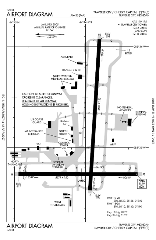 |
| FAA Airport Diagram |
| IATA: TVC – ICAO: KTVC – FAA LID: TVC |
| Summary |
| Airport type |
Public |
| Owner |
Grand Traverse & Leelanau Counties |
| Serves |
Traverse City, Michigan |
| Location |
Traverse City, Michigan |
| Elevation AMSL |
624 ft / 190 m |
| Coordinates |
44°44′29″N 085°34′56″W / 44.74139°N 85.58222°W / 44.74139; -85.58222 |
| Website |
www.tvcairport.com |
| Runways |
| Direction |
Length |
Surface |
| ft |
m |
| 10/28 |
6,501 |
1,982 |
Asphalt |
| 18/36 |
5,379 |
1,640 |
Asphalt |
| Statistics (2009) |
| Total passengers |
357,955 ▼ 4% |
| Total enplanements |
177,747 ▼ 3% |
| Aircraft operations |
92,483 |
| Based aircraft |
97 |
| Sources: Federal Aviation Administration |
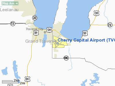
Cherry Capital Airport (IATA: TVC, ICAO: KTVC, FAA LID: TVC) is a public airport located two miles (3 km) south of the central business district of Traverse City, in Grand Traverse County, Michigan, United States. It is owned by Grand Traverse and Leelanau Counties.
In the fall of 2004, Cherry Capital opened a new terminal. Since then, Cherry Capital Airport has continued to grow with various carriers adding seasonal service and destinations.
Soon, the airport will implement the first biometric access systems in the country. The airport is the ninth to implement the advanced security measures suggested after the September 11, 2001 attacks. This terminal is able to comply better with security regulations and supports a greater number of flights and passengers. Facilities and aircraft
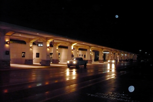 | |
Cherry Capital Airport terminal |
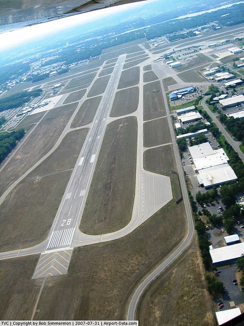
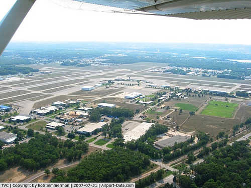
Cherry Capital Airport covers an area of 1,026 acres (415 ha) which contains two asphalt paved runways: 10/28 measuring 6,501 x 150 ft (1,982 x 46 m) and 18/36 measuring 5,379 x 150 ft (1,640 x 46 m).
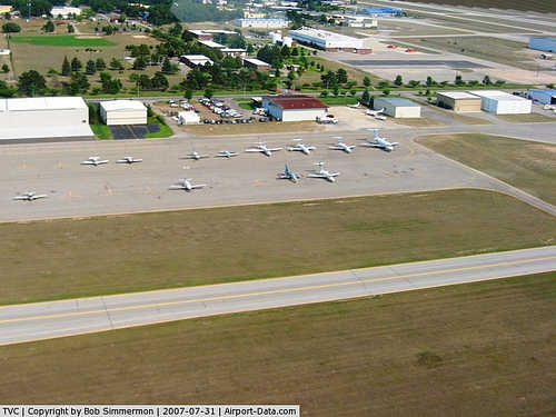
For the 12-month period ending December 31, 2006, the airport had 98,159 aircraft operations, an average of 268 per day: 69% general aviation, 15% military, 10% scheduled commercial and 6% air taxi. At that time there were 107 aircraft based at this airport: 70% single-engine, 22% multi-engine, 2% jet and 6% helicopter.
In February 2009, Forbes Magazine ranked Cherry Capital Airport second in their list of the top ten "rip-off" airports in the United States, citing an average cost per mile to travelers departing TVC of 41 cents.
Airlines and destinations
The following passenger airlines fly to and from Cherry Capital Airport:
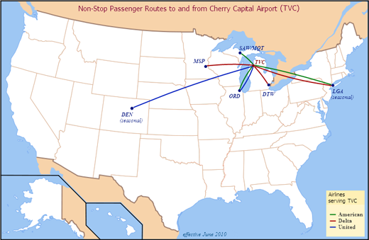 | |
Airlines and Destinations served from Traverse City (as of June 2010)
|
| Airlines |
Destinations |
| American Eagle |
Chicago-O'Hare, Marquette, New York-LaGuardia [seasonal] |
| Delta Air Lines |
Minneapolis/St. Paul [seasonal] |
| Delta Connection operated by Comair |
New York-LaGuardia [seasonal] |
| Delta Connection operated by Mesaba Airlines |
Detroit |
| Delta Connection operated by Pinnacle Airlines |
Detroit, Minneapolis/St. Paul |
| United Express operated by SkyWest Airlines |
Chicago-O'Hare, Denver [seasonal] |
Accidents and incidents
- Pinnacle Airlines Flight 4712 was a Bombardier CRJ200 from Traverse City, Michigan "which overran the runway while landing at TVC during a snowstorm on April 12, 2007. The aircraft received substantial damage, but the 52 people onboard were not injured. The Board determined that the probable cause of this accident was the pilots’ decision to land at TVC without performing a landing distance assessment, which was required by company policy. This poor decision-making likely reflected the effects of fatigue produced by a long, demanding duty day, and, for the captain, the duties associated with check airman functions. Contributing to the accident were 1) the Federal Aviation Administration pilot flight and duty time regulations that permitted the pilots’ long, demanding duty day and 2) the TVC operations supervisor’s use of ambiguous and unspecific radio phraseology in providing runway braking information. Four safety recommendations were issued to the FAA addressing timely post accident drug testing, training on landing distance assessment performance, ground operations personnel communications, and criteria for runway closures in snow and ice conditions. The NTSB adopted the report on June 10, 2008."
The above content comes from Wikipedia and is published under free licenses – click here to read more.
|
 |
(Click on the photo to enlarge) |
|
 |
(Click on the photo to enlarge) |
|
 |
(Click on the photo to enlarge) |
|
 |
(Click on the photo to enlarge) |
Location & QuickFacts
| FAA Information Effective: | 2008-09-25 |
| Airport Identifier: | TVC |
| Airport Status: | Operational |
| Longitude/Latitude: | 085-34-56.0460W/44-44-29.2010N
-85.582235/44.741445 (Estimated) |
| Elevation: | 624 ft / 190.20 m (Surveyed) |
| Land: | 1026 acres |
| From nearest city: | 2 nautical miles S of Traverse City, MI |
| Location: | Grand Traverse County, MI |
| Magnetic Variation: | 05W (1985) |
Owner & Manager
| Ownership: | Publicly owned |
| Owner: | Grand Traverse & Leelanau Co |
| Address: | Northwestern Rgnl Arpt Cmsn
Traverse City, MI 49686 |
| Phone number: | 231-947-2250 |
| Manager: | Stephen R. Cassens |
| Address: | 727 Fly Don't Drive
Traverse City, MI 49686 |
| Phone number: | 231-947-2250
OR 231-313-0928 AFTER NORMAL BUSINESS HRS. |
Airport Operations and Facilities
| Airport Use: | Open to public |
| Wind indicator: | Yes |
| Segmented Circle: | Yes |
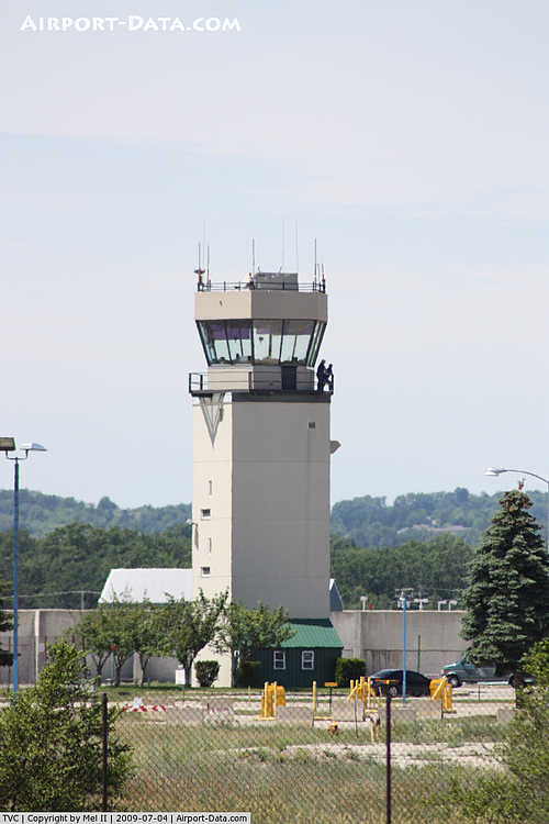
| Control Tower: | Yes |
| Lighting Schedule: | DUSK-DAWN
ACTVT HIRL RY 10/28, MIRL RY 18/36 VASI RY 18 & MALSR RY 28 & REIL RY 36 - CTAF. |
| Beacon Color: | Clear-Green (lighted land airport) |
| Landing fee charge: | Yes
LNDG FEE BASED ON ACFT WEIGHT; PRIVATE OWNED SINGLE ENGINE ACFT EXEMPT. |
| Sectional chart: | Green Bay |
| Region: | AGL - Great Lakes |
| Boundary ARTCC: | ZMP - Minneapolis |
| Tie-in FSS: | LAN - Lansing |
| FSS on Airport: | No |
| FSS Toll Free: | 1-800-WX-BRIEF |
| NOTAMs Facility: | TVC (NOTAM-d service avaliable) |
| Certification type/date: | I B S 05/1973
ARPT CLSD TO UNSKED ACR ACFT WITH OVER 30 PSGR SEATS WO PRIOR PMSM - CALL 231-947-2250. |
| Federal Agreements: | NGPVY3 |
Airport Communications
| CTAF: | 124.200 |
| Unicom: | 122.950 |
Airport Services
| Fuel available: | 100LLA |
| Airframe Repair: | MAJOR |
| Power Plant Repair: | MAJOR |
Runway Information
Runway 10/28
| Dimension: | 6501 x 150 ft / 1981.5 x 45.7 m |
| Surface: | ASPH, Good Condition |
| Surface Treatment: | Porous Friction Course |
| Weight Limit: | Single wheel: 90000 lbs.
Dual wheel: 130000 lbs.
Dual tandem wheel: 240000 lbs. |
| Edge Lights: | High |
| |
Runway 10 |
Runway 28 |
| Longitude: | 085-35-25.4820W | 085-33-55.6120W |
| Latitude: | 44-44-28.1860N | 44-44-24.0390N |
| Elevation: | 624.00 ft | 608.00 ft |
| Alignment: | 94 | 127 |
| ILS Type: | | ILS
|
| Traffic Pattern: | Left | Left |
| Markings: | Precision instrument, Good Condition | Precision instrument, Good Condition |
| Crossing Height: | 46.00 ft | 52.00 ft |
| VASI: | 4-box on left side | 4-light PAPI on left side |
| Visual Glide Angle: | 3.00° | 2.90° |
| Approach lights: | | MALSR |
| Runway End Identifier: | No | No |
| Centerline Lights: | No | No |
| Touchdown Lights: | No | No |
| Obstruction: | 74 ft tree, 2660.0 ft from runway, 33:1 slope to clear | 440 ft tower, 17070.0 ft from runway, 2350 ft left of centerline, 38:1 slope to clear |
|
Runway 18/36
| Dimension: | 5379 x 150 ft / 1639.5 x 45.7 m |
| Surface: | ASPH, Good Condition |
| Surface Treatment: | Porous Friction Course |
| Weight Limit: | Single wheel: 70000 lbs.
Dual wheel: 110000 lbs.
Dual tandem wheel: 190000 lbs. |
| Edge Lights: | Medium |
| |
Runway 18 |
Runway 36 |
| Longitude: | 085-35-15.6590W | 085-35-15.8770W |
| Latitude: | 44-45-01.0160N | 44-44-07.9170N |
| Elevation: | 0.00 ft | 624.00 ft |
| Alignment: | 127 | 0 |
| Traffic Pattern: | Left | Left |
| Markings: | Non-precision instrument, Fair Condition | Non-precision instrument, Fair Condition |
| Crossing Height: | 50.00 ft | 50.00 ft |
| Displaced threshold: | 270.00 ft | 0.00 ft |
| VASI: | 4-box on left side | 4-box on left side |
| Visual Glide Angle: | 3.00° | 3.00° |
| Runway End Identifier: | No | Yes |
| Centerline Lights: | No | No |
| Touchdown Lights: | No | No |
| Obstruction: | 64 ft trees, 2210.0 ft from runway, 310 ft left of centerline, 31:1 slope to clear | 59 ft tree, 1175.0 ft from runway, 300 ft left of centerline, 16:1 slope to clear |
| Decleard distances: | Take off run available 5379.00 ft
Take off distance available 5379.00 ft
Actual stop distance available 5109.00 ft
Landing distance available 4839.00 ft
| Take off run available 5379.00 ft
Take off distance available 5379.00 ft
Actual stop distance available 5109.00 ft
Landing distance available 5109.00 ft
|
|
Radio Navigation Aids
| ID |
Type |
Name |
Ch |
Freq |
Var |
Dist |
| TV | NDB | Gwenn | | 365.00 | 05W | 6.5 nm |
| CXK | NDB | Clam Lake | | 251.00 | 05W | 17.4 nm |
| CAD | NDB | Cadillac | | 269.00 | 04W | 28.9 nm |
| GYG | NDB | Grayling | | 359.00 | 06W | 32.2 nm |
| CVX | NDB | Charlevoix | | 392.00 | 05W | 36.2 nm |
| BFA | NDB | Boyne Falls | | 263.00 | 06W | 38.0 nm |
| CGG | VOR | Grayling | | 109.80 | 06W | 36.6 nm |
| MBL | VOR/DME | Manistee | 051X | 111.40 | 05W | 40.4 nm |
| GLR | VOR/DME | Gaylord | 029X | 109.20 | 06W | 40.8 nm |
| HTL | VOR/DME | Houghton Lake | 053X | 111.60 | 05W | 45.5 nm |
| TVC | VORTAC | Traverse City | 093X | 114.60 | 02W | 4.6 nm |
Remarks
- BIRDS AND DEER ON & INVOF ARPT.
- SNOW REMOVAL OPNS IN PROGRESS WINTER MONTHS; SNOW COMMAND WILL BE MONITORING CTAF.
- TWY C-1 BTWN TWY C AND RWY 18/36 AVBL TO ACR ACFT.
- FLIGHT CREWS SHOULD READ BACK ALL ADZY INFO PRVDD BY SNOW COMMAND.
Images and information placed above are from
http://www.airport-data.com/airport/TVC/
We thank them for the data!
| General Info
|
| Country |
United States
|
| State |
MICHIGAN
|
| FAA ID |
TVC
|
| Latitude |
44-44-29.201N
|
| Longitude |
085-34-56.046W
|
| Elevation |
624 feet
|
| Near City |
TRAVERSE CITY
|
We don't guarantee the information is fresh and accurate. The data may
be wrong or outdated.
For more up-to-date information please refer to other sources.
|
|


