 |
|
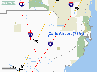
Location & QuickFacts
| FAA Information Effective: | 2008-09-25 |
| Airport Identifier: | 78MI |
| Airport Status: | Operational |
| Longitude/Latitude: | 083-18-12.7490W/42-02-26.1580N
-83.303541/42.040599 (Estimated) |
| Elevation: | 598 ft / 182.27 m (Surveyed) |
| Land: | 25 acres |
| From nearest city: | 3 nautical miles SW of South Rockwood, MI |
| Location: | Monroe County, MI |
| Magnetic Variation: | 05W (1985) |
Owner & Manager
| Ownership: | Privately owned |
| Owner: | Carl H. Brinkmeier
OWNER LIVES ON PREMISE. |
| Address: | 4235 E Sigler Rd
South Rockwood, MI 48179 |
| Phone number: | 313-782-9523 |
| Manager: | Carl H. Brinkmeier |
| Address: | 4235 E Sigler Rd
South Rockwood, MI 48179 |
| Phone number: | 313-782-9523 |
Airport Operations and Facilities
| Airport Use: | Private |
| Wind indicator: | Yes |
| Segmented Circle: | Yes |
| Control Tower: | No |
| Landing fee charge: | No |
| Sectional chart: | Detroit |
| Region: | AGL - Great Lakes |
| Boundary ARTCC: | ZOB - Cleveland |
| Tie-in FSS: | LAN - Lansing |
| FSS on Airport: | No |
| FSS Toll Free: | 1-800-WX-BRIEF |
Airport Services
| Airframe Repair: | MAJOR
& A72: PPR FOR REPAIRS - CALL 313-782-9523. |
| Power Plant Repair: | MAJOR |
Runway Information
Runway 18/36
| Dimension: | 2285 x 100 ft / 696.5 x 30.5 m |
| Surface: | TURF, Fair Condition |
| Edge Lights: | Non-standard lighting system
NSTD LIRL; NOT FOR PUBLIC USE. NOT FAA APPROVED L-800 SERIES. |
| |
Runway 18 |
Runway 36 |
| Longitude: | 083-18-12.7400W | 083-18-12.7400W |
| Latitude: | 42-02-37.4300N | 42-02-14.8600N |
| Elevation: | 598.00 ft | 598.00 ft |
| Traffic Pattern: | Left | Left |
| Obstruction: | 30 ft trees, 370.0 ft from runway, 160 ft right of centerline, 12:1 slope to clear | 15 ft road, 340.0 ft from runway, 22:1 slope to clear |
|
Radio Navigation Aids
| ID |
Type |
Name |
Ch |
Freq |
Var |
Dist |
| RYS | NDB | Grosse Ile | | 419.00 | 06W | 7.6 nm |
| G | NDB | Golf | | 398.00 | 05W | 16.7 nm |
| VQ | NDB | Cargl | | 230.00 | 05W | 24.5 nm |
| QG | NDB | Windsor | | 353.00 | 06W | 25.4 nm |
| TCU | NDB | Tecumseh | | 239.00 | 04W | 25.8 nm |
| PT | NDB | Pelee Island | | 283.00 | 05W | 32.4 nm |
| ADG | NDB | Adrian | | 278.00 | 06W | 36.1 nm |
| PCW | NDB | Port Clinton | | 423.00 | 06W | 36.9 nm |
| USE | NDB | Fulton | | 375.00 | 05W | 45.3 nm |
| OZW | NDB | Howell | | 243.00 | 05W | 46.9 nm |
| TOL | TACAN | Toledo | 072X | | 05W | 34.9 nm |
| MTC | TACAN | Selfridge | 064X | | 06W | 40.3 nm |
| DXO | VOR/DME | Detroit | 081X | 113.40 | 06W | 10.7 nm |
| YQG | VOR/DME | Windsor | 085X | 113.80 | 06W | 24.6 nm |
| VWV | VOR/DME | Waterville | 078X | 113.10 | 02W | 38.5 nm |
| SKY | VOR/DME | Sandusky | 029X | 109.20 | 04W | 46.6 nm |
| CRL | VORTAC | Carleton | 104X | 115.70 | 03W | 6.9 nm |
| SVM | VORTAC | Salem | 090X | 114.30 | 03W | 25.6 nm |
| PSI | VORTAC | Pontiac | 047X | 111.00 | 03W | 41.0 nm |
| DTW | VOT | Detroit Met Wayne | | 109.80 | | 11.6 nm |
| YIP | VOT | Willow Run | | 112.00 | | 15.2 nm |
| DET | VOT | Detroit City | | 111.60 | | 25.4 nm |
Remarks
- STANDING WTR ON RWY DURG HVY RAINS.
- NO SNOW RMVL DURG WINTER MONTHS.
Images and information placed above are from
http://www.airport-data.com/airport/78MI/
We thank them for the data!
| General Info
|
| Country |
United States
|
| State |
MICHIGAN
|
| FAA ID |
78MI
|
| Latitude |
42-02-26.158N
|
| Longitude |
083-18-12.749W
|
| Elevation |
598 feet
|
| Near City |
SOUTH ROCKWOOD
|
We don't guarantee the information is fresh and accurate. The data may
be wrong or outdated.
For more up-to-date information please refer to other sources.
|
|


