 |
|
Canton-Plymouth-Mettetal Airport |
| Canton-Plymouth-Mettetal Airport |
| IATA: none – ICAO: none – FAA LID: 1D2 |
| Summary |
| Airport type |
Public |
| Operator |
Michigan Department of Transportation |
| Location |
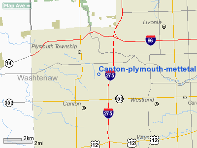
Canton Township, Michigan |
| Elevation AMSL |
696 ft / 212 m |
| Coordinates |
42°20′54″N 083°27′23″W / 42.34833°N 83.45639°W / 42.34833; -83.45639Coordinates: 42°20′54″N 083°27′23″W / 42.34833°N 83.45639°W / 42.34833; -83.45639 |
| Website |
www.mettetal.com |
| Runways |
| Direction |
Length |
Surface |
| ft |
m |
| 18/36 |
2303 |
702 |
Asphalt |
Tarmac area 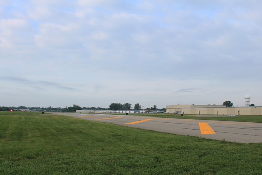 | |
Runway viewed from Joy Road |
Canton-Plymouth-Mettetal Airport (FAA LID: 1D2) is a public airport owned and operated by the Michigan Department of Transportation located in Canton Township, Michigan, United States, two miles (3.2 km) south of Plymouth. The airport in uncontrolled, and is used for general aviation purposes.
On average, 159 aircraft operations occur each day, and 100% of the operations are general aviation. No commercial airline service is available. 132 aircraft are based on the field. Due to the short runway length, touch and go operations, commonly used in flight training, are prohibited.
The above content comes from Wikipedia and is published under free licenses – click here to read more.
Location & QuickFacts
| FAA Information Effective: | 2008-09-25 |
| Airport Identifier: | 1D2 |
| Airport Status: | Operational |
| Longitude/Latitude: | 083-27-22.8255W/42-20-53.3525N
-83.456340/42.348153 (Estimated) |
| Elevation: | 696 ft / 212.14 m (Estimated) |
| Land: | 63 acres |
| From nearest city: | 2 nautical miles S of Plymouth, MI |
| Location: | Wayne County, MI |
| Magnetic Variation: | 05W (1980) |
Owner & Manager
| Ownership: | Publicly owned |
| Owner: | State Of Michigan - Mdot |
| Address: | 2700 East Airport Service Dr
Lansing, MI 48906 |
| Phone number: | 517-335-8521 |
| Manager: | Douglas Kitze |
| Address: | 8550 North Lilley Rd
Canton, MI 48187 |
| Phone number: | 734-459-6627 |
Airport Operations and Facilities
| Airport Use: | Open to public |
| Wind indicator: | Yes |
| Segmented Circle: | Yes |
| Control Tower: | No |
| Lighting Schedule: | SS-SR
ACTVT MIRL RY 18/36, PAPI RYS 18 & 36 - CTAF |
| Beacon Color: | Clear-Green (lighted land airport) |
| Landing fee charge: | No |
| Sectional chart: | Detroit |
| Region: | AGL - Great Lakes |
| Traffic Pattern Alt: | 1000 ft |
| Boundary ARTCC: | ZOB - Cleveland |
| Tie-in FSS: | LAN - Lansing |
| FSS on Airport: | No |
| FSS Toll Free: | 1-800-WX-BRIEF |
| NOTAMs Facility: | LAN (NOTAM-d service avaliable) |
| Federal Agreements: | N |
Airport Communications
| CTAF: | 122.700 |
| Unicom: | 122.700 |
Airport Services
| Fuel available: | 100LL
24 HR SELF SERVE. |
| Airframe Repair: | MAJOR |
| Power Plant Repair: | MAJOR |
| Bottled Oxygen: | NONE |
| Bulk Oxygen: | NONE |
Runway Information
Runway 18/36
| Dimension: | 2303 x 75 ft / 702.0 x 22.9 m |
| Surface: | ASPH, Fair Condition |
| Surface Treatment: | Saw-cut or plastic Grooved |
| Weight Limit: | Single wheel: 12500 lbs. |
| Edge Lights: | Medium |
| |
Runway 18 |
Runway 36 |
| Longitude: | 083-27-23.4200W | 083-27-22.0800W |
| Latitude: | 42-21-03.4700N | 42-20-40.7400N |
| Elevation: | 696.00 ft | 685.00 ft |
| Alignment: | 127 | 127 |
| Traffic Pattern: | Left | Left |
| Markings: | Basic, Good Condition | Basic, Good Condition |
| Crossing Height: | 25.00 ft | 25.00 ft |
| VASI: | 2-light PAPI on left side | 4-light PAPI on right side |
| Visual Glide Angle: | 4.00° | 3.00° |
| Runway End Identifier: | No | |
| Obstruction: | 15 ft road, 312.0 ft from runway, 7:1 slope to clear
RWY 18 APCH RATIO 20:1 FROM THRESHOLD. | 22 ft trees, 926.0 ft from runway, 55 ft left of centerline, 33:1 slope to clear |
|
Radio Navigation Aids
| ID |
Type |
Name |
Ch |
Freq |
Var |
Dist |
| G | NDB | Golf | | 398.00 | 05W | 19.2 nm |
| RYS | NDB | Grosse Ile | | 419.00 | 06W | 20.1 nm |
| VQ | NDB | Cargl | | 230.00 | 05W | 22.3 nm |
| QG | NDB | Windsor | | 353.00 | 06W | 26.2 nm |
| TCU | NDB | Tecumseh | | 239.00 | 04W | 26.6 nm |
| OZW | NDB | Howell | | 243.00 | 05W | 29.1 nm |
| ADG | NDB | Adrian | | 278.00 | 06W | 39.9 nm |
| PT | NDB | Pelee Island | | 283.00 | 05W | 49.0 nm |
| MTC | TACAN | Selfridge | 064X | | 06W | 31.9 nm |
| TOL | TACAN | Toledo | 072X | | 05W | 47.9 nm |
| DXO | VOR/DME | Detroit | 081X | 113.40 | 06W | 9.0 nm |
| YQG | VOR/DME | Windsor | 085X | 113.80 | 06W | 28.5 nm |
| JXN | VOR/DME | Jackson | 033X | 109.60 | 05W | 44.9 nm |
| SVM | VORTAC | Salem | 090X | 114.30 | 03W | 7.1 nm |
| CRL | VORTAC | Carleton | 104X | 115.70 | 03W | 18.0 nm |
| PSI | VORTAC | Pontiac | 047X | 111.00 | 03W | 21.5 nm |
| FNT | VORTAC | Flint | 116X | 116.90 | 06W | 39.3 nm |
| YIP | VOT | Willow Run | | 112.00 | | 7.5 nm |
| DTW | VOT | Detroit Met Wayne | | 109.80 | | 8.3 nm |
| DET | VOT | Detroit City | | 111.60 | | 19.8 nm |
Remarks
- NOISE SENSITIVE AREAS NORTH & SOUTH OF ARPT. CTC AMGR 734-459-0012 FOR NOISE ABATEMENT PROCEDURES.
- GCO AVBL ON FREQ 121.725 THRU DTW CD & FLT SVCS.
- EXISTED PRIOR TO 1959.
Images and information placed above are from
http://www.airport-data.com/airport/1D2/
We thank them for the data!
| General Info
|
| Country |
United States
|
| State |
MICHIGAN
|
| FAA ID |
1D2
|
| Latitude |
42-21-00.132N
|
| Longitude |
083-27-29.766W
|
| Elevation |
696 feet
|
| Near City |
PLYMOUTH
|
We don't guarantee the information is fresh and accurate. The data may
be wrong or outdated.
For more up-to-date information please refer to other sources.
|
|


