 |
|
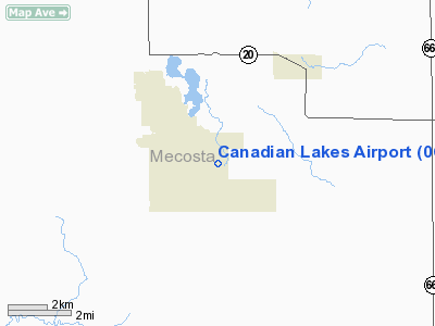
Location & QuickFacts
| FAA Information Effective: | 2008-09-25 |
| Airport Identifier: | 0C5 |
| Airport Status: | Operational |
| Longitude/Latitude: | 085-16-50.1260W/43-34-35.1010N
-85.280591/43.576417 (Estimated) |
| Elevation: | 960 ft / 292.61 m (Estimated) |
| Land: | 11 acres |
| From nearest city: | 5 nautical miles SW of Mecosta, MI |
| Location: | Mecosta County, MI |
| Magnetic Variation: | 04W (1985) |
Owner & Manager
| Ownership: | Privately owned |
| Owner: | Canadian Lakes Prop. Owners Corp. |
| Address: | 10690 Pierce Rd
Stanwood, MI 49346-7651 |
| Phone number: | 231-972-7651 |
| Manager: | Edward T. Goulet
ASST MGR BOB MORRIS 231-972-2583. |
| Address: | 7396 Cessna Lane, 10690 Pierce Rd
Stanwood, MI 49346 |
| Phone number: | 231-972-7821 |
Airport Operations and Facilities
| Airport Use: | Open to public |
| Wind indicator: | Yes |
| Segmented Circle: | No |
| Control Tower: | No |
| Lighting Schedule: | DUSK-DAWN |
| Landing fee charge: | No |
| Sectional chart: | Chicago |
| Region: | AGL - Great Lakes |
| Boundary ARTCC: | ZMP - Minneapolis |
| Tie-in FSS: | LAN - Lansing |
| FSS on Airport: | No |
| FSS Toll Free: | 1-800-WX-BRIEF |
| NOTAMs Facility: | LAN (NOTAM-d service avaliable) |
Airport Communications
Airport Services
Runway Information
Runway 18/36
| Dimension: | 3800 x 100 ft / 1158.2 x 30.5 m |
| Surface: | TURF, Good Condition |
| Edge Lights: | Low |
| |
Runway 18 |
Runway 36 |
| Longitude: | 085-16-50.1200W | 085-16-50.1200W |
| Latitude: | 43-34-53.8600N | 43-34-16.3300N |
| Elevation: | 960.00 ft | 960.00 ft |
| Alignment: | 127 | 0 |
| Traffic Pattern: | Left | Left |
| Displaced threshold: | 573.00 ft | 0.00 ft |
| Obstruction: | 15 ft road, 97 ft left of centerline
APCH RATIO 0:1 AT DSPLCD THLD OVR +15 RD, 0 FT DSTC, 90 FT L, 3:1 OVR +30 FT TREE, 90 FT DSTC, 134 FT R, 25:1 OVR +39 FT TREES, 975 DSTC, BASED ON STRAIGHT OUT. | 15 ft road, 0.0 ft from runway, 90 ft right of centerline
+16 FT HGR, 400 FT DSTC, 55 FT L, APCH RATIO 25:1, +42 FT TREES, 840 DSTC, APCH RATIO 20:1. |
|
Radio Navigation Aids
| ID |
Type |
Name |
Ch |
Freq |
Var |
Dist |
| AMN | NDB | Alma | | 329.00 | 05W | 26.4 nm |
| GDW | NDB | Wiggins | | 209.00 | 04W | 42.2 nm |
| CAD | NDB | Cadillac | | 269.00 | 04W | 42.4 nm |
| HIC | VOR/DME | White Cloud | 123X | 117.60 | 01W | 19.0 nm |
| MOP | VOR/DME | Mount Pleasant | 043X | 110.60 | 05W | 23.8 nm |
| GRR | VOR/DME | Grand Rapids | 106Y | 115.95 | 04W | 48.4 nm |
| MKG | VORTAC | Muskegon | 099X | 115.20 | 01W | 41.2 nm |
Remarks
- RWY 18 + 4 FT FENCE, 114 R (WEST SIDE) ENTIRE LENGTH.
- ACFT PARKED ALONG BOTH SIDES OF RY
- NO SNOW REMOVAL, CFM WINTER CONDS WITH AMGR 231-972-7821.
- DEER ON & INVOF ARPT.
Images and information placed above are from
http://www.airport-data.com/airport/0C5/
We thank them for the data!
| General Info
|
| Country |
United States
|
| State |
MICHIGAN
|
| FAA ID |
0C5
|
| Latitude |
43-34-35.101N
|
| Longitude |
085-16-50.126W
|
| Elevation |
960 feet
|
| Near City |
MECOSTA
|
We don't guarantee the information is fresh and accurate. The data may
be wrong or outdated.
For more up-to-date information please refer to other sources.
|
|


