 |
|
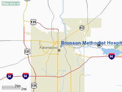
Bronson Methodist Hospital Heliport |
Location & QuickFacts
| FAA Information Effective: | 2008-09-25 |
| Airport Identifier: | 9MI9 |
| Airport Status: | Operational |
| Longitude/Latitude: | 085-34-53.0210W/42-17-13.1450N
-85.581395/42.286985 (Estimated) |
| Elevation: | 786 ft / 239.57 m (Estimated) |
| Land: | 0 acres |
| From nearest city: | 4 nautical miles E of Kalamazoo, MI |
| Location: | Kalamazoo County, MI |
| Magnetic Variation: | 03W (1985) |
Owner & Manager
| Ownership: | Privately owned |
| Owner: | Bronson Health Care Group |
| Address: | One Health Care Plaza
Kalamazoo, MI 49007 |
| Phone number: | 616-341-6327 |
| Manager: | Art Littlefield |
| Address: | One Health Care Plaza
Kalamazoo, MI 49007 |
| Phone number: | 616-341-6327 |
Airport Operations and Facilities
| Airport Use: | Private
MEDICAL USE. |
| Wind indicator: | Yes |
| Segmented Circle: | No |
| Control Tower: | No |
| Lighting Schedule: | DUSK-DAWN |
| Beacon Color: | Clear-Green-Yellow (heliport) |
| Sectional chart: | Chicago |
| Region: | AGL - Great Lakes |
| Boundary ARTCC: | ZAU - Chicago |
| Tie-in FSS: | LAN - Lansing |
| FSS on Airport: | No |
| FSS Toll Free: | 1-800-WX-BRIEF |
Airport Services
Runway Information
Helipad H1
| Dimension: | 150 x 80 ft / 45.7 x 24.4 m |
| Surface: | CONC, |
| |
Runway H1 |
Runway |
| Traffic Pattern: | Left | Left |
|
Radio Navigation Aids
| ID |
Type |
Name |
Ch |
Freq |
Var |
Dist |
| BT | NDB | Batol | | 272.00 | 04W | 18.2 nm |
| HAI | NDB | Three Rivers | | 407.00 | 02W | 19.8 nm |
| IRS | NDB | Sturgis | | 382.00 | 04W | 29.2 nm |
| HLM | NDB | Holland | | 233.00 | 03W | 39.9 nm |
| ANQ | NDB | Angola | | 347.00 | 05W | 44.7 nm |
| AZO | VOR/DME | Kalamazoo | 027X | 109.00 | 01W | 3.3 nm |
| ELX | VOR/DME | Keeler | 113X | 116.60 | 00E | 25.6 nm |
| PMM | VOR/DME | Pullman | 058X | 112.10 | 00E | 25.6 nm |
| GRR | VOR/DME | Grand Rapids | 106Y | 115.95 | 04W | 30.3 nm |
| LFD | VOR/DME | Litchfield | 049X | 111.20 | 05W | 38.8 nm |
| JXN | VOR/DME | Jackson | 033X | 109.60 | 05W | 50.0 nm |
| BTL | VORTAC | Battle Creek | 031X | 109.40 | 02W | 14.7 nm |
| GIJ | VORTAC | Gipper | 101X | 115.40 | 00E | 45.3 nm |
| LAN | VORTAC | Lansing | 045X | 110.80 | 05W | 46.9 nm |
| GSH | VORTAC | Goshen | 084X | 113.70 | 00E | 50.0 nm |
Remarks
- PRVDD OPNS ARE CONDD IN AREA FM 150-210 & 290-320 DEG, AREA IS MKD, WIND INDCR IS MAINTD.
Images and information placed above are from
http://www.airport-data.com/airport/9MI9/
We thank them for the data!
| General Info
|
| Country |
United States
|
| State |
MICHIGAN
|
| FAA ID |
9MI9
|
| Latitude |
42-17-13.145N
|
| Longitude |
085-34-53.021W
|
| Elevation |
786 feet
|
| Near City |
KALAMAZOO
|
We don't guarantee the information is fresh and accurate. The data may
be wrong or outdated.
For more up-to-date information please refer to other sources.
|
|


