 |
|
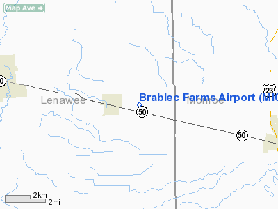
Location & QuickFacts
| FAA Information Effective: | 2008-09-25 |
| Airport Identifier: | MI02 |
| Airport Status: | Operational |
| Longitude/Latitude: | 083-48-16.7830W/41-59-13.1600N
-83.804662/41.986989 (Estimated) |
| Elevation: | 691 ft / 210.62 m (Surveyed) |
| Land: | 0 acres |
| From nearest city: | 1 nautical miles E of Britton, MI |
| Location: | Lenawee County, MI |
| Magnetic Variation: | 05W (1985) |
Owner & Manager
| Ownership: | Privately owned |
| Owner: | Barry B Barablec |
| Address: | Rr
Britton, MI 49229 |
| Manager: | B. B. Brablec |
| Address: | Rt 1
Britton, MI 49229 |
| Phone number: | 517-451-4010
OR 517-423-6213 |
Airport Operations and Facilities
| Airport Use: | Private |
| Wind indicator: | Yes |
| Segmented Circle: | No |
| Control Tower: | No |
| Landing fee charge: | No |
| Sectional chart: | Detroit |
| Region: | AGL - Great Lakes |
| Boundary ARTCC: | ZOB - Cleveland |
| Tie-in FSS: | LAN - Lansing |
| FSS on Airport: | No |
| FSS Toll Free: | 1-800-WX-BRIEF |
Airport Services
| Airframe Repair: | NONE |
| Power Plant Repair: | NONE |
Runway Information
Runway 18/36
| Dimension: | 3000 x 70 ft / 914.4 x 21.3 m |
| Surface: | TURF, |
| |
Runway 18 |
Runway 36 |
| Traffic Pattern: | Left | Left |
|
Radio Navigation Aids
| ID |
Type |
Name |
Ch |
Freq |
Var |
Dist |
| TCU | NDB | Tecumseh | | 239.00 | 04W | 4.5 nm |
| ADG | NDB | Adrian | | 278.00 | 06W | 14.1 nm |
| USE | NDB | Fulton | | 375.00 | 05W | 27.1 nm |
| RYS | NDB | Grosse Ile | | 419.00 | 06W | 29.9 nm |
| G | NDB | Golf | | 398.00 | 05W | 37.1 nm |
| OZW | NDB | Howell | | 243.00 | 05W | 39.7 nm |
| BYN | NDB | Bryan | | 260.00 | 04W | 42.5 nm |
| VQ | NDB | Cargl | | 230.00 | 05W | 43.9 nm |
| QG | NDB | Windsor | | 353.00 | 06W | 46.1 nm |
| DFI | NDB | Defiance | | 246.00 | 05W | 48.2 nm |
| TOL | TACAN | Toledo | 072X | | 05W | 23.6 nm |
| DXO | VOR/DME | Detroit | 081X | 113.40 | 06W | 23.8 nm |
| VWV | VOR/DME | Waterville | 078X | 113.10 | 02W | 33.0 nm |
| JXN | VOR/DME | Jackson | 033X | 109.60 | 05W | 33.4 nm |
| LFD | VOR/DME | Litchfield | 049X | 111.20 | 05W | 43.1 nm |
| YQG | VOR/DME | Windsor | 085X | 113.80 | 06W | 46.3 nm |
| CRL | VORTAC | Carleton | 104X | 115.70 | 03W | 15.9 nm |
| SVM | VORTAC | Salem | 090X | 114.30 | 03W | 27.0 nm |
| PSI | VORTAC | Pontiac | 047X | 111.00 | 03W | 44.6 nm |
| YIP | VOT | Willow Run | | 112.00 | | 19.5 nm |
| DTW | VOT | Detroit Met Wayne | | 109.80 | | 24.4 nm |
| DET | VOT | Detroit City | | 111.60 | | 43.2 nm |
Remarks
Images and information placed above are from
http://www.airport-data.com/airport/MI02/
We thank them for the data!
| General Info
|
| Country |
United States
|
| State |
MICHIGAN
|
| FAA ID |
MI02
|
| Latitude |
41-59-13.160N
|
| Longitude |
083-48-16.783W
|
| Elevation |
691 feet
|
| Near City |
BRITTON
|
We don't guarantee the information is fresh and accurate. The data may
be wrong or outdated.
For more up-to-date information please refer to other sources.
|
|


