 |
|
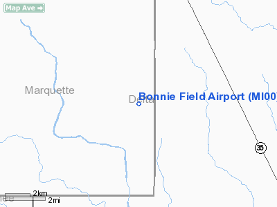
| Bonnie Field |
| IATA: none – ICAO: none – FAA LID: 6Y4 |
| Summary |
| Airport type |
Public |
| Owner |
Donald B. Mattson |
| Serves |
Rock, Michigan |
| Elevation AMSL |
970 ft / 296 m |
| Coordinates |
46°03′08″N 087°15′29″W / 46.05222°N 87.25806°W / 46.05222; -87.25806 |
| Runways |
| Direction |
Length |
Surface |
| ft |
m |
| 12/30 |
2,600 |
792 |
Turf |
| Statistics (2004) |
| Aircraft operations |
80 |
| Source: Federal Aviation Administration |
Bonnie Field (FAA LID: 6Y4) is a privately-owned, public-use airport in Marquette County, Michigan, United States. It located is 4 nautical miles (7 km) southwest of the central business district of Rock, Michigan.
Facilities and aircraft
Bonnie Field covers an area of 120 acres (49 ha) and has one runway designated 12/30 with a 2,600 by 100 ft (792 by 30 m) turf surface. For the 12-month period ending December 31, 2004, the airport had 80 general aviation aircraft operations.
The above content comes from Wikipedia and is published under free licenses – click here to read more.
Location & QuickFacts
| FAA Information Effective: | 2008-09-25 |
| Airport Identifier: | MI00 |
| Airport Status: | Operational |
| Longitude/Latitude: | 087-15-29.4990W/46-03-07.8390N
-87.258194/46.052177 (Estimated) |
| Elevation: | 970 ft / 295.66 m (Estimated) |
| Land: | 120 acres |
| From nearest city: | 4 nautical miles SW of Rock, MI |
| Location: | Marquette County, MI |
| Magnetic Variation: | 03W (1985) |
Owner & Manager
| Ownership: | Privately owned |
| Owner: | Donald B. Mattson |
| Address: | 4405 Harmony Lane
Belleville, MI 48111
ARPT ADDRESS; 14058 ARPT ROAD F-5 ROCK MI 49677. |
| Phone number: | 734-697-8056 |
| Manager: | Jim Lund |
| Address: | 14491 County Line Rd. G
Rock, MI 49880 |
| Phone number: | 906-356-6319 |
Airport Operations and Facilities
| Airport Use: | Private |
| Wind indicator: | No |
| Segmented Circle: | No |
| Control Tower: | No |
| Landing fee charge: | No |
| Sectional chart: | Green Bay |
| Region: | AGL - Great Lakes |
| Boundary ARTCC: | ZMP - Minneapolis |
| Tie-in FSS: | GRB - Green Bay |
| FSS on Airport: | No |
| FSS Toll Free: | 1-800-WX-BRIEF |
Runway Information
Runway 12/30
| Dimension: | 2725 x 100 ft / 830.6 x 30.5 m |
| Surface: | TURF, Poor Condition
RWY ROUGH |
| |
Runway 12 |
Runway 30 |
| Longitude: | 087-15-46.6600W | 087-15-12.3100W |
| Latitude: | 46-03-13.9800N | 46-03-01.6600N |
| Elevation: | 970.00 ft | 970.00 ft |
| Traffic Pattern: | Left | Left |
| Displaced threshold: | 390.00 ft | 1150.00 ft |
| Obstruction: | 70 ft trees, 110 ft left of centerline
APCH RATIO 0:1 AT DSPLCD THLD OVR +70 FT TREES 0 FT FM DSPLCD THR, 120 FT L. | 65 ft trees, 132.0 ft from runway, 2:1 slope to clear
APCH RATIO 20:1 AT DSPLCD THLD OVER +70 FT TREES; 1400 FT DSTC. |
|
Radio Navigation Aids
| ID |
Type |
Name |
Ch |
Freq |
Var |
Dist |
| SAW | VOR/DME | Sawyer | 118X | 117.10 | 04W | 19.3 nm |
| ESC | VOR/DME | Escanaba | 045X | 110.80 | 00E | 21.0 nm |
| MQT | VOR/DME | Marquette/dcmsnd | 114X | 116.70 | 02W | 31.7 nm |
| IMT | VOR/DME | Iron Mountain | 049X | 111.20 | 02W | 38.4 nm |
| ISQ | VOR/DME | Schoolcraft County | 041X | 110.40 | 05W | 45.5 nm |
Remarks
- NO SNOW REMOVAL & ARPT CLSD NOV - JUN & WHEN SNOW COVERED.
- DEER ON & INVOF ARPT.
- RY 12/30 SOFT WHEN WET; CALL TO VERIFY COND 906-356-6319.
- CLOSED TO PUBLIC USE
- RUNWAY NOT MOWED - RUNWAY MARKERS NOT VISIBLE - WIND INDICATOR NOT AVAILABLE
Images and information placed above are from
http://www.airport-data.com/airport/MI00/
We thank them for the data!
We don't guarantee the information is fresh and accurate. The data may
be wrong or outdated.
For more up-to-date information please refer to other sources.
|
|


