 |
|
| Beaver Island Airport |
| IATA: none – ICAO: KSJX – FAA LID: SJX |
| Summary |
| Airport type |
Public |
| Owner |
St. James & Peaine Townships |
| Serves |
Beaver Island, Michigan |
| Elevation AMSL |
669 ft / 204 m |
| Coordinates |
45°41′32″N 085°33′59″W / 45.69222°N 85.56639°W / 45.69222; -85.56639 |
| Runways |
| Direction |
Length |
Surface |
| ft |
m |
| 9/27 |
4,300 |
1,311 |
Asphalt |
| 14/32 |
3,300 |
1,006 |
Turf |
| 5/23 |
2,130 |
649 |
Turf |
| Statistics (2006) |
| Aircraft operations |
9,210 |
| Source: Federal Aviation Administration |
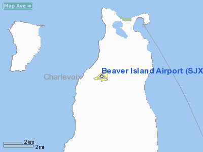
Beaver Island Airport (ICAO: KSJX, FAA LID: SJX) is a public use airport located on Beaver Island in Charlevoix County, Michigan, United States. It is owned by St. James Township and Peaine Township. According to the FAA's National Plan of Integrated Airport Systems for 2009–2013, it is categorized as a general aviation airport.
Although many U.S. airports use the same three-letter location identifier for the FAA and IATA, this airport is assigned SJX by the FAA and no designation from the IATA (which assigned SJX to Sartaneja Airport in Sartaneja, Belize).
Facilities and aircraft
Beaver Island Airport covers an area of 130 acres (53 ha) at an elevation of 669 feet (204 m) above mean sea level. It has three runways: 9/27 has an asphalt pavement measuring 4,300 by 75 feet (1,311 x 23 m); 14/32 and 5/23 have turf surfaces measuring 3,300 by 120 feet (1,006 x 37 m) and 2,130 by 120 feet (649 x 37 m) respectively. Runways 14/32 and 5/23 are closed November through April, and also when snow-covered. Access to the airport is via Donnell Mor's Lane.
For the 12-month period ending December 31, 2006, the airport had 9,210 aircraft operations, an average of 25 per day: 60% air taxi and 40% general aviation.
The above content comes from Wikipedia and is published under free licenses – click here to read more.
Location & QuickFacts
| FAA Information Effective: | 2008-09-25 |
| Airport Identifier: | SJX |
| Airport Status: | Operational |
| Longitude/Latitude: | 085-33-59.7980W/45-41-32.1480N
-85.566611/45.692263 (Estimated) |
| Elevation: | 669 ft / 203.91 m (Surveyed) |
| Land: | 130 acres |
| From nearest city: | 4 nautical miles SW of Beaver Island, MI |
| Location: | Charlevoix County, MI |
| Magnetic Variation: | 05W (1995) |
Owner & Manager
| Ownership: | Publicly owned |
| Owner: | St James & Peaine Townships |
| Address: | Beaver Island Airport, 28215 Airport Road
Beaver Island, MI 49782 |
| Phone number: | 231-448-2834 |
| Manager: | Rachel Teague
DON VYSE, BD CHAIR. 231-448-2834 38210 INDIAN PT RD, BEAVER ISLAND, MI 49782 |
| Address: | P.o. Box 134
Beaver Island, MI 49782 |
| Phone number: | 231-237-9482
231-675-5391 MGR CELL, 231-448-2750 AIRPORT PHONE |
Airport Operations and Facilities
| Airport Use: | Open to public |
| Wind indicator: | Yes |
| Segmented Circle: | Yes |
| Control Tower: | No |
| Lighting Schedule: | DUSK-DAWN
ACTVT MIRL RY 09/27 - CTAF. |
| Beacon Color: | Clear-Green (lighted land airport) |
| Landing fee charge: | No |
| Sectional chart: | Green Bay |
| Region: | AGL - Great Lakes |
| Boundary ARTCC: | ZMP - Minneapolis |
| Tie-in FSS: | LAN - Lansing |
| FSS on Airport: | No |
| FSS Toll Free: | 1-800-WX-BRIEF |
| NOTAMs Facility: | SJX (NOTAM-d service avaliable) |
| Federal Agreements: | N |
Airport Communications
| CTAF: | 122.800 |
| Unicom: | 122.800 |
Airport Services
| Fuel available: | 100LL |
| Airframe Repair: | NONE |
| Power Plant Repair: | NONE |
| Bottled Oxygen: | NONE |
| Bulk Oxygen: | NONE |
Runway Information
Runway 05/23
| Dimension: | 2130 x 120 ft / 649.2 x 36.6 m |
| Surface: | TURF, Fair Condition |
| |
Runway 05 |
Runway 23 |
| Longitude: | 085-34-09.7000W | 085-33-48.9380W |
| Latitude: | 45-41-30.4480N | 45-41-45.6300N |
| Alignment: | 44 | 127 |
| Traffic Pattern: | Left | Left |
| Displaced threshold: | 0.00 ft | 794.00 ft |
| Runway End Identifier: | No | No |
| Centerline Lights: | No | No |
| Touchdown Lights: | No | No |
| Obstruction: | 55 ft trees, 1100.0 ft from runway, 20:1 slope to clear | 43 ft trees, 258.0 ft from runway, 130 ft right of centerline, 6:1 slope to clear
APCH RATIO 20:1 AT DSPLCD THLD BASED ON STRAIGHT OUT. |
|
Runway 09/27
| Dimension: | 4300 x 75 ft / 1310.6 x 22.9 m |
| Surface: | ASPH, Good Condition |
| Edge Lights: | Medium |
| |
Runway 09 |
Runway 27 |
| Longitude: | 085-34-39.8560W | 085-33-39.2820W |
| Latitude: | 45-41-29.3360N | 45-41-29.2300N |
| Elevation: | 669.00 ft | 667.00 ft |
| Alignment: | 90 | 127 |
| Traffic Pattern: | Left | Left |
| Markings: | Basic, Fair Condition | Basic, Fair Condition |
| Crossing Height: | 24.00 ft | 32.00 ft |
| VASI: | 4-light PAPI on left side | 4-light PAPI on left side |
| Visual Glide Angle: | 3.00° | 4.00° |
| Runway End Identifier: | Yes | Yes |
| Centerline Lights: | No | No |
| Touchdown Lights: | No | |
| Obstruction: | 60 ft trees, 201.0 ft from runway, 205 ft right of centerline
APCH RATIO 20:1 BASED ON STRAIGHT OUT. | 44 ft trees, 1080.0 ft from runway, 260 ft right of centerline, 20:1 slope to clear |
|
Runway 14/32
| Dimension: | 3300 x 120 ft / 1005.8 x 36.6 m |
| Surface: | TURF, Fair Condition |
| |
Runway 14 |
Runway 32 |
| Longitude: | 085-34-04.6650W | 085-33-30.1030W |
| Latitude: | 45-41-42.9880N | 45-41-21.1710N |
| Alignment: | 127 | 127 |
| Traffic Pattern: | Left | Left |
| Displaced threshold: | 533.00 ft | 600.00 ft |
| Touchdown Lights: | No | No |
| Obstruction: | 70 ft trees, 125 ft left of centerline
RWY 14 APCH RATIO 8:1 AT DSPLCD THLD OVR + 54 FT TREES, 432 FT FM DSPLCD THR, 135 FT L. | 39 ft trees, 195.0 ft from runway, 120 ft right of centerline, 5:1 slope to clear
RWY 32 APCH RATIO 20:1 AT DSPLCD THR. |
|
Radio Navigation Aids
| ID |
Type |
Name |
Ch |
Freq |
Var |
Dist |
| SJX | NDB | St James | | 382.00 | 05W | 0.3 nm |
| CVX | NDB | Charlevoix | | 392.00 | 05W | 26.6 nm |
| BFA | NDB | Boyne Falls | | 263.00 | 06W | 41.7 nm |
| CXK | NDB | Clam Lake | | 251.00 | 05W | 49.6 nm |
| ISQ | VOR/DME | Schoolcraft County | 041X | 110.40 | 05W | 30.6 nm |
| ERY | VOR/DME | Newberry | 019X | 108.20 | 06W | 37.5 nm |
| PLN | VORTAC | Pellston | 055X | 111.80 | 06W | 38.1 nm |
Remarks
- DEER ON & INVOF ARPT.
- RYS 05/23 & 14/32 CLSD NOV THRU APR & WHEN SNOW COVERED.
- COURTESY CAR AVBL.
- NON-COMPLIANCE WITH FAR 157.
Images and information placed above are from
http://www.airport-data.com/airport/SJX/
We thank them for the data!
| General Info
|
| Country |
United States
|
| State |
MICHIGAN
|
| FAA ID |
SJX
|
| Latitude |
45-41-28.370N
|
| Longitude |
085-33-58.660W
|
| Elevation |
669 feet
|
| Near City |
BEAVER ISLAND
|
We don't guarantee the information is fresh and accurate. The data may
be wrong or outdated.
For more up-to-date information please refer to other sources.
|
|


