 |
|
Location & QuickFacts
| FAA Information Effective: | 2008-09-25 |
| Airport Identifier: | 61MI |
| Airport Status: | Operational |
| Longitude/Latitude: | 082-44-56.7000W/42-40-54.1100N
-82.749083/42.681697 (Estimated) |
| Elevation: | 905 ft / 275.84 m (Estimated) |
| Land: | 1 acres |
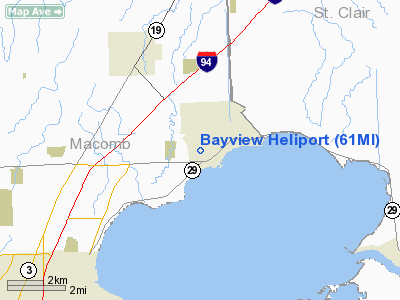
| From nearest city: | 1 nautical miles E of New Baltimore, MI |
| Location: | Macomb County, MI |
| Magnetic Variation: | 07W (1995) |
Owner & Manager
| Ownership: | Privately owned |
| Owner: | Greg Janski |
| Address: | 35215 Cricklewood
New Baltimore, MI 48047 |
| Phone number: | 810-725-7010 |
| Manager: | Greg Janski |
| Address: | 35215 Cricklewood
New Baltimore, MI 48047 |
| Phone number: | 810-725-7010 |
Airport Operations and Facilities
| Airport Use: | Private |
| Wind indicator: | Yes |
| Segmented Circle: | No |
| Control Tower: | No |
| Sectional chart: | Detroit |
| Region: | AGL - Great Lakes |
| Boundary ARTCC: | ZOB - Cleveland |
| Tie-in FSS: | LAN - Lansing |
| FSS on Airport: | No |
| FSS Toll Free: | 1-800-WX-BRIEF |
Runway Information
Helipad H1
| Dimension: | 20 x 20 ft / 6.1 x 6.1 m |
| Surface: | TURF, |
| |
Runway H1 |
Runway |
| Traffic Pattern: | Left | Left |
|
Radio Navigation Aids
| ID |
Type |
Name |
Ch |
Freq |
Var |
Dist |
| VQ | NDB | Cargl | | 230.00 | 05W | 21.6 nm |
| QG | NDB | Windsor | | 353.00 | 06W | 22.8 nm |
| ZR | NDB | Sarnia | | 404.00 | 06W | 27.5 nm |
| G | NDB | Golf | | 398.00 | 05W | 29.5 nm |
| 4L | NDB | Chatham | | 236.00 | 06W | 37.1 nm |
| RYS | NDB | Grosse Ile | | 419.00 | 06W | 39.2 nm |
| MTC | TACAN | Selfridge | 064X | | 06W | 5.5 nm |
| YQG | VOR/DME | Windsor | 085X | 113.80 | 06W | 26.2 nm |
| DXO | VOR/DME | Detroit | 081X | 113.40 | 06W | 39.3 nm |
| ECK | VORTAC | Peck | 087X | 114.00 | 07W | 34.5 nm |
| PSI | VORTAC | Pontiac | 047X | 111.00 | 03W | 34.6 nm |
| SVM | VORTAC | Salem | 090X | 114.30 | 03W | 40.9 nm |
| FNT | VORTAC | Flint | 116X | 116.90 | 06W | 47.2 nm |
| CRL | VORTAC | Carleton | 104X | 115.70 | 03W | 49.4 nm |
| DET | VOT | Detroit City | | 111.60 | | 20.4 nm |
| DTW | VOT | Detroit Met Wayne | | 109.80 | | 38.6 nm |
| YIP | VOT | Willow Run | | 112.00 | | 43.6 nm |
Remarks
- APCH/DEP OPS CONDUCTED 270 DEG CLKWS TO 290 DEG CLKWS FM PAD CNTR; COMPLIANCE WITH 14 CFR 91.126 (B)(2); APROP MARKED; MNTND WIND INDICATOR; REMOVAL OF 40 FT TREE W OF PAD TO ACHEIVE 8:1 APCH SLOPE.
Images and information placed above are from
http://www.airport-data.com/airport/61MI/
We thank them for the data!
| General Info
|
| Country |
United States
|
| State |
MICHIGAN
|
| FAA ID |
61MI
|
| Latitude |
42-40-54.110N
|
| Longitude |
082-44-56.700W
|
| Elevation |
905 feet
|
| Near City |
NEW BALTIMORE
|
We don't guarantee the information is fresh and accurate. The data may
be wrong or outdated.
For more up-to-date information please refer to other sources.
|
|


