 |
|
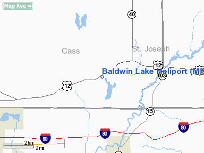
Location & QuickFacts
| FAA Information Effective: | 2008-09-25 |
| Airport Identifier: | MI90 |
| Airport Status: | Operational |
| Longitude/Latitude: | 085-50-19.9880W/41-47-25.1770N
-85.838886/41.790327 (Estimated) |
| Elevation: | 850 ft / 259.08 m (Estimated) |
| Land: | 0 acres |
| From nearest city: | 1 nautical miles E of Union, MI |
| Location: | Cass County, MI |
| Magnetic Variation: | 03W (1985) |
Owner & Manager
| Ownership: | Privately owned |
| Owner: | Reed M. Powers |
| Address: | 14163 Us 12
Union, MI 49130 |
| Phone number: | 616-641-7260 |
| Manager: | Ben R. Games |
| Address: | 14163 Us 12
Union, MI 49130 |
| Phone number: | 312-448-2022 |
Airport Operations and Facilities
| Airport Use: | Private |
| Wind indicator: | Yes |
| Segmented Circle: | Yes |
| Control Tower: | No |
| Landing fee charge: | No |
| Sectional chart: | Chicago |
| Region: | AGL - Great Lakes |
| Boundary ARTCC: | ZAU - Chicago |
| Tie-in FSS: | LAN - Lansing |
| FSS on Airport: | No |
| FSS Toll Free: | 1-800-WX-BRIEF
OR LOCAL CALL 293-8916. |
Airport Services
| Airframe Repair: | NONE |
| Power Plant Repair: | NONE |
Runway Information
Helipad H1
| Dimension: | 30 x 30 ft / 9.1 x 9.1 m
CONC TOUCHDOWN WITHIN A 500 X 500 TURF LANDING AREA. |
| Surface: | CONC, |
| |
Runway H1 |
Runway |
| Traffic Pattern: | Left | Left |
|
Radio Navigation Aids
| ID |
Type |
Name |
Ch |
Freq |
Var |
Dist |
| HAI | NDB | Three Rivers | | 407.00 | 02W | 15.0 nm |
| IRS | NDB | Sturgis | | 382.00 | 04W | 18.2 nm |
| ANQ | NDB | Angola | | 347.00 | 05W | 34.9 nm |
| CPB | NDB | Culver | | 391.00 | 01W | 42.3 nm |
| MGC | NDB | Michigan City | | 203.00 | 01W | 44.1 nm |
| BT | NDB | Batol | | 272.00 | 04W | 45.1 nm |
| IUL | NDB | La Porte | | 356.00 | 03W | 45.4 nm |
| RCR | NDB | Rochester | | 216.00 | 03W | 46.4 nm |
| OLK | VOR | Wolf Lake | | 110.40 | 03W | 36.1 nm |
| ELX | VOR/DME | Keeler | 113X | 116.60 | 00E | 24.8 nm |
| AZO | VOR/DME | Kalamazoo | 027X | 109.00 | 01W | 29.7 nm |
| PMM | VOR/DME | Pullman | 058X | 112.10 | 00E | 42.3 nm |
| OXI | VOR/DME | Knox | 103X | 115.60 | 00E | 46.1 nm |
| GSH | VORTAC | Goshen | 084X | 113.70 | 00E | 18.1 nm |
| GIJ | VORTAC | Gipper | 101X | 115.40 | 00E | 21.5 nm |
| BTL | VORTAC | Battle Creek | 031X | 109.40 | 02W | 40.7 nm |
Remarks
- HELIPORT USED FOR ARNG TRNG.LETTER OF AGREEMENT GIVEN TO AVIATION OFFICER,MI.DEPT.OF MILITARY AFFAIRS.
Images and information placed above are from
http://www.airport-data.com/airport/MI90/
We thank them for the data!
| General Info
|
| Country |
United States
|
| State |
MICHIGAN
|
| FAA ID |
MI90
|
| Latitude |
41-47-25.177N
|
| Longitude |
085-50-19.988W
|
| Elevation |
850 feet
|
| Near City |
UNION
|
We don't guarantee the information is fresh and accurate. The data may
be wrong or outdated.
For more up-to-date information please refer to other sources.
|
|


