 |
|
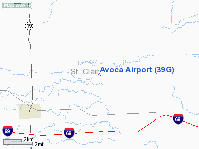
Location & QuickFacts
| FAA Information Effective: | 2008-09-25 |
| Airport Identifier: | 39G |
| Airport Status: | Operational |
| Longitude/Latitude: | 082-40-09.7270W/43-01-48.0990N
-82.669369/43.030027 (Estimated) |
| Elevation: | 726 ft / 221.28 m (Estimated) |
| Land: | 40 acres |
| From nearest city: | 2 nautical miles SE of Avoca, MI |
| Location: | St Clair County, MI |
| Magnetic Variation: | 06W (1985) |
Owner & Manager
| Ownership: | Privately owned |
| Owner: | Leland Engel
OWNED BY GROUPS. |
| Address: | 8323 Imlay City Rd
Avoca, MI 48006 |
| Phone number: | 810-324-2352 |
| Manager: | Leland Engel |
| Address: | 8323 Imlay City Rd
Avoca, MI 48006 |
| Phone number: | 810-324-2352 |
Airport Operations and Facilities
| Airport Use: | Open to public |
| Wind indicator: | Yes |
| Segmented Circle: | No |
| Control Tower: | No |
| Landing fee charge: | No |
| Sectional chart: | Detroit |
| Region: | AGL - Great Lakes |
| Boundary ARTCC: | ZOB - Cleveland |
| Tie-in FSS: | LAN - Lansing |
| FSS on Airport: | No |
| FSS Toll Free: | 1-800-WX-BRIEF |
| NOTAMs Facility: | LAN (NOTAM-d service avaliable) |
Airport Communications
Airport Services
| Airframe Repair: | NONE |
| Power Plant Repair: | NONE |
| Bottled Oxygen: | NONE |
| Bulk Oxygen: | NONE |
Runway Information
Runway 09/27
| Dimension: | 2105 x 100 ft / 641.6 x 30.5 m |
| Surface: | TURF, Fair Condition |
| |
Runway 09 |
Runway 27 |
| Longitude: | 082-40-23.8500W | 082-39-55.5800W |
| Latitude: | 43-01-47.9000N | 43-01-48.2600N |
| Elevation: | 726.00 ft | 726.00 ft |
| Traffic Pattern: | Right | Left |
| Displaced threshold: | 267.00 ft | 0.00 ft |
| Runway End Identifier: | No | No |
| Centerline Lights: | No | No |
| Touchdown Lights: | No | No |
| Obstruction: | 16 ft road, 44.0 ft from runway, 2:1 slope to clear
RY 09 APCH RATIO 0:1 AT DSPLCD THLD, +25 FT TREES 0 FT DSTC, 90 FT L. | 60 ft trees, 45.0 ft from runway, 75 ft left of centerline |
|
Radio Navigation Aids
| ID |
Type |
Name |
Ch |
Freq |
Var |
Dist |
| ZR | NDB | Sarnia | | 404.00 | 06W | 19.9 nm |
| VQ | NDB | Cargl | | 230.00 | 05W | 42.4 nm |
| QG | NDB | Windsor | | 353.00 | 06W | 44.0 nm |
| MTC | TACAN | Selfridge | 064X | | 06W | 26.1 nm |
| BAX | VOR/DME | Bad Axe | 019X | 108.20 | 05W | 47.3 nm |
| YQG | VOR/DME | Windsor | 085X | 113.80 | 06W | 47.4 nm |
| ECK | VORTAC | Peck | 087X | 114.00 | 07W | 13.7 nm |
| PSI | VORTAC | Pontiac | 047X | 111.00 | 03W | 42.9 nm |
| FNT | VORTAC | Flint | 116X | 116.90 | 06W | 47.5 nm |
| DET | VOT | Detroit City | | 111.60 | | 40.6 nm |
Remarks
- ULTRALIGHT OPNS AT ARPT.
- PRVDD AREA 125 FT EITHER SIDE OF RY CNTRLN & 200 FT OFF EACH END IS CLEAR; PARKED ACFT ARE TO REMAIN OUTSIDE THIS AREA. ANY OBSTR BE REMOVED/LOWERED OR THLD DSPLD TO PRVD A CLEAR 20:1. LOA DATED 11/28/93 REMAINS IN EFFECT.
Images and information placed above are from
http://www.airport-data.com/airport/39G/
We thank them for the data!
| General Info
|
| Country |
United States
|
| State |
MICHIGAN
|
| FAA ID |
39G
|
| Latitude |
43-01-48.099N
|
| Longitude |
082-40-09.727W
|
| Elevation |
726 feet
|
| Near City |
AVOCA
|
We don't guarantee the information is fresh and accurate. The data may
be wrong or outdated.
For more up-to-date information please refer to other sources.
|
|


