 |
|
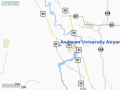
Andrews University Airpark Airport |
Location & QuickFacts
| FAA Information Effective: | 2008-09-25 |
| Airport Identifier: | C20 |
| Airport Status: | Operational |
| Longitude/Latitude: | 086-22-03.5720W/41-57-06.1980N
-86.367659/41.951722 (Estimated) |
| Elevation: | 668 ft / 203.61 m (Estimated) |
| Land: | 50 acres |
| From nearest city: | 2 nautical miles W of Berrien Springs, MI |
| Location: | Berrien County, MI |
| Magnetic Variation: | 03W (1985) |
Owner & Manager
| Ownership: | Privately owned |
| Owner: | Andrews University |
| Address: | 3898 Griggs Dr
Berrien Springs, MI 49104-0830 |
| Phone number: | 269-471-3547 |
| Manager: | Allan Payne |
| Address: | 3898 Griggs Dr
Berrien Springs, MI 49104-0830 |
| Phone number: | 269-471-3387 |
Airport Operations and Facilities
| Airport Use: | Open to public |
| Wind indicator: | Yes |
| Segmented Circle: | Yes |
| Control Tower: | No |
| Lighting Schedule: | DUSK-DAWN
ACTVT LIRL RY 13/31 - CTAF. |
| Beacon Color: | Clear-Green (lighted land airport) |
| Landing fee charge: | No |
| Sectional chart: | Chicago |
| Region: | AGL - Great Lakes |
| Boundary ARTCC: | ZAU - Chicago |
| Tie-in FSS: | LAN - Lansing |
| FSS on Airport: | No |
| FSS Toll Free: | 1-800-WX-BRIEF |
| NOTAMs Facility: | LAN (NOTAM-d service avaliable) |
Airport Communications
| CTAF: | 122.700 |
| Unicom: | 122.700 |
Airport Services
| Fuel available: | 100LL |
| Airframe Repair: | MAJOR |
| Power Plant Repair: | MAJOR |
| Bottled Oxygen: | NONE |
Runway Information
Runway 03/21
| Dimension: | 1944 x 115 ft / 592.5 x 35.1 m |
| Surface: | TURF, Fair Condition |
| |
Runway 03 |
Runway 21 |
| Longitude: | 086-22-16.9141W | 086-22-05.0000W |
| Latitude: | 41-57-06.4786N | 41-57-23.5000N |
| Alignment: | 28 | 127 |
| Traffic Pattern: | Left | Right |
| Displaced threshold: | 613.00 ft | 550.00 ft |
| Obstruction: | 94 ft trees, 565.0 ft from runway, 6:1 slope to clear
RWY 03 APCH RATIO 12:1 AT DSPLCD THLD BASED ON +94 FT TREES, 0B, 1186 FT DSTC. | 70 ft trees, 90.0 ft from runway, 90 ft right of centerline
RWY 21 APCH RATIO 12:1 AT DSPLCD THLD. |
|
Runway 13/31
| Dimension: | 4161 x 75 ft / 1268.3 x 22.9 m |
| Surface: | ASPH, Good Condition |
| Edge Lights: | Low
RWY 31 NSTD LIRL DUE TO DSPLD THLD NOT LGTD. |
| |
Runway 13 |
Runway 31 |
| Longitude: | 086-22-22.2000W | 086-21-40.8000W |
| Latitude: | 41-57-12.2000N | 41-56-45.1000N |
| Alignment: | 127 | 127 |
| Traffic Pattern: | Right | Left |
| Markings: | Basic, Good Condition | Basic, Good Condition |
| Displaced threshold: | 0.00 ft | 1140.00 ft |
| Runway End Identifier: | No | No |
| Obstruction: | 96 ft pline, 2130.0 ft from runway, 20:1 slope to clear
-25 FT DITCH IN PRIM SFC 40 FT DSTC, +10 FT TREE, 10 FT DSTC, 88 FT R. | 85 ft trees, 795.0 ft from runway, 7:1 slope to clear
APCH RATIO 20:1 TO DSPLCD BASED ON 52 FT TREES, 1040 FT DSTC. |
|
Radio Navigation Aids
| ID |
Type |
Name |
Ch |
Freq |
Var |
Dist |
| MGC | NDB | Michigan City | | 203.00 | 01W | 24.9 nm |
| IUL | NDB | La Porte | | 356.00 | 03W | 32.7 nm |
| HAI | NDB | Three Rivers | | 407.00 | 02W | 34.7 nm |
| VP | NDB | Sedly | | 212.00 | 02W | 37.8 nm |
| IRS | NDB | Sturgis | | 382.00 | 04W | 42.6 nm |
| CPB | NDB | Culver | | 391.00 | 01W | 44.2 nm |
| ELX | VOR/DME | Keeler | 113X | 116.60 | 00E | 15.9 nm |
| PMM | VOR/DME | Pullman | 058X | 112.10 | 00E | 33.1 nm |
| OXI | VOR/DME | Knox | 103X | 115.60 | 00E | 39.9 nm |
| AZO | VOR/DME | Kalamazoo | 027X | 109.00 | 01W | 40.2 nm |
| GIJ | VORTAC | Gipper | 101X | 115.40 | 00E | 11.2 nm |
| GSH | VORTAC | Goshen | 084X | 113.70 | 00E | 29.8 nm |
Remarks
- RY 03/21 LOCAL USE ONLY.
- EXTENSIVE FLT TRNG ACTIVITY.
Images and information placed above are from
http://www.airport-data.com/airport/C20/
We thank them for the data!
| General Info
|
| Country |
United States
|
| State |
MICHIGAN
|
| FAA ID |
C20
|
| Latitude |
41-57-06.198N
|
| Longitude |
086-22-03.572W
|
| Elevation |
668 feet
|
| Near City |
BERRIEN SPRINGS
|
We don't guarantee the information is fresh and accurate. The data may
be wrong or outdated.
For more up-to-date information please refer to other sources.
|
|


